How to get to Trinity Alliance by bus?
Click on the bus route to see step by step directions with maps, line arrival times and updated time schedules.
From Waterside Hotel and Suites Miami Beach, Miami Beach
60 minFrom North Beach, Miami Beach
58 minFrom Hollywood Beach-Broadwalk, Hollywood
82 minFrom The Sherry Frontenac Hotel, Miami Beach
60 minFrom NW 183rd St / NW 7th Ave, Miami Gardens
57 minFrom Miami Norland Senior High School, Miami Gardens
66 minFrom Collins Hotel, Miami Beach
60 minFrom Hard Rock Stadium (Dolphin Stadium), Miami Gardens
108 minFrom Opa-Locka, FL, Miami
61 minFrom North Shore Medical Center, Miami
67 min
How to get to Trinity Alliance by train?
Click on the train route to see step by step directions with maps, line arrival times and updated time schedules.
Bus stops near Trinity Alliance in Miami
Train station near Trinity Alliance in Miami
- Aventura, 39 min walk,VIEW
Bus lines to Trinity Alliance in Miami
What are the closest stations to Trinity Alliance?
The closest stations to Trinity Alliance are:
- Ne 172 St & Ne 23 Av is 252 yards away, 4 min walk.
- W Dixie Hwy @ Ne 171 St is 540 yards away, 7 min walk.
- Biscayne Bd & Ne 172 St is 673 yards away, 9 min walk.
- Ne 19 Av & Ne 173 St is 781 yards away, 10 min walk.
- Aventura is 3316 yards away, 39 min walk.
Which bus lines stop near Trinity Alliance?
These bus lines stop near Trinity Alliance: 3, 9.
Which train line stops near Trinity Alliance?
BLFM (Mco)
What’s the nearest bus station to Trinity Alliance in Miami?
The nearest bus station to Trinity Alliance in Miami is Ne 172 St & Ne 23 Av. It’s a 4 min walk away.
What time is the first train to Trinity Alliance in Miami?
The BLFM is the first train that goes to Trinity Alliance in Miami. It stops nearby at 6:09 AM.
What time is the last train to Trinity Alliance in Miami?
The BLFM is the last train that goes to Trinity Alliance in Miami. It stops nearby at 12:07 AM.
What time is the first bus to Trinity Alliance in Miami?
The 3 is the first bus that goes to Trinity Alliance in Miami. It stops nearby at 3:21 AM.
What time is the last bus to Trinity Alliance in Miami?
The 3 is the last bus that goes to Trinity Alliance in Miami. It stops nearby at 2:42 AM.
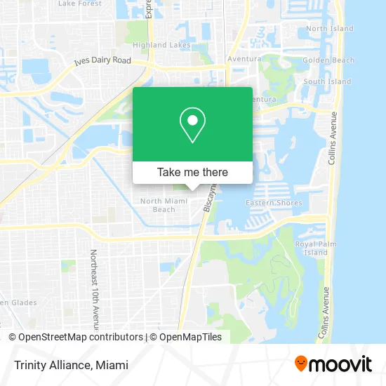
See Trinity Alliance, Miami, on the map
Public Transit to Trinity Alliance in Miami
Wondering how to get to Trinity Alliance in Miami? Moovit helps you find the best way to get to Trinity Alliance with step-by-step directions from the nearest public transit station.
Moovit provides free maps and live directions to help you navigate through your city. View schedules, routes, timetables, and find out how long does it take to get to Trinity Alliance in real time.
Looking for the nearest stop or station to Trinity Alliance? Check out this list of stops closest to your destination: Ne 172 St & Ne 23 Av; W Dixie Hwy @ Ne 171 St; Biscayne Bd & Ne 172 St; Ne 19 Av & Ne 173 St; Aventura.
Bus: 3, 9, NMBEACB, 203, 510.Train: BLFM.
Want to see if there’s another route that gets you there at an earlier time? Moovit helps you find alternative routes or times. Get directions from and directions to Trinity Alliance easily from the Moovit App or Website.
We make riding to Trinity Alliance easy, which is why over 1.5 million users, including users in Miami, trust Moovit as the best app for public transit. You don’t need to download an individual bus app or train app, Moovit is your all-in-one transit app that helps you find the best bus time or train time available.
For information on prices of bus and train, costs and ride fares to Trinity Alliance, please check the Moovit app.
Use the app to navigate to popular places including to the airport, hospital, stadium, grocery store, mall, coffee shop, school, college, and university.
Trinity Alliance Address: 2243 NE 173rd St North Miami Beach, FL 33160 street in Miami
- Ideal PC Repairs,
- The Gan Frida,
- We Provide Locksmith Services,
- Arbors Aventura,
- Group BBP,
- Ultra Trading International,
- DR.Vivian Keeler's Amazing Births & Beyond,
- Thespotacupuncture,
- Scarano Joseph A Funeral Home,
- Biscayne Memorial Chapel,
- Rush Smoke Shop,
- Ellen S Brazer MS LMHC (Ellen Brazer, Holistic Psychotherapist),
- Kay's Bath and More,
- Chef Services,
- Boulder Clinical Research,
- Latin America Express Aventura,
- W Dixie Hwy / NE 172nd St,
- Fruteria la Hacienda Market,
- Barra Callao,
- Miami Keys & Locksmiths
Places Near Trinity Alliance (Miami)
- Dolphin Mall Bus, Miami,
- Aventura Mall, Miami,
- Sawgrass Mall, Miami,
- Keiser University Flagship Campus, West Palm Beach,
- Richard E. Gerstein Justice Building, Miami,
- Miami VA Hospital, Miami,
- Little Havana, Miami,
- Miami-Dade County Courthouse, Miami,
- Port of Miami Cruise Terminal, Miami,
- Miami Freedom Park, Miami,
- Aventura Mall, Miami Beach,
- Bayside Marketplace, Miami,
- Hard Rock Stadium, Miami Gardens,
- Sawgrass mall ( FL ), Miami Beach,
- Zoo Miami, Miami,
- Marlins Park, Miami,
- Miami Design District, Miami,
- Brickell City Centre, Miami,
- Wynwood, Miami,
- Dolphin Mall, Miami
How to get to popular places in Miami with public transit
Get around Miami by public transit!
Traveling around Miami has never been so easy. See step by step directions as you travel to any attraction, street or major public transit station. View bus and train schedules, arrival times, service alerts and detailed routes on a map, so you know exactly how to get to anywhere in Miami.
When traveling to any destination around Miami use Moovit's Live Directions with Get Off Notifications to know exactly where and how far to walk, how long to wait for your line, and how many stops are left. Moovit will alert you when it's time to get off — no need to constantly re-check whether yours is the next stop.
Wondering how to use public transit in Miami or how to pay for public transit in Miami? Moovit public transit app can help you navigate your way with public transit easily, and at minimum cost. It includes public transit fees, ticket prices, and costs. Looking for a map of Miami public transit lines? Moovit public transit app shows all public transit maps in Miami with all Bus, Train, Light Rail and Ferry routes and stops on an interactive map.
Miami has 4 transit type(s), including: Bus, Train, Light Rail and Ferry, operated by several transit agencies, including Broward County Transit, Miami-Dade Transit, Metrorail, Palm Tran, Tri-Rail, Brightline, MARTY, City of Homestead Trolley, Key West Transit, Treasure Coast Connector, GoLine IRT, Amtrak, Greyhound-us, FlixBus-us and Aventura Express Shuttle Bus