How to get to Trinity Cafe by bus?
Click on the bus route to see step by step directions with maps, line arrival times and updated time schedules.
From 5 E 98th St, Manhattan
41 minFrom East 96th Street, Manhattan
49 minFrom 5 East 98th Street, Manhattan
41 minFrom 520 E 70th St, Manhattan
59 minFrom Mt Sinai, Manhattan
42 minFrom W 72nd St / Broadway, Manhattan
54 minFrom New York Hilton Midtown, Manhattan
37 minFrom Hyatt Centric Times Square, Manhattan
41 minFrom Walmart, Secaucus
87 min
How to get to Trinity Cafe by train?
Click on the train route to see step by step directions with maps, line arrival times and updated time schedules.
How to get to Trinity Cafe by subway?
Click on the subway route to see step by step directions with maps, line arrival times and updated time schedules.
From 5 E 98th St, Manhattan
39 minFrom East 96th Street, Manhattan
34 minFrom 5 East 98th Street, Manhattan
39 minFrom 520 E 70th St, Manhattan
39 minFrom Mt Sinai, Manhattan
41 minFrom W 72nd St / Broadway, Manhattan
33 minFrom New York Hilton Midtown, Manhattan
29 minFrom Hyatt Centric Times Square, Manhattan
27 min
Bus stops near Trinity Cafe in Manhattan
Subway stations near Trinity Cafe in Manhattan
Bus lines to Trinity Cafe in Manhattan
- BM1, Mill Basin - Downtown/Midtown,VIEW
- BM2, Canarsie/Spring Creek - Downtown/Midtown,VIEW
- BM3, Sheepshead Bay - Downtown/Midtown,VIEW
- BM4, Gerritsen Beach - Downtown/Midtown,VIEW
- M55, South Ferry,VIEW
- SIM1, Eltingville - Lower Manhattan Express,VIEW
- SIM1C, Eltingville - Manhattan Express,VIEW
- SIM2, Tottenville - Lower Manhattan Express,VIEW
- SIM3C, Pt. Richmond - Manhattan Express,VIEW
- SIM4, Eltingville - Lower Manhattan Express,VIEW
- SIM4C, Huguenot - Manhattan Express,VIEW
- SIM15, Eltingville - Lower Manhattan Express,VIEW
- SIM32, Travis - Lower Manhattan Express,VIEW
- SIM33C, Mariners Harbor - Greenwich Village Express,VIEW
- SIM34, Mariners Harbor - Lower Manhattan Express,VIEW
- X27, Bay Ridge - Manhattan Express,VIEW
- X28, Sea Gate / Bensonhurst - Manhattan Express,VIEW
- 404, Wall Street to Route 9 (Freehold Mall) ,VIEW
- 120, Bayonne,VIEW
- BXM18, Riverdale 263 St Via Madison Av Via H. Hudson Pky,VIEW
What are the closest stations to Trinity Cafe?
The closest stations to Trinity Cafe are:
- Trinity Pl/Rector St is 107 yards away, 2 min walk.
- Trinity Pl. Between Rector & Thames St. is 137 yards away, 2 min walk.
- Trinity Pl/Thames St is 153 yards away, 2 min walk.
- New York - Trinity Pl @ Rector & Thames Sts (Southbound) is 157 yards away, 2 min walk.
- Rector St is 177 yards away, 3 min walk.
- Trinity Pl & Exchange Alley is 178 yards away, 3 min walk.
- Broadway & Wall St is 218 yards away, 3 min walk.
- Cortlandt St is 332 yards away, 5 min walk.
- Wall St is 378 yards away, 5 min walk.
- Broad St is 430 yards away, 6 min walk.
Which bus lines stop near Trinity Cafe?
These bus lines stop near Trinity Cafe: BXM18, M55, X28.
Which train line stops near Trinity Cafe?
GRE (Hoboken - World Trade Center)
Which subway lines stop near Trinity Cafe?
These subway lines stop near Trinity Cafe: 1, 4, R, W.
What’s the nearest subway station to Trinity Cafe in Manhattan?
The nearest subway station to Trinity Cafe in Manhattan is Rector St. It’s a 3 min walk away.
What’s the nearest bus station to Trinity Cafe in Manhattan?
The nearest bus stations to Trinity Cafe in Manhattan are Trinity Pl/Rector St, Trinity Pl. Between Rector & Thames St., Trinity Pl/Thames St and New York - Trinity Pl @ Rector & Thames Sts (Southbound). The closest one is a 2 min walk away.
What time is the first subway to Trinity Cafe in Manhattan?
The 1 is the first subway that goes to Trinity Cafe in Manhattan. It stops nearby at 3:00 AM.
What time is the last subway to Trinity Cafe in Manhattan?
The 4 is the last subway that goes to Trinity Cafe in Manhattan. It stops nearby at 3:56 AM.
What time is the first bus to Trinity Cafe in Manhattan?
The SIM1C is the first bus that goes to Trinity Cafe in Manhattan. It stops nearby at 3:47 AM.
What time is the last bus to Trinity Cafe in Manhattan?
The SIM1C is the last bus that goes to Trinity Cafe in Manhattan. It stops nearby at 2:56 AM.
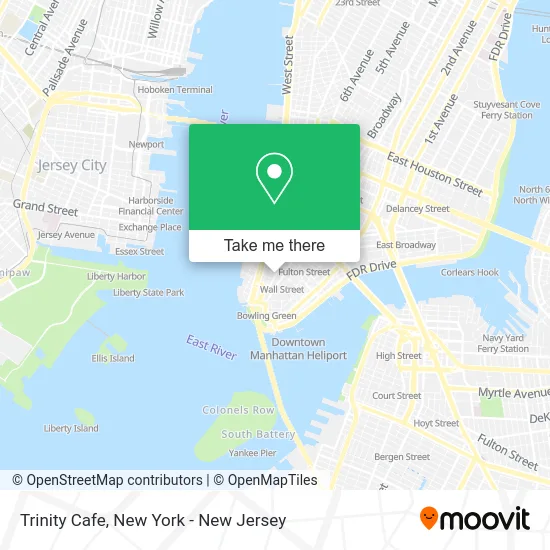
See Trinity Cafe, Manhattan, on the map
Public Transit to Trinity Cafe in Manhattan
Wondering how to get to Trinity Cafe in Manhattan? Moovit helps you find the best way to get to Trinity Cafe with step-by-step directions from the nearest public transit station.
Moovit provides free maps and live directions to help you navigate through your city. View schedules, routes, timetables, and find out how long does it take to get to Trinity Cafe in real time.
Looking for the nearest stop or station to Trinity Cafe? Check out this list of stops closest to your destination: Trinity Pl/Rector St; Trinity Pl. Between Rector & Thames St.; Trinity Pl/Thames St; New York - Trinity Pl @ Rector & Thames Sts (Southbound); Rector St; Trinity Pl & Exchange Alley; Broadway & Wall St; Cortlandt St; Wall St; Broad St.
Bus: BXM18, M55, X28, BM1, BM2, BM3, BM4.Train: GRE.Subway: 1, 4, R, W, N, 5, J, M, Z.
Want to see if there’s another route that gets you there at an earlier time? Moovit helps you find alternative routes or times. Get directions from and directions to Trinity Cafe easily from the Moovit App or Website.
We make riding to Trinity Cafe easy, which is why over 1.5 million users, including users in Manhattan, trust Moovit as the best app for public transit. You don’t need to download an individual bus app or train app, Moovit is your all-in-one transit app that helps you find the best bus time or train time available.
For information on prices of subway, bus and train, costs and ride fares to Trinity Cafe, please check the Moovit app.
Use the app to navigate to popular places including to the airport, hospital, stadium, grocery store, mall, coffee shop, school, college, and university.
Trinity Cafe Address: 76 Trinity Pl New York, NY 10006 street in Manhattan
- Trinity Church Wall Street,
- Trinity Television Department,
- Jubilee Mission,
- Greater Good Events,
- New York Brisk Auto Glass Auto Glass,
- Trinity Place/Rector Street,
- Louis Vuitton NYC VVV,
- Nyse Mkt,
- Grant, Herrmann, Schwartz & Klinger LLP,
- Puck,
- H&R Block,
- Dream Home,
- สุชม พาอ่อนตา,
- Rios Racing,
- Harvey Store,
- Nisha Joshi,
- Hamraz Podcast,
- Bounce Luggage Storage - 104 Greenwich St,
- Aptis One - Thi 1 Lần Là Đạt,
- Resolute Freight Agency
Places Near Trinity Cafe (Manhattan)
- Pier 83, Manhattan,
- Wall Street, Manhattan,
- Chinatown, Manhattan,
- Rockefeller Center, Manhattan,
- SoHo, Manhattan,
- Bellevue Hospital, Manhattan,
- 66 John Street, Manhattan,
- 111 Centre New York City Supreme Court, Manhattan,
- 3 Stone St, Manhattan,
- Mountainside Hospital, Glen Ridge,
- Hudson Yards, Manhattan,
- Katz's Deli, Manhattan,
- Times Square, Manhattan,
- Queens Center Mall, Queens,
- qqqq, Manhattan,
- 26 Federal Plaza, Manhattan,
- 911 Memorial, Manhattan,
- 376 Hudson Street, Manhattan,
- 1 Police Plaza, Manhattan,
- San Gennaro Feast, Manhattan
How to get to popular places in New York - New Jersey with public transit
Get around Manhattan by public transit!
Traveling around Manhattan has never been so easy. See step by step directions as you travel to any attraction, street or major public transit station. View bus and train schedules, arrival times, service alerts and detailed routes on a map, so you know exactly how to get to anywhere in Manhattan.
When traveling to any destination around Manhattan use Moovit's Live Directions with Get Off Notifications to know exactly where and how far to walk, how long to wait for your line, and how many stops are left. Moovit will alert you when it's time to get off — no need to constantly re-check whether yours is the next stop.
Wondering how to use public transit in Manhattan or how to pay for public transit in Manhattan? Moovit public transit app can help you navigate your way with public transit easily, and at minimum cost. It includes public transit fees, ticket prices, and costs. Looking for a map of Manhattan public transit lines? Moovit public transit app shows all public transit maps in Manhattan with all Bus, Train, Subway, Light Rail, Ferry and Cable Car routes and stops on an interactive map.
New York - New Jersey has 6 transit type(s), including: Bus, Train, Subway, Light Rail, Ferry and Cable Car, operated by several transit agencies, including MTA Subway, Metro-North Railroad, LIRR, PATH, MTA New York City Transit - Express routes, MTA Bus, NJ Transit, NYC Ferry, NICE bus, Bee-Line Bus, NJ Transit Rail, Norwalk Transit District, Hartford Line, River Valley Transit and HART