How to get to Trinity Community Church by bus?
Click on the bus route to see step by step directions with maps, line arrival times and updated time schedules.
From Baruch College, Manhattan
79 minFrom 31st St (astoria blvd & 31st street), Queens
105 minFrom 7th 7th Ave Central Park S, Manhattan
54 minFrom Marquis Theatre, Manhattan
47 minFrom 5 E 98th St, Manhattan
51 minFrom Staten Island Ferry, Staten Island
86 minFrom New York Presbyterian Hospital, Manhattan
59 minFrom The Shops At Atlas Park, Queens
64 minFrom North Bergen, NJ, North Bergen
90 min
How to get to Trinity Community Church by train?
Click on the train route to see step by step directions with maps, line arrival times and updated time schedules.
How to get to Trinity Community Church by subway?
Click on the subway route to see step by step directions with maps, line arrival times and updated time schedules.
Bus stops near Trinity Community Church in Manhattan
Subway stations near Trinity Community Church in Manhattan
Bus lines to Trinity Community Church in Manhattan
What are the closest stations to Trinity Community Church?
The closest stations to Trinity Community Church are:
- Essex St/East Broadway is 139 yards away, 2 min walk.
- Madison St/Rutgers St is 143 yards away, 2 min walk.
- Pike St/Madison St is 179 yards away, 3 min walk.
- Delancey St-Essex St is 240 yards away, 4 min walk.
- Grand St is 884 yards away, 11 min walk.
- Canal St is 1204 yards away, 15 min walk.
Which bus lines stop near Trinity Community Church?
These bus lines stop near Trinity Community Church: M14A-SBS, M15, M15-SBS, M22, M9.
Which train line stops near Trinity Community Church?
GRE (Hoboken - World Trade Center)
Which subway line stops near Trinity Community Church?
F (Uptown & Queens)
What’s the nearest subway station to Trinity Community Church in Manhattan?
The nearest subway station to Trinity Community Church in Manhattan is Delancey St-Essex St. It’s a 4 min walk away.
What’s the nearest bus station to Trinity Community Church in Manhattan?
The nearest bus stations to Trinity Community Church in Manhattan are Essex St/East Broadway and Madison St/Rutgers St. The closest one is a 2 min walk away.
What time is the first subway to Trinity Community Church in Manhattan?
The J is the first subway that goes to Trinity Community Church in Manhattan. It stops nearby at 3:00 AM.
What time is the last subway to Trinity Community Church in Manhattan?
The 6 is the last subway that goes to Trinity Community Church in Manhattan. It stops nearby at 4:01 AM.
What time is the first bus to Trinity Community Church in Manhattan?
The M15 is the first bus that goes to Trinity Community Church in Manhattan. It stops nearby at 3:06 AM.
What time is the last bus to Trinity Community Church in Manhattan?
The M15 is the last bus that goes to Trinity Community Church in Manhattan. It stops nearby at 3:08 AM.
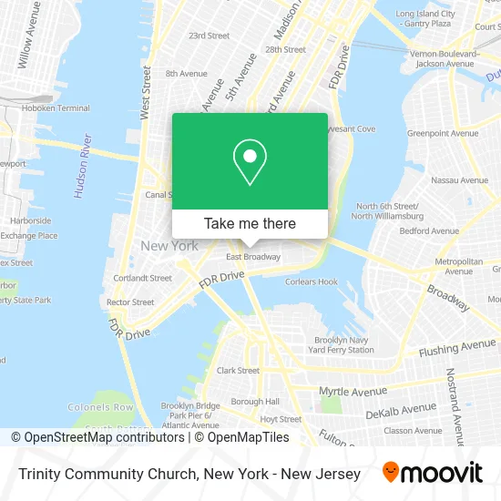
See Trinity Community Church, Manhattan, on the map
Public Transit to Trinity Community Church in Manhattan
Wondering how to get to Trinity Community Church in Manhattan? Moovit helps you find the best way to get to Trinity Community Church with step-by-step directions from the nearest public transit station.
Moovit provides free maps and live directions to help you navigate through your city. View schedules, routes, timetables, and find out how long does it take to get to Trinity Community Church in real time.
Looking for the nearest stop or station to Trinity Community Church? Check out this list of stops closest to your destination: Essex St/East Broadway; Madison St/Rutgers St; Pike St/Madison St; Delancey St-Essex St; Grand St; Canal St.
Bus: M14A-SBS, M15, M15-SBS, M22, M9.Train: GRE.Subway: F, B39, FX, J, M, B, D, N, Q, R, W, 4.
Want to see if there’s another route that gets you there at an earlier time? Moovit helps you find alternative routes or times. Get directions from and directions to Trinity Community Church easily from the Moovit App or Website.
We make riding to Trinity Community Church easy, which is why over 1.7 million users, including users in Manhattan, trust Moovit as the best app for public transit. You don’t need to download an individual bus app or train app, Moovit is your all-in-one transit app that helps you find the best bus time or train time available.
For information on prices of subway, bus, train and ferry, costs and ride fares to Trinity Community Church, please check the Moovit app.
Use the app to navigate to popular places including to the airport, hospital, stadium, grocery store, mall, coffee shop, school, college, and university.
Trinity Community Church Address: 138 Henry St street in Manhattan
- Area Youth Ministry Nyc,
- Hester Street Fair Project Space,
- Lyle Gallery,
- Hello Human,
- South Manhattan Kingdom Hall,
- Henry Street Gardens,
- Diana New York,
- Open Sight,
- Henry Street NY USA,
- New York Central Park,
- Ancien,
- Chen Wong,
- Uniquepos Business Solutions,
- Les Skatepark,
- El Famoso Cuchifrito,
- F Train East Broadway Stop,
- Kingdom Hall Of Jehovah's Witnesses,
- Kopitiam Malaysian Coffee,
- Tlb Trading Co Ltd,
- Sell New Technology
Places Near Trinity Community Church (Manhattan)
- San Gennaro Feast, Manhattan,
- Times Square, Manhattan,
- 911 Memorial, Manhattan,
- 376 Hudson Street, Manhattan,
- Bellevue Hospital, Manhattan,
- Katz's Deli, Manhattan,
- qqqq, Manhattan,
- Wall Street, Manhattan,
- Pier 83, Manhattan,
- 111 Centre New York City Supreme Court, Manhattan,
- Chinatown, Manhattan,
- Mountainside Hospital, Glen Ridge,
- 66 John Street, Manhattan,
- 1 Police Plaza, Manhattan,
- SoHo, Manhattan,
- 3 Stone St, Manhattan,
- Hudson Yards, Manhattan,
- Queens Center Mall, Queens,
- 26 Federal Plaza, Manhattan,
- Rockefeller Center, Manhattan
How to get to popular places in New York - New Jersey with public transit
Get around Manhattan by public transit!
Traveling around Manhattan has never been so easy. See step by step directions as you travel to any attraction, street or major public transit station. View bus and train schedules, arrival times, service alerts and detailed routes on a map, so you know exactly how to get to anywhere in Manhattan.
When traveling to any destination around Manhattan use Moovit's Live Directions with Get Off Notifications to know exactly where and how far to walk, how long to wait for your line, and how many stops are left. Moovit will alert you when it's time to get off — no need to constantly re-check whether yours is the next stop.
Wondering how to use public transit in Manhattan or how to pay for public transit in Manhattan? Moovit public transit app can help you navigate your way with public transit easily, and at minimum cost. It includes public transit fees, ticket prices, and costs. Looking for a map of Manhattan public transit lines? Moovit public transit app shows all public transit maps in Manhattan with all Bus, Train, Subway, Light Rail, Ferry and Cable Car routes and stops on an interactive map.
New York - New Jersey has 6 transit type(s), including: Bus, Train, Subway, Light Rail, Ferry and Cable Car, operated by several transit agencies, including MTA Subway, Metro-North Railroad, LIRR, PATH, MTA New York City Transit - Express routes, MTA Bus, NJ Transit, NYC Ferry, NICE bus, Bee-Line Bus, NJ Transit Rail, Norwalk Transit District, Hartford Line, River Valley Transit and HART