How to get to Trinity Lutheran School by bus?
Click on the bus route to see step by step directions with maps, line arrival times and updated time schedules.
Bus stops near Trinity Lutheran School in Newport News
Bus lines to Trinity Lutheran School in Newport News
- 106, WARWICK BOULEVARD,VIEW
- 107, DENBIGH BOULEVARD,VIEW
- 114, Hampton Transit Center,VIEW
- 405, W. OAKS/COL.MALL,VIEW
- 430, DENBIGH FRINGE,VIEW
- 921, WILLIAMSBURG,VIEW
- 961, 757X - NORFOLK TO NNTC,VIEW
- 964, SMITHFIELD,VIEW
- 967, 757X - NNTC TO INDIAN RIVER PARK & RIDE,VIEW
- 972, 757X - TCC to NN SHIPYARD,VIEW
- 966, Commuter & Independence,VIEW
- 112, Newport News Transit Center,VIEW
- 414, Picketts Line & Warwick,VIEW
What are the closest stations to Trinity Lutheran School?
The closest stations to Trinity Lutheran School are:
- Huntington & 68th is 214 yards away, 3 min walk.
- 73rd & Belvedere is 617 yards away, 8 min walk.
- River Road is 630 yards away, 8 min walk.
- North Gate Grumman Shelter is 841 yards away, 11 min walk.
- Jefferson & Deborah is 2762 yards away, 33 min walk.
Which bus lines stop near Trinity Lutheran School?
These bus lines stop near Trinity Lutheran School: 106, 107.
What’s the nearest bus station to Trinity Lutheran School in Newport News?
The nearest bus station to Trinity Lutheran School in Newport News is Huntington & 68th. It’s a 3 min walk away.
What time is the first bus to Trinity Lutheran School in Newport News?
The 964 is the first bus that goes to Trinity Lutheran School in Newport News. It stops nearby at 4:16 AM.
What time is the last bus to Trinity Lutheran School in Newport News?
The 112 is the last bus that goes to Trinity Lutheran School in Newport News. It stops nearby at 1:23 AM.
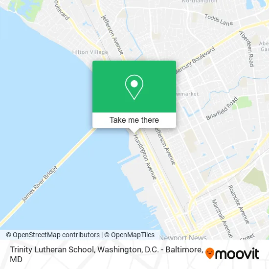
See Trinity Lutheran School, Newport News, on the map
Public Transit to Trinity Lutheran School in Newport News
Wondering how to get to Trinity Lutheran School in Newport News? Moovit helps you find the best way to get to Trinity Lutheran School with step-by-step directions from the nearest public transit station.
Moovit provides free maps and live directions to help you navigate through your city. View schedules, routes, timetables, and find out how long does it take to get to Trinity Lutheran School in real time.
Looking for the nearest stop or station to Trinity Lutheran School? Check out this list of stops closest to your destination: Huntington & 68th; 73rd & Belvedere; River Road; North Gate Grumman Shelter; Jefferson & Deborah.
Bus: 106, 107, 114, 405, 430, 921, 961, 964, 966, 112, 414.
Want to see if there’s another route that gets you there at an earlier time? Moovit helps you find alternative routes or times. Get directions from and directions to Trinity Lutheran School easily from the Moovit App or Website.
We make riding to Trinity Lutheran School easy, which is why over 1.7 million users, including users in Newport News, trust Moovit as the best app for public transit. You don’t need to download an individual bus app or train app, Moovit is your all-in-one transit app that helps you find the best bus time or train time available.
For information on prices of bus and train, costs and ride fares to Trinity Lutheran School, please check the Moovit app.
Use the app to navigate to popular places including to the airport, hospital, stadium, grocery store, mall, coffee shop, school, college, and university.
Trinity Lutheran School Address: 6812 River Rd Newport News, VA 23607 street in Newport News
- Trinity Lutheran Church,
- NNS Welding School,
- Camp Hill And Camp Alexander,
- Huntington Heigths,
- Bistro Pub,
- T J's Sports Tavern,
- Huntington Heights Square,
- Bgr8 Fitness & Performance,
- Mobile Mechanic Pros Newport News,
- Cornerstone Christian Center,
- Gosine's Auto Repair,
- Huntington Heights,
- Navy Federal Credit Union,
- US Bank,
- WESTERN UNION,
- ATM,
- Credit Union 1,
- 7-Eleven,
- ATM 7eleven-Fcti,
- World Class Marketing
Places Near Trinity Lutheran School (Newport News)
- National Museum of African American History and Culture, Washington,
- Washington DC VA Medical Center, Washington,
- Georgetown, Washington,
- PG Mall, Prince George's County,
- Rock Creek Tennis Center, Washington,
- Pennsylvania Ave NW (3rd st and pennsylvania), Washington,
- Warner Theatre, Washington,
- The Anthem, Washington,
- Camden Yards, Baltimore,
- National Theatre, Washington,
- Capital One Arena, Washington,
- Museum Of The Bible, Washington,
- Amazon Hq2, Arlington County,
- Westfield Montgomery Mall, Montgomery County,
- Basilica of the National Shrine, Washington,
- Washington National Cathedral, Washington,
- National Zoo, Washington,
- M&T Bank Stadium, Baltimore,
- Marriott Marquis Washington, DC, Washington,
- Sibley Memorial Hospital, Washington
How to get to popular places in Washington, D.C. - Baltimore, MD with public transit
Get around Newport News by public transit!
Traveling around Newport News has never been so easy. See step by step directions as you travel to any attraction, street or major public transit station. View bus and train schedules, arrival times, service alerts and detailed routes on a map, so you know exactly how to get to anywhere in Newport News.
When traveling to any destination around Newport News use Moovit's Live Directions with Get Off Notifications to know exactly where and how far to walk, how long to wait for your line, and how many stops are left. Moovit will alert you when it's time to get off — no need to constantly re-check whether yours is the next stop.
Wondering how to use public transit in Newport News or how to pay for public transit in Newport News? Moovit public transit app can help you navigate your way with public transit easily, and at minimum cost. It includes public transit fees, ticket prices, and costs. Looking for a map of Newport News public transit lines? Moovit public transit app shows all public transit maps in Newport News with all Bus, Train, Metro, Light Rail and Ferry routes and stops on an interactive map.
Washington, D.C. - Baltimore, MD has 5 transit type(s), including: Bus, Train, Metro, Light Rail and Ferry, operated by several transit agencies, including WMATA, Montgomery County Ride On, Fairfax Connector, TheBus, PRTC, DASH - Alexandria, Arlington Transit (ART), RTA of Central Maryland, MDOT MTA, MDOT MTA Light RailLink, MDOT MTA Commuter Bus, MDOT MTA Local Bus, FXBGO!, Virginia Railway Express (VRE) and MARC