How to get to Trinity Pl Mary St by bus?
Click on the bus route to see step by step directions with maps, line arrival times and updated time schedules.
From NJ 440, Jersey City, Nj
84 minFrom Walmart, Kearny, Nj
70 minFrom East Orange, NJ, East Orange, Nj
53 minFrom Linden, NJ, Linden, Nj
33 minFrom Irvington, NJ, Irvington, Nj
48 minFrom 78 John Miller Way, Kearny, Nj
68 minFrom Bayonne, NJ, Bayonne, Nj
101 minFrom Walmart, Linden, Nj
47 minFrom Walmart Supercenter, Kearny, Nj
70 min
How to get to Trinity Pl Mary St by train?
Click on the train route to see step by step directions with maps, line arrival times and updated time schedules.
Bus stops near Trinity Pl Mary St in Elizabeth, Nj
Train stations near Trinity Pl Mary St in Elizabeth, Nj
Bus lines to Trinity Pl Mary St in Elizabeth, Nj
What are the closest stations to Trinity Pl Mary St?
The closest stations to Trinity Pl Mary St are:
- North Broad St at Mary St is 165 yards away, 3 min walk.
- Westfield Ave at Morris Ave is 393 yards away, 5 min walk.
- Elizabeth is 1363 yards away, 16 min walk.
- Union is 2310 yards away, 28 min walk.
Which bus lines stop near Trinity Pl Mary St?
These bus lines stop near Trinity Pl Mary St: 24, 59.
Which train lines stop near Trinity Pl Mary St?
These train lines stop near Trinity Pl Mary St: NC, NJCL.
What’s the nearest train station to Trinity Pl Mary St in Elizabeth, Nj?
The nearest train station to Trinity Pl Mary St in Elizabeth, Nj is Elizabeth. It’s a 16 min walk away.
What’s the nearest bus station to Trinity Pl Mary St in Elizabeth, Nj?
The nearest bus station to Trinity Pl Mary St in Elizabeth, Nj is North Broad St at Mary St. It’s a 3 min walk away.
What time is the first train to Trinity Pl Mary St in Elizabeth, Nj?
The NC is the first train that goes to Trinity Pl Mary St in Elizabeth, Nj. It stops nearby at 4:36 AM.
What time is the last train to Trinity Pl Mary St in Elizabeth, Nj?
The NC is the last train that goes to Trinity Pl Mary St in Elizabeth, Nj. It stops nearby at 2:19 AM.
What time is the first bus to Trinity Pl Mary St in Elizabeth, Nj?
The 59 is the first bus that goes to Trinity Pl Mary St in Elizabeth, Nj. It stops nearby at 4:56 AM.
What time is the last bus to Trinity Pl Mary St in Elizabeth, Nj?
The 24 is the last bus that goes to Trinity Pl Mary St in Elizabeth, Nj. It stops nearby at 1:46 AM.
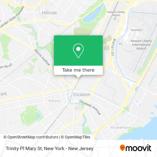
See Trinity Pl Mary St, Elizabeth, Nj, on the map
Public Transit to Trinity Pl Mary St in Elizabeth, Nj
Wondering how to get to Trinity Pl Mary St in Elizabeth, Nj? Moovit helps you find the best way to get to Trinity Pl Mary St with step-by-step directions from the nearest public transit station.
Moovit provides free maps and live directions to help you navigate through your city. View schedules, routes, timetables, and find out how long does it take to get to Trinity Pl Mary St in real time.
Looking for the nearest stop or station to Trinity Pl Mary St? Check out this list of stops closest to your destination: North Broad St at Mary St; Westfield Ave at Morris Ave; Elizabeth; Union.
Bus: 24, 59, 112, 26, 52, 58.Train: NC, NJCL, NEC, RARV.
Want to see if there’s another route that gets you there at an earlier time? Moovit helps you find alternative routes or times. Get directions from and directions to Trinity Pl Mary St easily from the Moovit App or Website.
We make riding to Trinity Pl Mary St easy, which is why over 1.5 million users, including users in Elizabeth, Nj, trust Moovit as the best app for public transit. You don’t need to download an individual bus app or train app, Moovit is your all-in-one transit app that helps you find the best bus time or train time available.
For information on prices of bus and train, costs and ride fares to Trinity Pl Mary St, please check the Moovit app.
Use the app to navigate to popular places including to the airport, hospital, stadium, grocery store, mall, coffee shop, school, college, and university.
Trinity Pl Mary St Address: Elizabeth, NJ 07201 street in Elizabeth, Nj
- National Life Insurance,
- All in the Detail,
- Whitehead Pennsylvania,
- Barcode New Jersey,
- Elizabeth Long Distance Movers,
- Broad St and Parker Rd,
- Amtrak 161 to Washington DC,
- DUNKIN',
- Playa Bowls,
- Back Out Training,
- Teriyaki Madness,
- Bullhorns Grill + Burgers,
- TACO BELL,
- bus 24,
- AA Auto Body (A A Auto Body),
- R Housman Anayancy,
- Smackin Shack,
- The Union Foursquare Gospel Church,
- 432 Westminster Avenue,
- Optimum
Places Near Trinity Pl Mary St (Elizabeth, Nj)
- Katz's Deli, Manhattan,
- 26 Federal Plaza, Manhattan,
- 911 Memorial, Manhattan,
- Times Square, Manhattan,
- Chinatown, Manhattan,
- 111 Centre New York City Supreme Court, Manhattan,
- 3 Stone St, Manhattan,
- Pier 83, Manhattan,
- Rockefeller Center, Manhattan,
- San Gennaro Feast, Manhattan,
- Hudson Yards, Manhattan,
- 66 John Street, Manhattan,
- Bellevue Hospital, Manhattan,
- Mountainside Hospital, Glen Ridge,
- Wall Street, Manhattan,
- SoHo, Manhattan,
- qqqq, Manhattan,
- Queens Center Mall, Queens,
- 1 Police Plaza, Manhattan,
- 376 Hudson Street, Manhattan
How to get to popular places in New York - New Jersey with public transit
Get around Elizabeth, Nj by public transit!
Traveling around Elizabeth, Nj has never been so easy. See step by step directions as you travel to any attraction, street or major public transit station. View bus and train schedules, arrival times, service alerts and detailed routes on a map, so you know exactly how to get to anywhere in Elizabeth, Nj.
When traveling to any destination around Elizabeth, Nj use Moovit's Live Directions with Get Off Notifications to know exactly where and how far to walk, how long to wait for your line, and how many stops are left. Moovit will alert you when it's time to get off — no need to constantly re-check whether yours is the next stop.
Wondering how to use public transit in Elizabeth, Nj or how to pay for public transit in Elizabeth, Nj? Moovit public transit app can help you navigate your way with public transit easily, and at minimum cost. It includes public transit fees, ticket prices, and costs. Looking for a map of Elizabeth, Nj public transit lines? Moovit public transit app shows all public transit maps in Elizabeth, Nj with all Bus, Train, Subway, Light Rail, Ferry and Cable Car routes and stops on an interactive map.
New York - New Jersey has 6 transit type(s), including: Bus, Train, Subway, Light Rail, Ferry and Cable Car, operated by several transit agencies, including MTA Subway, Metro-North Railroad, LIRR, PATH, MTA New York City Transit - Express routes, MTA Bus, NJ Transit, NYC Ferry, NICE bus, Bee-Line Bus, NJ Transit Rail, Norwalk Transit District, Hartford Line, River Valley Transit and HART