How to get to Tru Point by bus?
Click on the bus route to see step by step directions with maps, line arrival times and updated time schedules.
From Doral Academy Prep Middle /High School, North Westside
139 minFrom Doral Voice, North Westside
144 minFrom Conchitas Transit Express, Hialeah
86 minFrom La Quinta Inn & Suites by Wyndham Miami Airport West, North Westside
94 minFrom Amtrak, Miami
95 minFrom MDT Metrorail - Hialeah Station, Hialeah
74 minFrom W 49th St / NW 103rd St, Hialeah
61 minFrom Miami Springs, FL, Miami
86 minFrom Miami Springs Senior High School, Miami
102 minFrom Spin Group, North Westside
142 min
Bus stops near Tru Point in Hialeah
Bus lines to Tru Point in Hialeah
What are the closest stations to Tru Point?
The closest stations to Tru Point are:
- W 76 St@w 34 Av is 384 yards away, 5 min walk.
- W 68 St@w 36 Av is 892 yards away, 11 min walk.
Which bus lines stop near Tru Point?
These bus lines stop near Tru Point: HIAFLA, HIAMAR.
What’s the nearest bus station to Tru Point in Hialeah?
The nearest bus station to Tru Point in Hialeah is W 76 St@w 34 Av. It’s a 5 min walk away.
What time is the first bus to Tru Point in Hialeah?
The HIAFLA is the first bus that goes to Tru Point in Hialeah. It stops nearby at 6:16 AM.
What time is the last bus to Tru Point in Hialeah?
The HIAMAR is the last bus that goes to Tru Point in Hialeah. It stops nearby at 8:36 PM.
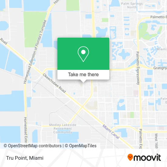
See Tru Point, Hialeah, on the map
Public Transit to Tru Point in Hialeah
Wondering how to get to Tru Point in Hialeah? Moovit helps you find the best way to get to Tru Point with step-by-step directions from the nearest public transit station.
Moovit provides free maps and live directions to help you navigate through your city. View schedules, routes, timetables, and find out how long does it take to get to Tru Point in real time.
Looking for the nearest stop or station to Tru Point? Check out this list of stops closest to your destination: W 76 St@w 34 Av; W 68 St@w 36 Av.
Bus: HIAFLA, HIAMAR.
Want to see if there’s another route that gets you there at an earlier time? Moovit helps you find alternative routes or times. Get directions from and directions to Tru Point easily from the Moovit App or Website.
We make riding to Tru Point easy, which is why over 1.5 million users, including users in Hialeah, trust Moovit as the best app for public transit. You don’t need to download an individual bus app or train app, Moovit is your all-in-one transit app that helps you find the best bus time or train time available.
For information on prices of bus and train, costs and ride fares to Tru Point, please check the Moovit app.
Use the app to navigate to popular places including to the airport, hospital, stadium, grocery store, mall, coffee shop, school, college, and university.
Tru Point Address: 7575 W 36th Ave Hialeah, FL 33018 street in Hialeah
- Rockitcoin,
- Sushigourmetbox,
- Slice of Habana Pizza (Twin Tower Pizza),
- Dimelo Pizza Cubana,
- Yas! Burger,
- Chikas Latin Bakery Corp,
- Omega Tire Company,
- Cat's Productions,
- Fingerprint Me,
- County of Miami-Dade,
- The Sobe Group,
- Furnuture Y Masss,
- Ajcrod Investments,
- Castellon Plumbing,
- On My Way Septic Inc Grease Trap,
- A & D Cleaning Services,
- Jonathan's Professional Painting,
- Renova Services Group,
- Nails by Lisbet,
- T3nt Labor Kr3w
Places Near Tru Point (Hialeah)
- Little Havana, Miami,
- Hard Rock Stadium, Miami Gardens,
- Brickell City Centre, Miami,
- Aventura Mall, Miami,
- Aventura Mall, Miami Beach,
- Keiser University Flagship Campus, West Palm Beach,
- Sawgrass Mall, Miami,
- Miami VA Hospital, Miami,
- Wynwood, Miami,
- Dolphin Mall, Miami,
- Miami Design District, Miami,
- Port of Miami Cruise Terminal, Miami,
- Richard E. Gerstein Justice Building, Miami,
- Dolphin Mall Bus, Miami,
- Bayside Marketplace, Miami,
- Miami-Dade County Courthouse, Miami,
- Sawgrass mall ( FL ), Miami Beach,
- Zoo Miami, Miami,
- Marlins Park, Miami,
- Miami Freedom Park, Miami
How to get to popular places in Miami with public transit
Get around Hialeah by public transit!
Traveling around Hialeah has never been so easy. See step by step directions as you travel to any attraction, street or major public transit station. View bus and train schedules, arrival times, service alerts and detailed routes on a map, so you know exactly how to get to anywhere in Hialeah.
When traveling to any destination around Hialeah use Moovit's Live Directions with Get Off Notifications to know exactly where and how far to walk, how long to wait for your line, and how many stops are left. Moovit will alert you when it's time to get off — no need to constantly re-check whether yours is the next stop.
Wondering how to use public transit in Hialeah or how to pay for public transit in Hialeah? Moovit public transit app can help you navigate your way with public transit easily, and at minimum cost. It includes public transit fees, ticket prices, and costs. Looking for a map of Hialeah public transit lines? Moovit public transit app shows all public transit maps in Hialeah with all Bus, Train, Light Rail and Ferry routes and stops on an interactive map.
Miami has 4 transit type(s), including: Bus, Train, Light Rail and Ferry, operated by several transit agencies, including Broward County Transit, Miami-Dade Transit, Metrorail, Palm Tran, Tri-Rail, Brightline, MARTY, City of Homestead Trolley, Key West Transit, Treasure Coast Connector, GoLine IRT, Amtrak, Greyhound-us, FlixBus-us and Aventura Express Shuttle Bus