Directions to Tu Community Dance (Baltimore County) with public transportation
The following transit lines have routes that pass near Tu Community Dance
How to get to Tu Community Dance by bus?
Click on the bus route to see step by step directions with maps, line arrival times and updated time schedules.
From Lyric Theater, Baltimore
43 minFrom Baltimore Poly Tech High School, Baltimore
37 minFrom Mercy Medical Center, Baltimore
43 minFrom Giant Food Stores, Baltimore
22 minFrom Social Security Administration, Baltimore
53 minFrom Enoch Pratt Free Library - Central Library, Baltimore
44 minFrom The Johns Hopkins Hospital, Baltimore
43 minFrom Coppin State University, Baltimore
56 minFrom Druid Hill Park, Baltimore
58 minFrom Johns Hopkins University, Baltimore
35 min
Bus stops near Tu Community Dance in Baltimore County
Bus lines to Tu Community Dance in Baltimore County
- GOLD ROUTE, Gold,VIEW
- WEST VILLAGE TO CORE CAMPUS, West Village Core,VIEW
- LAKE AVE, Lake Ave,VIEW
- KENILWORTH AVE/401, Kenilworth Ave/401,VIEW
- CITYLINK RED, Um Medical Center,VIEW
- 52, Greenmount North,VIEW
- 53, Sheppard Pratt,VIEW
- GOUCHER - LOCH RAVEN, Goucher - Loch Raven,VIEW
- TOWSON PURPLE, Purple Loop Northbound,VIEW
What are the closest stations to Tu Community Dance?
The closest stations to Tu Community Dance are:
- #14 Glen Garage/Admin Bldg is 62 yards away, 1 min walk.
- #17 Administration is 139 yards away, 2 min walk.
- York Rd & Towsontown Blvd is 400 yards away, 6 min walk.
- #58 Liberal Arts *** is 644 yards away, 8 min walk.
- York Rd @ St Joseph Hospital Rd Sb 0014 (South) is 722 yards away, 9 min walk.
Which bus line stops near Tu Community Dance?
CITYLINK RED (Lutherville Light Rail)
What’s the nearest bus station to Tu Community Dance in Baltimore County?
The nearest bus station to Tu Community Dance in Baltimore County is #14 Glen Garage/Admin Bldg. It’s a 1 min walk away.
What time is the first bus to Tu Community Dance in Baltimore County?
The CITYLINK RED is the first bus that goes to Tu Community Dance in Baltimore County. It stops nearby at 3:08 AM.
What time is the last bus to Tu Community Dance in Baltimore County?
The CITYLINK RED is the last bus that goes to Tu Community Dance in Baltimore County. It stops nearby at 3:09 AM.
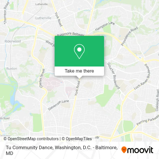
See Tu Community Dance, Baltimore County, on the map
Public Transit to Tu Community Dance in Baltimore County
Wondering how to get to Tu Community Dance in Baltimore County? Moovit helps you find the best way to get to Tu Community Dance with step-by-step directions from the nearest public transit station.
Moovit provides free maps and live directions to help you navigate through your city. View schedules, routes, timetables, and find out how long does it take to get to Tu Community Dance in real time.
Looking for the nearest stop or station to Tu Community Dance? Check out this list of stops closest to your destination: #14 Glen Garage/Admin Bldg; #17 Administration; York Rd & Towsontown Blvd; #58 Liberal Arts ***; York Rd @ St Joseph Hospital Rd Sb 0014 (South).
Bus: CITYLINK RED, GOLD ROUTE, WEST VILLAGE TO CORE CAMPUS, LAKE AVE, KENILWORTH AVE/401, 52, 53, GOUCHER - LOCH RAVEN, TOWSON PURPLE.
Want to see if there’s another route that gets you there at an earlier time? Moovit helps you find alternative routes or times. Get directions from and directions to Tu Community Dance easily from the Moovit App or Website.
We make riding to Tu Community Dance easy, which is why over 1.7 million users, including users in Baltimore County, trust Moovit as the best app for public transit. You don’t need to download an individual bus app or train app, Moovit is your all-in-one transit app that helps you find the best bus time or train time available.
For information on prices of bus and metro, costs and ride fares to Tu Community Dance, please check the Moovit app.
Use the app to navigate to popular places including to the airport, hospital, stadium, grocery store, mall, coffee shop, school, college, and university.
Tu Community Dance Address: 8000 York Rd street in Baltimore County
- Towson University,
- Towson High School,
- 200 Washington Ave towson md,
- Baltimore County Jail,
- St. Joseph Medical Center Sister Marie Cecilia Irwin Center,
- Amazon Locker-Adelmiro,
- Rabbit Transit Express Stop 83S,
- Jane's Cane,
- University of Maryland St. Joseph Medical Center,
- Towson Historic Courthouse,
- York Pennsylvania,
- Baltimore County Circuit Court,
- O'Dea Building- St. Josephs Hospital,
- Towson Town Center,
- Cinemark Towson and XD,
- The Law Office of David T. Lampton PC,
- E Joppa Rd at Virginia Ave,
- Andrea B. Sherwin Playground,
- Ymca,
- Towson Town Center
Places Near Tu Community Dance (Baltimore County)
- Westfield Montgomery Mall, Montgomery County,
- Washington DC VA Medical Center, Washington,
- Museum Of The Bible, Washington,
- Basilica of the National Shrine, Washington,
- The Anthem, Washington,
- Pennsylvania Ave NW (3rd st and pennsylvania), Washington,
- National Museum of African American History and Culture, Washington,
- Capital One Arena, Washington,
- Sibley Memorial Hospital, Washington,
- M&T Bank Stadium, Baltimore,
- Camden Yards, Baltimore,
- Washington National Cathedral, Washington,
- PG Mall, Prince George's County,
- Rock Creek Tennis Center, Washington,
- National Zoo, Washington,
- Georgetown, Washington,
- National Theatre, Washington,
- Marriott Marquis Washington, DC, Washington,
- Amazon Hq2, Arlington County,
- Warner Theatre, Washington
How to get to popular places in Washington, D.C. - Baltimore, MD with public transit
Get around Baltimore County by public transit!
Traveling around Baltimore County has never been so easy. See step by step directions as you travel to any attraction, street or major public transit station. View bus and train schedules, arrival times, service alerts and detailed routes on a map, so you know exactly how to get to anywhere in Baltimore County.
When traveling to any destination around Baltimore County use Moovit's Live Directions with Get Off Notifications to know exactly where and how far to walk, how long to wait for your line, and how many stops are left. Moovit will alert you when it's time to get off — no need to constantly re-check whether yours is the next stop.
Wondering how to use public transit in Baltimore County or how to pay for public transit in Baltimore County? Moovit public transit app can help you navigate your way with public transit easily, and at minimum cost. It includes public transit fees, ticket prices, and costs. Looking for a map of Baltimore County public transit lines? Moovit public transit app shows all public transit maps in Baltimore County with all Bus, Train, Metro, Light Rail and Ferry routes and stops on an interactive map.
Washington, D.C. - Baltimore, MD has 5 transit type(s), including: Bus, Train, Metro, Light Rail and Ferry, operated by several transit agencies, including WMATA, Montgomery County Ride On, Fairfax Connector, TheBus, PRTC, DASH - Alexandria, Arlington Transit (ART), RTA of Central Maryland, MDOT MTA, MDOT MTA Light RailLink, MDOT MTA Commuter Bus, MDOT MTA Local Bus, FXBGO!, Virginia Railway Express (VRE) and MARC