How to get to Tunxis Library by bus?
Click on the bus route to see step by step directions with maps, line arrival times and updated time schedules.
Bus stops near Tunxis Library in Farmington
Bus lines to Tunxis Library in Farmington
What are the closest stations to Tunxis Library?
The closest stations to Tunxis Library are:
- Tunxis Comm College @ Plainville Ave is 167 yards away, 3 min walk.
- Tunxis Community College @ Main Entrance is 192 yards away, 3 min walk.
Which bus lines stop near Tunxis Library?
These bus lines stop near Tunxis Library: 503, 66.
What’s the nearest bus station to Tunxis Library in Farmington?
The nearest bus stations to Tunxis Library in Farmington are Tunxis Comm College @ Plainville Ave and Tunxis Community College @ Main Entrance. The closest one is a 3 min walk away.
What time is the first bus to Tunxis Library in Farmington?
The 503 is the first bus that goes to Tunxis Library in Farmington. It stops nearby at 5:21 AM.
What time is the last bus to Tunxis Library in Farmington?
The 503 is the last bus that goes to Tunxis Library in Farmington. It stops nearby at 12:30 AM.
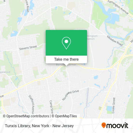
See Tunxis Library, Farmington, on the map
Public Transit to Tunxis Library in Farmington
Wondering how to get to Tunxis Library in Farmington? Moovit helps you find the best way to get to Tunxis Library with step-by-step directions from the nearest public transit station.
Moovit provides free maps and live directions to help you navigate through your city. View schedules, routes, timetables, and find out how long does it take to get to Tunxis Library in real time.
Looking for the nearest stop or station to Tunxis Library? Check out this list of stops closest to your destination: Tunxis Comm College @ Plainville Ave; Tunxis Community College @ Main Entrance.
Bus: 503, 66, 541.
Want to see if there’s another route that gets you there at an earlier time? Moovit helps you find alternative routes or times. Get directions from and directions to Tunxis Library easily from the Moovit App or Website.
We make riding to Tunxis Library easy, which is why over 1.5 million users, including users in Farmington, trust Moovit as the best app for public transit. You don’t need to download an individual bus app or train app, Moovit is your all-in-one transit app that helps you find the best bus time or train time available.
For information on prices of bus and train, costs and ride fares to Tunxis Library, please check the Moovit app.
Use the app to navigate to popular places including to the airport, hospital, stadium, grocery store, mall, coffee shop, school, college, and university.
Tunxis Library Address: 271 Scott Swamp Rd street in Farmington
- Pages Cafe,
- Ct State Tunxis,
- The Corner Cafe,
- Tunxis Criminal Justice Club/ Criminal Justice Program,
- Tunxis CC Bookstore,
- Tunxis Business Club,
- Tunxis Stage,
- Car Parking,
- The Croft Farmington,
- Saradol Investments Llc,
- River Valley Constr Co Llc,
- Xclusive Ink III,
- The Arch Bar,
- Nobly Nails & Spa,
- Dr. Wade Federspiel,
- Fmbeauties,
- Golden Mango,
- Farmington Recreation Department,
- Sylvia Ho,
- Goldstar Medical Services
Places Near Tunxis Library (Farmington)
- Pier 83, Manhattan,
- 911 Memorial, Manhattan,
- Queens Center Mall, Queens,
- 111 Centre New York City Supreme Court, Manhattan,
- Wall Street, Manhattan,
- qqqq, Manhattan,
- 66 John Street, Manhattan,
- Mountainside Hospital, Glen Ridge,
- 3 Stone St, Manhattan,
- Katz's Deli, Manhattan,
- Hudson Yards, Manhattan,
- 1 Police Plaza, Manhattan,
- SoHo, Manhattan,
- Bellevue Hospital, Manhattan,
- 26 Federal Plaza, Manhattan,
- Rockefeller Center, Manhattan,
- Times Square, Manhattan,
- Chinatown, Manhattan,
- 376 Hudson Street, Manhattan,
- San Gennaro Feast, Manhattan
How to get to popular places in New York - New Jersey with public transit
Get around Farmington by public transit!
Traveling around Farmington has never been so easy. See step by step directions as you travel to any attraction, street or major public transit station. View bus and train schedules, arrival times, service alerts and detailed routes on a map, so you know exactly how to get to anywhere in Farmington.
When traveling to any destination around Farmington use Moovit's Live Directions with Get Off Notifications to know exactly where and how far to walk, how long to wait for your line, and how many stops are left. Moovit will alert you when it's time to get off — no need to constantly re-check whether yours is the next stop.
Wondering how to use public transit in Farmington or how to pay for public transit in Farmington? Moovit public transit app can help you navigate your way with public transit easily, and at minimum cost. It includes public transit fees, ticket prices, and costs. Looking for a map of Farmington public transit lines? Moovit public transit app shows all public transit maps in Farmington with all Bus, Train, Subway, Light Rail, Ferry and Cable Car routes and stops on an interactive map.
New York - New Jersey has 6 transit type(s), including: Bus, Train, Subway, Light Rail, Ferry and Cable Car, operated by several transit agencies, including MTA Subway, Metro-North Railroad, LIRR, PATH, MTA New York City Transit - Express routes, MTA Bus, NJ Transit, NYC Ferry, NICE bus, Bee-Line Bus, NJ Transit Rail, Norwalk Transit District, Hartford Line, River Valley Transit and HART