How to get to Turkey Run Mmx & Disc Golf by bus?
Click on the bus route to see step by step directions with maps, line arrival times and updated time schedules.
Train station near Turkey Run Mmx & Disc Golf in Vermont
- Waterbury-Stowe Amtrak Station, 60 min walk,VIEW
What are the closest stations to Turkey Run Mmx & Disc Golf?
The closest stations to Turkey Run Mmx & Disc Golf are:
- Waterbury-Stowe Amtrak Station is 5122 yards away, 60 min walk.
Which bus line stops near Turkey Run Mmx & Disc Golf?
83 (Montpelier Transit Center→Waterbury State Complex)
What time is the first train to Turkey Run Mmx & Disc Golf in Vermont?
The VERMONTER is the first train that goes to Turkey Run Mmx & Disc Golf in Vermont. It stops nearby at 10:10 AM.
What time is the last train to Turkey Run Mmx & Disc Golf in Vermont?
The VERMONTER is the last train that goes to Turkey Run Mmx & Disc Golf in Vermont. It stops nearby at 7:50 PM.
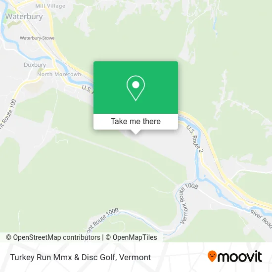
See Turkey Run Mmx & Disc Golf, Vermont, on the map
Public Transit to Turkey Run Mmx & Disc Golf in Vermont
Wondering how to get to Turkey Run Mmx & Disc Golf in Vermont? Moovit helps you find the best way to get to Turkey Run Mmx & Disc Golf with step-by-step directions from the nearest public transit station.
Moovit provides free maps and live directions to help you navigate through your city. View schedules, routes, timetables, and find out how long does it take to get to Turkey Run Mmx & Disc Golf in real time.
Looking for the nearest stop or station to Turkey Run Mmx & Disc Golf? Check out this list of stops closest to your destination: Waterbury-Stowe Amtrak Station.
Bus: 83.Train: VERMONTER.
Want to see if there’s another route that gets you there at an earlier time? Moovit helps you find alternative routes or times. Get directions from and directions to Turkey Run Mmx & Disc Golf easily from the Moovit App or Website.
We make riding to Turkey Run Mmx & Disc Golf easy, which is why over 1.5 million users, including users in Vermont, trust Moovit as the best app for public transit. You don’t need to download an individual bus app or train app, Moovit is your all-in-one transit app that helps you find the best bus time or train time available.
For information on prices of bus, costs and ride fares to Turkey Run Mmx & Disc Golf, please check the Moovit app.
Get to Turkey Run Mmx & Disc Golf with public transit and pay for the ride in the Moovit app. In addition to all info you may need for your trip to Turkey Run Mmx & Disc Golf, including live directions, real-time arrivals and fare prices, you can also buy public transit passes for your rides. No need for cash or paper tickets to get to Turkey Run Mmx & Disc Golf - everything you need is accessible in the app with a click of the button.
Use the app to navigate to popular places including to the airport, hospital, stadium, grocery store, mall, coffee shop, school, college, and university.
Turkey Run Mmx & Disc Golf Address: 187 Foggy Mountain Dr street in Vermont
- 4wd Ashland Woods Dr,
- Central Vermont Gymnastics Academy,
- Dave's Community Fitness of Waterbury,
- Ballet Vermont,
- Pop Soda,
- Stonepath Program,
- Kingsbury Companies LLC,
- Harwood Union Middle and High School,
- Noyes and Noyes Supply,
- Barn Gym & Fitness Center,
- Exit 9/Middlesex/N,
- Learning Ladder Children's Center,
- Local,
- Camp Meade,
- Arandas Mexican Cuisine,
- Green Mountain Muttz,
- The Francis Foundation,
- Dancingroot Permaculture Project,
- East Barre Congregational Church,
- Church St
Places Near Turkey Run Mmx & Disc Golf (Vermont)
- Castleton, VT, Rutland,
- MVU,
- Missisquoi River Basin Association,
- Waterbury, VT,
- Castleton University, Rutland,
- Xxxxxxxxxxxxx, Chittenden,
- Barre, VT,
- Hannaford, Rutland,
- Derby Line Stanstead Border Crossing,
- University of Vermont Medical Center - Fanny Allen Campus, Chittenden,
- Ecco,
- Richford Auto,
- WXXX, Chittenden,
- Springfield, VT, Windsor,
- Champlain Valley Exposition, Chittenden,
- Spring Step,
- Dartmouth-Hitchcock Medical Center, Clinical Systems, Grafton,
- Sugarbush Resort,
- Rutland, VT, Rutland,
- GLOBALFOUNDRIES, Chittenden
How to get to popular places in Vermont with public transit
Get around Vermont by public transit!
Traveling around Vermont has never been so easy. See step by step directions as you travel to any attraction, street or major public transit station. View bus and train schedules, arrival times, service alerts and detailed routes on a map, so you know exactly how to get to anywhere in Vermont.
When traveling to any destination around Vermont use Moovit's Live Directions with Get Off Notifications to know exactly where and how far to walk, how long to wait for your line, and how many stops are left. Moovit will alert you when it's time to get off — no need to constantly re-check whether yours is the next stop.
Wondering how to use public transit in Vermont or how to pay for public transit in Vermont? Moovit public transit app can help you navigate your way with public transit easily, and at minimum cost. It includes public transit fees, ticket prices, and costs. Looking for a map of Vermont public transit lines? Moovit public transit app shows all public transit maps in Vermont with all Bus, Train and Ferry routes and stops on an interactive map.
Vermont has 3 transit type(s), including: Bus, Train and Ferry, operated by several transit agencies, including Green Mountain Transit, Wilmington MOOver, Advance Transit, Vermont Translines, Rockingham MOOver, The Bus (Marble Valley Regional Transit District), Green Mountain Express, Rural Community Transportation, Addison County Transit Resources, Stagecoach Transportation Services, Amtrak, Greyhound-us, Dartmouth Campus Connector and Lake Champlain Ferries