Directions to Turn Key Properties of Wichita with public transportation
The following transit lines have routes that pass near Turn Key Properties of Wichita
 Bus: ROUTE29: HYDRAUL, Q-LINE CLIFTON T.
How to get to Turn Key Properties of Wichita by bus?
Click on the bus route to see step by step directions with maps, line arrival times and updated time schedules.
Bus stops near Turn Key Properties of Wichita
Bus lines to Turn Key Properties of Wichita
What are the closest stations to Turn Key Properties of Wichita?
The closest stations to Turn Key Properties of Wichita are:
- Douglas And Rutan Ob is 482 yards away, 6 min walk.
- Morris & Roosevelt Inbd is 643 yards away, 8 min walk.
Which bus line stops near Turn Key Properties of Wichita?
ROUTE29: HYDRAUL (Route 29 Outboun)
What’s the nearest bus station to Turn Key Properties of Wichita?
The nearest bus station to Turn Key Properties of Wichita is Douglas And Rutan Ob. It’s a 6 min walk away.
What time is the first bus to Turn Key Properties of Wichita?
The ROUTE29: HYDRAUL is the first bus that goes to Turn Key Properties of Wichita. It stops nearby at 5:05 AM.
What time is the last bus to Turn Key Properties of Wichita?
The Q-LINE CLIFTON T is the last bus that goes to Turn Key Properties of Wichita. It stops nearby at 10:12 PM.
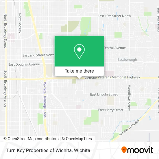
See Turn Key Properties of Wichita on the map
Public Transportation to Turn Key Properties of Wichita
Wondering how to get to Turn Key Properties of Wichita? Moovit helps you find the best way to get to Turn Key Properties of Wichita with step-by-step directions from the nearest public transit station.
Moovit provides free maps and live directions to help you navigate through your city. View schedules, routes, timetables, and find out how long does it take to get to Turn Key Properties of Wichita in real time.
Looking for the nearest stop or station to Turn Key Properties of Wichita? Check out this list of stops closest to your destination: Douglas And Rutan Ob; Morris & Roosevelt Inbd.
Bus: ROUTE29: HYDRAUL, Q-LINE CLIFTON T.
Want to see if there’s another route that gets you there at an earlier time? Moovit helps you find alternative routes or times. Get directions from and directions to Turn Key Properties of Wichita easily from the Moovit App or Website.
We make riding to Turn Key Properties of Wichita easy, which is why over 1.5 million users, including users in Wichita, trust Moovit as the best app for public transit. You don’t need to download an individual bus app or train app, Moovit is your all-in-one transit app that helps you find the best bus time or train time available.
For information on prices of bus, costs and ride fares to Turn Key Properties of Wichita, please check the Moovit app.
Use the app to navigate to popular places including to the airport, hospital, stadium, grocery store, mall, coffee shop, school, college, and university.
Turn Key Properties of Wichita Address: 521 S Roosevelt St Wichita, KS 67218 street in Wichita
- Jill Nuss,
- 523 South Yale Street,
- Miller Mark,
- S Quentin St,
- Wesley Medical Center,
- Independent Leasing & Management,
- Steven Wayne Green,
- Event Styled,
- Atomic Armour,
- Kellogg And Hillside,
- Wichita Southeast Spanish Sda Church,
- Sewer Cleaning Services,
- Meyer Jim Photography,
- Clearlake Club,
- Blyholder, Jaclyn Mark W Schuyler DDS and Jaclyn Schuyler Blyholder DMD Office,
- Kubina Glenn R,
- Idc Pharmacy,
- Infectious Disease Consultants Pa,
- Dr Matthew Stumpe MD,
- Valero
Places Near Turn Key Properties of Wichita
- Lopez Services, Wichita,
- Bmer Tech Automotive, Wichita,
- Spirit Aerosystems Inc, Building 1-198D,
- Ratcliff Auto and Truck Repair, Wichita,
- East 21st Street North and Webb Road, Wichita,
- 21st & Maize, Wichita,
- Hubb's glory hole, Wichita,
- Afghan Halal Market, Wichita,
- Four Corners Cafe @ Wesley Medical Center, Wichita,
- North High School, Wichita,
- Wichita Dwight D. Eisenhower National Airport (ICT) (Wichita Eisenhower National Airport), Wichita,
- Spirit Aerosystems,
- Westside Athletic Field (Friends University Baseball Field), Wichita,
- Ascencion Via Christi Hospital St Francis, Wichita,
- Spirit AeroSystems, Bldg 2-280J (Section 9),
- Total Card Solutions, Wichita,
- Towne East Mall, Wichita,
- McConnell Air Force Base, Mcconnell Afb,
- Sena African Hair Braiding LLC, Wichita,
- Paige Place Apartments, Wichita
How to get to popular places in Wichita with public transit
Get around Wichita by public transit!
Traveling around Wichita has never been so easy. See step by step directions as you travel to any attraction, street or major public transit station. View bus and train schedules, arrival times, service alerts and detailed routes on a map, so you know exactly how to get to anywhere in Wichita.
When traveling to any destination around Wichita use Moovit's Live Directions with Get Off Notifications to know exactly where and how far to walk, how long to wait for your line, and how many stops are left. Moovit will alert you when it's time to get off — no need to constantly re-check whether yours is the next stop.
Wondering how to use public transit in Wichita or how to pay for public transit in Wichita? Moovit public transit app can help you navigate your way with public transit easily, and at minimum cost. It includes public transit fees, ticket prices, and costs. Looking for a map of Wichita public transit lines? Moovit public transit app shows all public transit maps in Wichita with all bus routes and stops on an interactive map.
Wichita has 1 transit type(s), including: bus, operated by several transit agencies, including Wichita Transit, Greyhound-us and FlixBus-us