How to get to Tweeter by bus?
Click on the bus route to see step by step directions with maps, line arrival times and updated time schedules.
From The Mall In Columbia, Howard County
73 minFrom Lincoln Tech, Howard County
111 minFrom Walmart, Baltimore County
132 minFrom Columbia, MD, Howard County
91 minFrom Merriweather Post Pavilion, Howard County
81 minFrom Walmart Supercenter, Baltimore County
133 minFrom Guinness Open Gate Brewery & Barrel House, Baltimore County
172 minFrom Walmart, Baltimore County
133 minFrom Glen Burnie, MD, Anne Arundel County
151 min
Bus stops near Tweeter in Howard County
Train station near Tweeter in Howard County
- Dorsey Marc Sb, 50 min walk,VIEW
Bus lines to Tweeter in Howard County
What are the closest stations to Tweeter?
The closest stations to Tweeter are:
- Washington Blvd & Amberton Dr Nb is 816 yards away, 10 min walk.
- Washington Blvd / Troy Hill Dr is 1672 yards away, 20 min walk.
- Dorsey Marc Nb is 2721 yards away, 32 min walk.
- Dorsey Marc Station is 4263 yards away, 50 min walk.
- Dorsey Marc Sb is 4291 yards away, 50 min walk.
Which bus lines stop near Tweeter?
These bus lines stop near Tweeter: 409, 501.
What’s the nearest bus station to Tweeter in Howard County?
The nearest bus station to Tweeter in Howard County is Washington Blvd & Amberton Dr Nb. It’s a 10 min walk away.
What time is the first train to Tweeter in Howard County?
The MARC is the first train that goes to Tweeter in Howard County. It stops nearby at 5:18 AM.
What time is the last train to Tweeter in Howard County?
The MARC is the last train that goes to Tweeter in Howard County. It stops nearby at 8:24 PM.
What time is the first bus to Tweeter in Howard County?
The 320 is the first bus that goes to Tweeter in Howard County. It stops nearby at 5:36 AM.
What time is the last bus to Tweeter in Howard County?
The 201 is the last bus that goes to Tweeter in Howard County. It stops nearby at 10:30 PM.
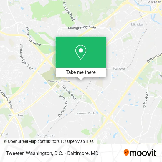
See Tweeter, Howard County, on the map
Public Transit to Tweeter in Howard County
Wondering how to get to Tweeter in Howard County? Moovit helps you find the best way to get to Tweeter with step-by-step directions from the nearest public transit station.
Moovit provides free maps and live directions to help you navigate through your city. View schedules, routes, timetables, and find out how long does it take to get to Tweeter in real time.
Looking for the nearest stop or station to Tweeter? Check out this list of stops closest to your destination: Washington Blvd & Amberton Dr Nb; Washington Blvd / Troy Hill Dr; Dorsey Marc Nb; Dorsey Marc Station; Dorsey Marc Sb.
Bus: 409, 501, 320, 201.Train: MARC.
Want to see if there’s another route that gets you there at an earlier time? Moovit helps you find alternative routes or times. Get directions from and directions to Tweeter easily from the Moovit App or Website.
We make riding to Tweeter easy, which is why over 1.5 million users, including users in Howard County, trust Moovit as the best app for public transit. You don’t need to download an individual bus app or train app, Moovit is your all-in-one transit app that helps you find the best bus time or train time available.
For information on prices of bus, light rail and train, costs and ride fares to Tweeter, please check the Moovit app.
Get to Tweeter with public transit and pay for the ride in the Moovit app. In addition to all info you may need for your trip to Tweeter, including live directions, real-time arrivals and fare prices, you can also buy public transit passes for your rides. No need for cash or paper tickets to get to Tweeter - everything you need is accessible in the app with a click of the button.
Use the app to navigate to popular places including to the airport, hospital, stadium, grocery store, mall, coffee shop, school, college, and university.
Location: Howard County, Washington, D.C. - Baltimore, MD
- Inovative Marketing Svc,
- Belt's Corporation,
- Inter-County Broadband Network (ICBN) Warehouse,
- Potomac IB,
- DH Moving and Storage,
- Site Link,
- Wurth Wood Group, Elkridge, MD,
- Realty Associates Fund,
- Gym Source,
- Afterglow Lighting,
- Cutler-Hammer,
- COIN ACCEPTORS, COINCO,
- Extra Innings,
- Cabinets & Interiors,
- Medicare Insurance Advisors Elkridge,
- W. R. Grace & Co.,
- Ferguson Hvac Supply,
- Global Executive Security Solutions,
- Theresa Arawole - Intuit Turbotax Verified Pro,
- Blueprint Appliance Repair
Places Near Tweeter (Howard County)
- Georgetown, Washington,
- Camden Yards, Baltimore,
- Washington National Cathedral, Washington,
- National Mall, Washington,
- National Zoo, Washington,
- M&T Bank Stadium, Baltimore,
- National Museum of African American History and Culture, Washington,
- Rock Creek Tennis Center, Washington,
- Warner Theatre, Washington,
- Museum Of The Bible, Washington,
- Pennsylvania Ave NW (3rd st and pennsylvania), Washington,
- Amazon Hq2, Arlington County,
- Sibley Memorial Hospital, Washington,
- The Anthem, Washington,
- Capital One Arena, Washington,
- Marriott Marquis Washington, DC, Washington,
- Basilica of the National Shrine, Washington,
- Washington DC VA Medical Center, Washington,
- PG Mall, Prince George's County,
- Westfield Montgomery Mall, Montgomery County
How to get to popular places in Washington, D.C. - Baltimore, MD with public transit
Get around Howard County by public transit!
Traveling around Howard County has never been so easy. See step by step directions as you travel to any attraction, street or major public transit station. View bus and train schedules, arrival times, service alerts and detailed routes on a map, so you know exactly how to get to anywhere in Howard County.
When traveling to any destination around Howard County use Moovit's Live Directions with Get Off Notifications to know exactly where and how far to walk, how long to wait for your line, and how many stops are left. Moovit will alert you when it's time to get off — no need to constantly re-check whether yours is the next stop.
Wondering how to use public transit in Howard County or how to pay for public transit in Howard County? Moovit public transit app can help you navigate your way with public transit easily, and at minimum cost. It includes public transit fees, ticket prices, and costs. Looking for a map of Howard County public transit lines? Moovit public transit app shows all public transit maps in Howard County with all Bus, Train, Metro, Light Rail and Ferry routes and stops on an interactive map.
Washington, D.C. - Baltimore, MD has 5 transit type(s), including: Bus, Train, Metro, Light Rail and Ferry, operated by several transit agencies, including WMATA, Montgomery County Ride On, Fairfax Connector, TheBus, PRTC, DASH - Alexandria, Arlington Transit (ART), RTA of Central Maryland, MDOT MTA, MDOT MTA Light RailLink, MDOT MTA Commuter Bus, MDOT MTA Local Bus, FXBGO!, Virginia Railway Express (VRE) and MARC