How to get to Two Eight Two by bus?
Click on the bus route to see step by step directions with maps, line arrival times and updated time schedules.
From Consulado Ecuatoriano en Queens, Queens
95 minFrom 300 E 66th street, Manhattan
100 minFrom East 83rd Street, Manhattan
102 minFrom Consulate General Of Italy, Manhattan
98 minFrom W 72nd St / Broadway, Manhattan
117 minFrom 2nd Ave (59th st and 2nd ave), Manhattan
87 minFrom New-York Historical Society, Manhattan
123 minFrom E 34th St, Manhattan
82 minFrom Louis Vuitton, Manhattan
91 minFrom Union City, NJ, Union City
102 min
How to get to Two Eight Two by train?
Click on the train route to see step by step directions with maps, line arrival times and updated time schedules.
How to get to Two Eight Two by subway?
Click on the subway route to see step by step directions with maps, line arrival times and updated time schedules.
From Consulado Ecuatoriano en Queens, Queens
49 minFrom 300 E 66th street, Manhattan
42 minFrom East 83rd Street, Manhattan
52 minFrom Consulate General Of Italy, Manhattan
39 minFrom W 72nd St / Broadway, Manhattan
39 minFrom 2nd Ave (59th st and 2nd ave), Manhattan
37 minFrom New-York Historical Society, Manhattan
43 minFrom E 34th St, Manhattan
46 minFrom Louis Vuitton, Manhattan
37 min
Bus stops near Two Eight Two in New York - New Jersey
Subway stations near Two Eight Two in New York - New Jersey
Bus lines to Two Eight Two in New York - New Jersey
- B65, Crown Heights Ralph Av,VIEW
- B63, Bay Ridge Shore Rd Via 5 Av,VIEW
- B61, Park Slope 20 St Via Red Hook,VIEW
- B57, Red Hook Ikea,VIEW
- B62, Downtown Brooklyn,VIEW
- B103, Limited Canarsie - Williams Ave Via Avenue H Via Avenue M,VIEW
- B45, Crown Heights Ralph Av,VIEW
- B67, Wlmsbrg Wythe Av Via Flbsh Av Via Nvy Yd,VIEW
- B41, Kings Plaza Via Flatbush,VIEW
What are the closest stations to Two Eight Two?
The closest stations to Two Eight Two are:
- Smith St/Atlantic Av is 79 yards away, 2 min walk.
- Atlantic Av/Smith St is 85 yards away, 2 min walk.
- Atlantic Av/Boerum Pl is 160 yards away, 2 min walk.
- Smith St/Bergen St is 243 yards away, 3 min walk.
- Smith St/Livingston St is 317 yards away, 4 min walk.
- Livingston St / Smith St is 320 yards away, 4 min walk.
- Livingston St/Smith St is 324 yards away, 4 min walk.
- Bergen St is 365 yards away, 5 min walk.
- Jay St-Metrotech is 454 yards away, 6 min walk.
- Borough Hall is 623 yards away, 8 min walk.
Which bus lines stop near Two Eight Two?
These bus lines stop near Two Eight Two: B62, B63, M103.
Which train lines stop near Two Eight Two?
These train lines stop near Two Eight Two: CITY TERMINAL ZONE, HEMPSTEAD BRANCH.
Which subway lines stop near Two Eight Two?
These subway lines stop near Two Eight Two: 2, 5, A, C, F, G.
What’s the nearest subway station to Two Eight Two in New York - New Jersey?
The nearest subway station to Two Eight Two in New York - New Jersey is Bergen St. It’s a 5 min walk away.
What’s the nearest bus station to Two Eight Two in New York - New Jersey?
The nearest bus stations to Two Eight Two in New York - New Jersey are Smith St/Atlantic Av, Atlantic Av/Smith St and Atlantic Av/Boerum Pl. The closest one is a 2 min walk away.
What time is the first subway to Two Eight Two in New York - New Jersey?
The G is the first subway that goes to Two Eight Two in New York - New Jersey. It stops nearby at 3:02 AM.
What time is the last subway to Two Eight Two in New York - New Jersey?
The 2 is the last subway that goes to Two Eight Two in New York - New Jersey. It stops nearby at 4:19 AM.
What time is the first bus to Two Eight Two in New York - New Jersey?
The B61 is the first bus that goes to Two Eight Two in New York - New Jersey. It stops nearby at 3:02 AM.
What time is the last bus to Two Eight Two in New York - New Jersey?
The B62 is the last bus that goes to Two Eight Two in New York - New Jersey. It stops nearby at 3:20 AM.
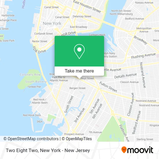
See Two Eight Two, New York - New Jersey, on the map
Public Transit to Two Eight Two in New York - New Jersey
Wondering how to get to Two Eight Two in New York - New Jersey? Moovit helps you find the best way to get to Two Eight Two with step-by-step directions from the nearest public transit station.
Moovit provides free maps and live directions to help you navigate through your city. View schedules, routes, timetables, and find out how long does it take to get to Two Eight Two in real time.
Looking for the nearest stop or station to Two Eight Two? Check out this list of stops closest to your destination: Smith St/Atlantic Av; Atlantic Av/Smith St; Atlantic Av/Boerum Pl; Smith St/Bergen St; Smith St/Livingston St; Livingston St / Smith St; Livingston St/Smith St; Bergen St; Jay St-Metrotech; Borough Hall.
Bus: B62, B63, M103, B65, B61.Train: CITY TERMINAL ZONE, HEMPSTEAD BRANCH.Subway: 2, 5, A, C, F, G, FX, N, R, 3, 4.
Want to see if there’s another route that gets you there at an earlier time? Moovit helps you find alternative routes or times. Get directions from and directions to Two Eight Two easily from the Moovit App or Website.
We make riding to Two Eight Two easy, which is why over 1.5 million users, including users in New York - New Jersey, trust Moovit as the best app for public transit. You don’t need to download an individual bus app or train app, Moovit is your all-in-one transit app that helps you find the best bus time or train time available.
For information on prices of subway, bus and train, costs and ride fares to Two Eight Two, please check the Moovit app.
Use the app to navigate to popular places including to the airport, hospital, stadium, grocery store, mall, coffee shop, school, college, and university.
Two Eight Two Address: 282 Atlantic Ave street in New York - New Jersey
- Brooklyn Detention Complex,
- Criminal Court/AP6,
- 120 Schermerhorn Street Criminal Court Jury 1,
- Ultravirgo,
- Brooklyn House Of Detention,
- Touching Earth Yoga,
- Atelier Healing Arts,
- Atlantic Ave (smith st / atlantic av),
- Taqueria El Jardin Corp,
- Homage Home Furnishings,
- Zerda,
- Yard Bar,
- 7onevape,
- Local Locker Storage,
- Blank Street Coffee,
- NU Hotel (Nu Bar & Lounge),
- Tipsy Grape,
- Nu Hotel,
- Nu Bar & Lounge,
- Michaels
Places Near Two Eight Two (New York - New Jersey)
- 1 Police Plaza, Manhattan,
- San Gennaro Feast, Manhattan,
- Queens Center Mall, Queens,
- Hudson Yards, Manhattan,
- Wall Street, Manhattan,
- Katz's Deli, Manhattan,
- Mountainside Hospital, Glen Ridge,
- Times Square, Manhattan,
- qqqq, Manhattan,
- Bellevue Hospital, Manhattan,
- 66 John Street, Manhattan,
- Pier 83, Manhattan,
- 376 Hudson Street, Manhattan,
- 3 Stone St, Manhattan,
- Chinatown, Manhattan,
- Rockefeller Center, Manhattan,
- 26 Federal Plaza, Manhattan,
- 911 Memorial, Manhattan,
- 111 Centre New York City Supreme Court, Manhattan,
- SoHo, Manhattan
How to get to popular places in New York - New Jersey with public transit
Get around New York - New Jersey by public transit!
Traveling around New York - New Jersey has never been so easy. See step by step directions as you travel to any attraction, street or major public transit station. View bus and train schedules, arrival times, service alerts and detailed routes on a map, so you know exactly how to get to anywhere in New York - New Jersey.
When traveling to any destination around New York - New Jersey use Moovit's Live Directions with Get Off Notifications to know exactly where and how far to walk, how long to wait for your line, and how many stops are left. Moovit will alert you when it's time to get off — no need to constantly re-check whether yours is the next stop.
Wondering how to use public transit in New York - New Jersey or how to pay for public transit in New York - New Jersey? Moovit public transit app can help you navigate your way with public transit easily, and at minimum cost. It includes public transit fees, ticket prices, and costs. Looking for a map of New York - New Jersey public transit lines? Moovit public transit app shows all public transit maps in New York - New Jersey with all Bus, Train, Subway, Light Rail, Ferry and Cable Car routes and stops on an interactive map.
New York - New Jersey has 6 transit type(s), including: Bus, Train, Subway, Light Rail, Ferry and Cable Car, operated by several transit agencies, including MTA Subway, Metro-North Railroad, LIRR, PATH, MTA New York City Transit - Express routes, MTA Bus, NJ Transit, NYC Ferry, NICE bus, Bee-Line Bus, NJ Transit Rail, Norwalk Transit District, Hartford Line, River Valley Transit and HART