How to get to Two Perrys by bus?
Click on the bus route to see step by step directions with maps, line arrival times and updated time schedules.
From Frick Museum, Manhattan
50 minFrom Resorts World Shuttle Bus, Queens
61 minFrom Upper East Side, Manhattan
45 minFrom Forest Park, Queens
68 minFrom Costco, Queens
55 minFrom NJ 440, Jersey City
100 minFrom Mitsuwa Shuttle Bus Stop, Edgewater
76 minFrom Hudson Mall, Jersey City
125 minFrom Walmart, North Bergen
91 minFrom Mitsuwa Marketplace, Edgewater
76 min
How to get to Two Perrys by train?
Click on the train route to see step by step directions with maps, line arrival times and updated time schedules.
How to get to Two Perrys by subway?
Click on the subway route to see step by step directions with maps, line arrival times and updated time schedules.
Bus stops near Two Perrys in Manhattan
Subway stations near Two Perrys in Manhattan
Ferry station near Two Perrys in Manhattan
- Stuyvesant Cove, 14 min walk,VIEW
Bus lines to Two Perrys in Manhattan
What are the closest stations to Two Perrys?
The closest stations to Two Perrys are:
- E 10 St/Avenue D is 34 yards away, 1 min walk.
- Avenue C/E 10 St is 312 yards away, 4 min walk.
- 3 Av is 431 yards away, 6 min walk.
- Stuyvesant Cove is 1125 yards away, 14 min walk.
- Delancey St-Essex St is 1415 yards away, 17 min walk.
Which bus lines stop near Two Perrys?
These bus lines stop near Two Perrys: M14D-SBS, M8, M9.
Which train line stops near Two Perrys?
YEL (Journal Square - 33rd Street)
Which subway lines stop near Two Perrys?
These subway lines stop near Two Perrys: J, L, M, R.
What’s the nearest subway station to Two Perrys in Manhattan?
The nearest subway station to Two Perrys in Manhattan is 3 Av. It’s a 6 min walk away.
What’s the nearest bus station to Two Perrys in Manhattan?
The nearest bus station to Two Perrys in Manhattan is E 10 St/Avenue D. It’s a 1 min walk away.
What’s the nearest ferry station to Two Perrys in Manhattan?
The nearest ferry station to Two Perrys in Manhattan is Stuyvesant Cove. It’s a 14 min walk away.
What time is the first subway to Two Perrys in Manhattan?
The L is the first subway that goes to Two Perrys in Manhattan. It stops nearby at 3:00 AM.
What time is the last subway to Two Perrys in Manhattan?
The F is the last subway that goes to Two Perrys in Manhattan. It stops nearby at 3:58 AM.
What time is the first bus to Two Perrys in Manhattan?
The M14D-SBS is the first bus that goes to Two Perrys in Manhattan. It stops nearby at 3:04 AM.
What time is the last bus to Two Perrys in Manhattan?
The M14D-SBS is the last bus that goes to Two Perrys in Manhattan. It stops nearby at 2:46 AM.
What time is the first ferry to Two Perrys in Manhattan?
The RS is the first ferry that goes to Two Perrys in Manhattan. It stops nearby at 5:51 AM.
What time is the last ferry to Two Perrys in Manhattan?
The RS is the last ferry that goes to Two Perrys in Manhattan. It stops nearby at 9:17 PM.
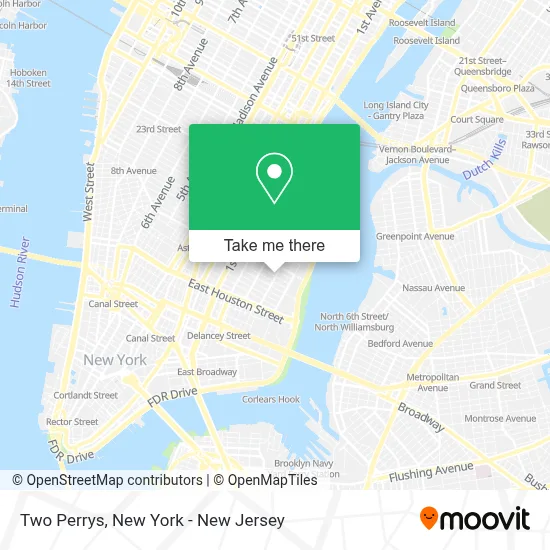
See Two Perrys, Manhattan, on the map
Public Transit to Two Perrys in Manhattan
Wondering how to get to Two Perrys in Manhattan? Moovit helps you find the best way to get to Two Perrys with step-by-step directions from the nearest public transit station.
Moovit provides free maps and live directions to help you navigate through your city. View schedules, routes, timetables, and find out how long does it take to get to Two Perrys in real time.
Looking for the nearest stop or station to Two Perrys? Check out this list of stops closest to your destination: E 10 St/Avenue D; Avenue C/E 10 St; 3 Av; Stuyvesant Cove; Delancey St-Essex St.
Bus: M14D-SBS, M8, M9.Train: YEL.Subway: J, L, M, R, B39, A, C, F, FX.Ferry: RS.
Want to see if there’s another route that gets you there at an earlier time? Moovit helps you find alternative routes or times. Get directions from and directions to Two Perrys easily from the Moovit App or Website.
We make riding to Two Perrys easy, which is why over 1.5 million users, including users in Manhattan, trust Moovit as the best app for public transit. You don’t need to download an individual bus app or train app, Moovit is your all-in-one transit app that helps you find the best bus time or train time available.
For information on prices of bus, subway and train, costs and ride fares to Two Perrys, please check the Moovit app.
Use the app to navigate to popular places including to the airport, hospital, stadium, grocery store, mall, coffee shop, school, college, and university.
Two Perrys Address: 127 Avenue C street in Manhattan
- NYPD Housing Bureau - PSA 4,
- Nypd PSA 4,
- Big Sky Nyc,
- Nypd Anchor Club,
- Mystic Falls,
- Lovewild Design,
- Monza Market East Village,
- Sevenfifty House,
- Alphabet City,
- Le Jardin Bistro,
- Earth People Garden,
- The Third Man,
- The Poetry Society Of New York,
- Kosmic Community Anti Bar & Coffee Shop,
- Ding-A-Ling,
- Carmen Pabon Del Amanecer,
- Cafe Cambodge,
- Loisaida Ave 9th St,
- Loisaidafest,
- The Cabinet Mezcal Bar
Places Near Two Perrys (Manhattan)
- 111 Centre New York City Supreme Court, Manhattan,
- 376 Hudson Street, Manhattan,
- 66 John Street, Manhattan,
- Bellevue Hospital, Manhattan,
- Times Square, Manhattan,
- San Gennaro Feast, Manhattan,
- qqqq, Manhattan,
- 911 Memorial, Manhattan,
- Chinatown, Manhattan,
- Rockefeller Center, Manhattan,
- Katz's Deli, Manhattan,
- 26 Federal Plaza, Manhattan,
- Queens Center Mall, Queens,
- 3 Stone St, Manhattan,
- Wall Street, Manhattan,
- Hudson Yards, Manhattan,
- SoHo, Manhattan,
- Pier 83, Manhattan,
- Mountainside Hospital, Glen Ridge,
- 1 Police Plaza, Manhattan
How to get to popular places in New York - New Jersey with public transit
Get around Manhattan by public transit!
Traveling around Manhattan has never been so easy. See step by step directions as you travel to any attraction, street or major public transit station. View bus and train schedules, arrival times, service alerts and detailed routes on a map, so you know exactly how to get to anywhere in Manhattan.
When traveling to any destination around Manhattan use Moovit's Live Directions with Get Off Notifications to know exactly where and how far to walk, how long to wait for your line, and how many stops are left. Moovit will alert you when it's time to get off — no need to constantly re-check whether yours is the next stop.
Wondering how to use public transit in Manhattan or how to pay for public transit in Manhattan? Moovit public transit app can help you navigate your way with public transit easily, and at minimum cost. It includes public transit fees, ticket prices, and costs. Looking for a map of Manhattan public transit lines? Moovit public transit app shows all public transit maps in Manhattan with all Bus, Train, Subway, Light Rail, Ferry and Cable Car routes and stops on an interactive map.
New York - New Jersey has 6 transit type(s), including: Bus, Train, Subway, Light Rail, Ferry and Cable Car, operated by several transit agencies, including MTA Subway, Metro-North Railroad, LIRR, PATH, MTA New York City Transit - Express routes, MTA Bus, NJ Transit, NYC Ferry, NICE bus, Bee-Line Bus, NJ Transit Rail, Norwalk Transit District, Hartford Line, River Valley Transit and HART