How to get to Two Sigma by bus?
Click on the bus route to see step by step directions with maps, line arrival times and updated time schedules.
From Long Island City Courthouse, Queens
74 minFrom Elmhurst Hospital, Queens
86 minFrom Middle Village, NY, Queens
74 minFrom Queens Center Mall, Queens
88 minFrom Baruch College, Manhattan
65 minFrom New York Presbyterian Hospital, Manhattan
58 minFrom Wollman Rink, Manhattan
41 minFrom Museo Americano de Historia Natural, Manhattan
63 minFrom Costco Wholesale, Manhattan
83 minFrom Costco, Manhattan
83 min
How to get to Two Sigma by train?
Click on the train route to see step by step directions with maps, line arrival times and updated time schedules.
How to get to Two Sigma by subway?
Click on the subway route to see step by step directions with maps, line arrival times and updated time schedules.
From Long Island City Courthouse, Queens
28 minFrom Elmhurst Hospital, Queens
40 minFrom Middle Village, NY, Queens
55 minFrom Queens Center Mall, Queens
47 minFrom Baruch College, Manhattan
28 minFrom New York Presbyterian Hospital, Manhattan
38 minFrom Wollman Rink, Manhattan
29 minFrom Museo Americano de Historia Natural, Manhattan
27 minFrom Costco Wholesale, Manhattan
52 minFrom Costco, Manhattan
53 min
Bus stops near Two Sigma in Manhattan
Bus lines to Two Sigma in Manhattan
- SHORTLINE HUDSON, Nanuet,VIEW
- SHORTLINE HUDSON, Circleville,VIEW
- M20, South Ferry Via 7 Av Via Bat Pk City,VIEW
- X27, Midtown 57 St Via Church Via Madison,VIEW
- X28, 23 St-Broadway Via Church St,VIEW
- M21, Lower E Side Grand-Fdr Crosstown,VIEW
- M55, 44 St 6 Av,VIEW
- SIM1, Eltingville - Lower Manhattan Express,VIEW
- SIM1C, Eltingville - Manhattan Express,VIEW
- SIM3C, Pt. Richmond - Manhattan Express,VIEW
- SIM4C, Huguenot - Manhattan Express,VIEW
- SIM33C, Mariners Harbor - Greenwich Village Express,VIEW
- SIM34, Mariners Harbor - Lower Manhattan Express,VIEW
- BXM18, Riverdale 263 St Via Madison Av Via H. Hudson Pky,VIEW
What are the closest stations to Two Sigma?
The closest stations to Two Sigma are:
- Spring St is 214 yards away, 3 min walk.
- 6th Ave & Spring St is 231 yards away, 3 min walk.
- Varick St/Charlton St is 232 yards away, 3 min walk.
- 6 Av/Spring St is 241 yards away, 4 min walk.
- Broadway/Broome St is 268 yards away, 4 min walk.
- 6 Av/W Broadway is 447 yards away, 6 min walk.
- Houston St is 466 yards away, 6 min walk.
Which bus lines stop near Two Sigma?
These bus lines stop near Two Sigma: BXM18, M1, M20, M55.
Which train lines stop near Two Sigma?
These train lines stop near Two Sigma: BLU, YEL.
Which subway lines stop near Two Sigma?
These subway lines stop near Two Sigma: 1, 6, 6X, A, C, E, Q.
What’s the nearest subway station to Two Sigma in Manhattan?
The nearest subway station to Two Sigma in Manhattan is Spring St. It’s a 3 min walk away.
What’s the nearest bus station to Two Sigma in Manhattan?
The nearest bus stations to Two Sigma in Manhattan are 6th Ave & Spring St and Varick St/Charlton St. The closest one is a 3 min walk away.
What time is the first subway to Two Sigma in Manhattan?
The 1 is the first subway that goes to Two Sigma in Manhattan. It stops nearby at 3:00 AM.
What time is the last subway to Two Sigma in Manhattan?
The 2 is the last subway that goes to Two Sigma in Manhattan. It stops nearby at 4:06 AM.
What time is the first bus to Two Sigma in Manhattan?
The SIM1C is the first bus that goes to Two Sigma in Manhattan. It stops nearby at 3:49 AM.
What time is the last bus to Two Sigma in Manhattan?
The SIM1C is the last bus that goes to Two Sigma in Manhattan. It stops nearby at 2:51 AM.
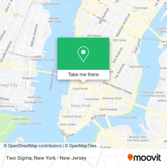
See Two Sigma, Manhattan, on the map
Public Transit to Two Sigma in Manhattan
Wondering how to get to Two Sigma in Manhattan? Moovit helps you find the best way to get to Two Sigma with step-by-step directions from the nearest public transit station.
Moovit provides free maps and live directions to help you navigate through your city. View schedules, routes, timetables, and find out how long does it take to get to Two Sigma in real time.
Looking for the nearest stop or station to Two Sigma? Check out this list of stops closest to your destination: Spring St; 6th Ave & Spring St; Varick St/Charlton St; 6 Av/Spring St; Broadway/Broome St; 6 Av/W Broadway; Houston St.
Bus: BXM18, M1, M20, M55, SHORTLINE HUDSON, SHORTLINE HUDSON, X27, X28, M21.Train: BLU, YEL.Subway: 1, 6, 6X, A, C, E, Q, 2.
Want to see if there’s another route that gets you there at an earlier time? Moovit helps you find alternative routes or times. Get directions from and directions to Two Sigma easily from the Moovit App or Website.
We make riding to Two Sigma easy, which is why over 1.5 million users, including users in Manhattan, trust Moovit as the best app for public transit. You don’t need to download an individual bus app or train app, Moovit is your all-in-one transit app that helps you find the best bus time or train time available.
For information on prices of subway, bus and train, costs and ride fares to Two Sigma, please check the Moovit app.
Use the app to navigate to popular places including to the airport, hospital, stadium, grocery store, mall, coffee shop, school, college, and university.
Two Sigma Address: 100 6th Ave street in Manhattan
- A Lock and Locksmith,
- Renata Smith,
- Brooklyn Flea,
- Nyc First,
- Mehedi Art by Roja,
- Qs Heating & Building Maintenance,
- West Village,
- Made In Usa,
- 6th Ave (6th & watts),
- 6th Ave & Watts St,
- Nyc Lead & Mold,
- William Reynolds, Psy.D.,
- Tirrell De Gannes, Psy.D.,
- Moore Family Law, P.C.,
- Takeshi,
- African Grove,
- Barbarian,
- Tokuyamatcha & Onigirazu Bar,
- Kintsugi,
- Tender Crush
Places Near Two Sigma (Manhattan)
- Bellevue Hospital, Manhattan,
- 111 Centre New York City Supreme Court, Manhattan,
- Katz's Deli, Manhattan,
- Hudson Yards, Manhattan,
- 66 John Street, Manhattan,
- SoHo, Manhattan,
- 376 Hudson Street, Manhattan,
- Rockefeller Center, Manhattan,
- 26 Federal Plaza, Manhattan,
- qqqq, Manhattan,
- 3 Stone St, Manhattan,
- 911 Memorial, Manhattan,
- Chinatown, Manhattan,
- San Gennaro Feast, Manhattan,
- Wall Street, Manhattan,
- Times Square, Manhattan,
- Queens Center Mall, Queens,
- Mountainside Hospital, Glen Ridge,
- Pier 83, Manhattan,
- 1 Police Plaza, Manhattan
How to get to popular places in New York - New Jersey with public transit
Get around Manhattan by public transit!
Traveling around Manhattan has never been so easy. See step by step directions as you travel to any attraction, street or major public transit station. View bus and train schedules, arrival times, service alerts and detailed routes on a map, so you know exactly how to get to anywhere in Manhattan.
When traveling to any destination around Manhattan use Moovit's Live Directions with Get Off Notifications to know exactly where and how far to walk, how long to wait for your line, and how many stops are left. Moovit will alert you when it's time to get off — no need to constantly re-check whether yours is the next stop.
Wondering how to use public transit in Manhattan or how to pay for public transit in Manhattan? Moovit public transit app can help you navigate your way with public transit easily, and at minimum cost. It includes public transit fees, ticket prices, and costs. Looking for a map of Manhattan public transit lines? Moovit public transit app shows all public transit maps in Manhattan with all Bus, Train, Subway, Light Rail, Ferry and Cable Car routes and stops on an interactive map.
New York - New Jersey has 6 transit type(s), including: Bus, Train, Subway, Light Rail, Ferry and Cable Car, operated by several transit agencies, including MTA Subway, Metro-North Railroad, LIRR, PATH, MTA New York City Transit - Express routes, MTA Bus, NJ Transit, NYC Ferry, NICE bus, Bee-Line Bus, NJ Transit Rail, Norwalk Transit District, Hartford Line, River Valley Transit and HART