How to get to Two Sparrows Homestead by bus?
Click on the bus route to see step by step directions with maps, line arrival times and updated time schedules.
How to get to Two Sparrows Homestead by train?
Click on the train route to see step by step directions with maps, line arrival times and updated time schedules.
Bus stop near Two Sparrows Homestead in Beacon
- Main Street & S Brett (Across From Key Food), 3 min walk,VIEW
Train station near Two Sparrows Homestead in Beacon
- Beacon, 15 min walk,VIEW
Bus lines to Two Sparrows Homestead in Beacon
What are the closest stations to Two Sparrows Homestead?
The closest stations to Two Sparrows Homestead are:
- Main Street & S Brett (Across From Key Food) is 191 yards away, 3 min walk.
- Beacon is 1211 yards away, 15 min walk.
Which bus lines stop near Two Sparrows Homestead?
These bus lines stop near Two Sparrows Homestead: B MS, G MS.
Which train line stops near Two Sparrows Homestead?
1 (813#| Poughkeepsie)
What’s the nearest train station to Two Sparrows Homestead in Beacon?
The nearest train station to Two Sparrows Homestead in Beacon is Beacon. It’s a 15 min walk away.
What’s the nearest bus station to Two Sparrows Homestead in Beacon?
The nearest bus station to Two Sparrows Homestead in Beacon is Main Street & S Brett (Across From Key Food). It’s a 3 min walk away.
What time is the first train to Two Sparrows Homestead in Beacon?
The 1 is the first train that goes to Two Sparrows Homestead in Beacon. It stops nearby at 3:44 AM.
What time is the last train to Two Sparrows Homestead in Beacon?
The 1 is the last train that goes to Two Sparrows Homestead in Beacon. It stops nearby at 2:29 AM.
What time is the first bus to Two Sparrows Homestead in Beacon?
The G MS is the first bus that goes to Two Sparrows Homestead in Beacon. It stops nearby at 6:03 AM.
What time is the last bus to Two Sparrows Homestead in Beacon?
The B MS is the last bus that goes to Two Sparrows Homestead in Beacon. It stops nearby at 11:01 PM.
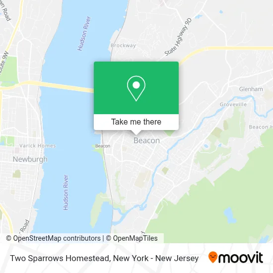
See Two Sparrows Homestead, Beacon, on the map
Public Transit to Two Sparrows Homestead in Beacon
Wondering how to get to Two Sparrows Homestead in Beacon? Moovit helps you find the best way to get to Two Sparrows Homestead with step-by-step directions from the nearest public transit station.
Moovit provides free maps and live directions to help you navigate through your city. View schedules, routes, timetables, and find out how long does it take to get to Two Sparrows Homestead in real time.
Looking for the nearest stop or station to Two Sparrows Homestead? Check out this list of stops closest to your destination: Main Street & S Brett (Across From Key Food); Beacon.
Bus: B MS, G MS, B SUN, F, G MS1.Train: 1.
Want to see if there’s another route that gets you there at an earlier time? Moovit helps you find alternative routes or times. Get directions from and directions to Two Sparrows Homestead easily from the Moovit App or Website.
We make riding to Two Sparrows Homestead easy, which is why over 1.5 million users, including users in Beacon, trust Moovit as the best app for public transit. You don’t need to download an individual bus app or train app, Moovit is your all-in-one transit app that helps you find the best bus time or train time available.
For information on prices of bus and train, costs and ride fares to Two Sparrows Homestead, please check the Moovit app.
Use the app to navigate to popular places including to the airport, hospital, stadium, grocery store, mall, coffee shop, school, college, and university.
Two Sparrows Homestead Address: 226 Main St street in Beacon
- Paul Westlake,
- Zappian Media Llc,
- Bagelish,
- Living In Beacon NY,
- Berkshire Hathaway Homeservices Hudson Valley Properties,
- Garage Gallery Beacon,
- Dave the Butcher,
- Beacon Digital Marketing,
- Roc Pilates,
- Sunoco,
- Team Odell Collectibles & Memorabilia,
- Veritech Wireless,
- Antalek & Moore Insurance,
- Lovely Sunday Jewelry,
- Jairo's Mobile Pit Stop,
- Hudson Valley's Best Parkour - Beacon,
- Mirbeau Inn & Spa Beacon,
- Cirqueducreep,
- Home Spa Pressure Washing,
- Mount Beacon
Places Near Two Sparrows Homestead (Beacon)
- 111 Centre New York City Supreme Court, Manhattan,
- Katz's Deli, Manhattan,
- SoHo, Manhattan,
- Bellevue Hospital, Manhattan,
- Chinatown, Manhattan,
- Queens Center Mall, Queens,
- Mountainside Hospital, Glen Ridge,
- Wall Street, Manhattan,
- 911 Memorial, Manhattan,
- Hudson Yards, Manhattan,
- Rockefeller Center, Manhattan,
- 376 Hudson Street, Manhattan,
- 3 Stone St, Manhattan,
- 66 John Street, Manhattan,
- Times Square, Manhattan,
- Pier 83, Manhattan,
- San Gennaro Feast, Manhattan,
- qqqq, Manhattan,
- 26 Federal Plaza, Manhattan,
- 1 Police Plaza, Manhattan
How to get to popular places in New York - New Jersey with public transit
Get around Beacon by public transit!
Traveling around Beacon has never been so easy. See step by step directions as you travel to any attraction, street or major public transit station. View bus and train schedules, arrival times, service alerts and detailed routes on a map, so you know exactly how to get to anywhere in Beacon.
When traveling to any destination around Beacon use Moovit's Live Directions with Get Off Notifications to know exactly where and how far to walk, how long to wait for your line, and how many stops are left. Moovit will alert you when it's time to get off — no need to constantly re-check whether yours is the next stop.
Wondering how to use public transit in Beacon or how to pay for public transit in Beacon? Moovit public transit app can help you navigate your way with public transit easily, and at minimum cost. It includes public transit fees, ticket prices, and costs. Looking for a map of Beacon public transit lines? Moovit public transit app shows all public transit maps in Beacon with all Bus, Train, Subway, Light Rail, Ferry and Cable Car routes and stops on an interactive map.
New York - New Jersey has 6 transit type(s), including: Bus, Train, Subway, Light Rail, Ferry and Cable Car, operated by several transit agencies, including MTA Subway, Metro-North Railroad, LIRR, PATH, MTA New York City Transit - Express routes, MTA Bus, NJ Transit, NYC Ferry, NICE bus, Bee-Line Bus, NJ Transit Rail, Norwalk Transit District, Hartford Line, River Valley Transit and HART
Public transit lines with stations closest to Two Sparrows Homestead in Beacon
Train lines with stations closest to Two Sparrows Homestead in Beacon
Bus lines with stations closest to Two Sparrows Homestead in Beacon
Main Street & S Brett (Across From Key Food)
 B MSTransit Hub - Beacon Post Office - Veterans Place & Henry Street
- B SUNTransit Hub - Main Street & S Brett (Across from Key Food)
- FHopewell - Acme Plaza - Beacon Post Office - Veterans Place & Henry Street
- G MSRoute 376 & CR 77 (Vassar Road) Eastside - Beacon Train Station
- G MS1Route 376 & CR 77 (Vassar Road) Eastside - Beacon Train Station