Directions to Two Way Radio Gear (Fort Pierce) with public transportation
The following transit lines have routes that pass near Two Way Radio Gear
 Bus: 1, 3, 8, FLIXBUS N2411, RT 15.
How to get to Two Way Radio Gear by bus?
Click on the bus route to see step by step directions with maps, line arrival times and updated time schedules.
From Clover Park, Port St. Lucie
91 minFrom US-1 / SE Port St Lucie Blvd, Port St. Lucie
118 minFrom CVS Pharmacy - (Lyngate Dr), Port St. Lucie
90 minFrom US-1, Fort Pierce
57 minFrom Tradition Park, Port St. Lucie
101 minFrom Donald Ross Rd / Military Trl, Jupiter
423 minFrom Suncoast Community High School, Riviera Beach
293 minFrom William T. Dwyer High School, Jupiter
437 minFrom Suncoast High School, Riviera Beach
291 min
Bus stops near Two Way Radio Gear in Fort Pierce
Bus lines to Two Way Radio Gear in Fort Pierce
What are the closest stations to Two Way Radio Gear?
The closest stations to Two Way Radio Gear are:
- Okeechobee Rd & S 33rd St is 114 yards away, 2 min walk.
- Frist Blvd & S 25th St is 854 yards away, 11 min walk.
- IRSC Main Campus is 1421 yards away, 17 min walk.
Which bus lines stop near Two Way Radio Gear?
These bus lines stop near Two Way Radio Gear: 1, 3, 8, FLIXBUS N2411.
What’s the nearest bus station to Two Way Radio Gear in Fort Pierce?
The nearest bus station to Two Way Radio Gear in Fort Pierce is Okeechobee Rd & S 33rd St. It’s a 2 min walk away.
What time is the first bus to Two Way Radio Gear in Fort Pierce?
The 3 is the first bus that goes to Two Way Radio Gear in Fort Pierce. It stops nearby at 6:12 AM.
What time is the last bus to Two Way Radio Gear in Fort Pierce?
The 3 is the last bus that goes to Two Way Radio Gear in Fort Pierce. It stops nearby at 7:37 PM.
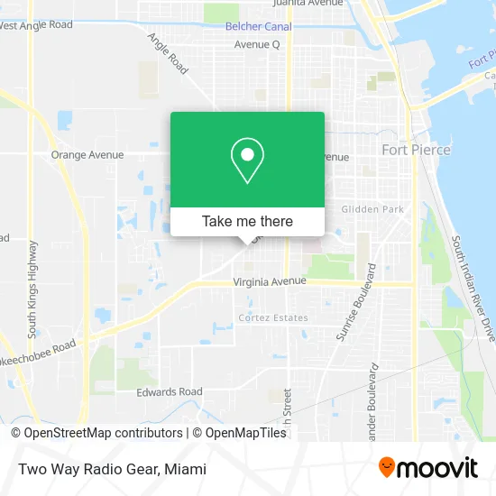
See Two Way Radio Gear, Fort Pierce, on the map
Public Transit to Two Way Radio Gear in Fort Pierce
Wondering how to get to Two Way Radio Gear in Fort Pierce? Moovit helps you find the best way to get to Two Way Radio Gear with step-by-step directions from the nearest public transit station.
Moovit provides free maps and live directions to help you navigate through your city. View schedules, routes, timetables, and find out how long does it take to get to Two Way Radio Gear in real time.
Looking for the nearest stop or station to Two Way Radio Gear? Check out this list of stops closest to your destination: Okeechobee Rd & S 33rd St; Frist Blvd & S 25th St; IRSC Main Campus.
Bus: 1, 3, 8, FLIXBUS N2411, RT 15.
Want to see if there’s another route that gets you there at an earlier time? Moovit helps you find alternative routes or times. Get directions from and directions to Two Way Radio Gear easily from the Moovit App or Website.
We make riding to Two Way Radio Gear easy, which is why over 1.5 million users, including users in Fort Pierce, trust Moovit as the best app for public transit. You don’t need to download an individual bus app or train app, Moovit is your all-in-one transit app that helps you find the best bus time or train time available.
For information on prices of bus, costs and ride fares to Two Way Radio Gear, please check the Moovit app.
Use the app to navigate to popular places including to the airport, hospital, stadium, grocery store, mall, coffee shop, school, college, and university.
Two Way Radio Gear Address: 3245 Okeechobee Rd Fort Pierce, FL 34947 street in Fort Pierce
- First Assembly of God Church,
- Fairlawn Elementary Magnet School,
- Open Door House of Prayer,
- Indian River Baptist Association,
- Livingword Ministry Inc,
- Iris's Grocery Store,
- T-Mobile,
- Monarda Apiary,
- Tikal Grocery Store,
- All Star Transmission,
- Elite Auto Rental,
- Bree's Cake's & Baking Supplies, LLC,
- By His Blood Church,
- Open Door Apostolic Church,
- La Placita Grocery,
- Jreamvisions TV,
- Family Used Cars,
- Mac's Automotive & Transmission,
- First Appearance Salon,
- MLB Barbershop 2 Inc.
Places Near Two Way Radio Gear (Fort Pierce)
- Port of Miami Cruise Terminal, Miami,
- Aventura Mall, Miami Beach,
- Dolphin Mall Bus, Miami,
- Keiser University Flagship Campus, West Palm Beach,
- Miami Design District, Miami,
- Richard E. Gerstein Justice Building, Miami,
- Hard Rock Stadium, Miami Gardens,
- Miami-Dade County Courthouse, Miami,
- Aventura Mall, Miami,
- Little Havana, Miami,
- Bayside Marketplace, Miami,
- Sawgrass mall ( FL ), Miami Beach,
- Miami Freedom Park, Miami,
- Marlins Park, Miami,
- Dolphin Mall, Miami,
- Wynwood, Miami,
- Miami VA Hospital, Miami,
- Zoo Miami, Miami,
- Sawgrass Mall, Miami,
- Brickell City Centre, Miami
How to get to popular places in Miami with public transit
Get around Fort Pierce by public transit!
Traveling around Fort Pierce has never been so easy. See step by step directions as you travel to any attraction, street or major public transit station. View bus and train schedules, arrival times, service alerts and detailed routes on a map, so you know exactly how to get to anywhere in Fort Pierce.
When traveling to any destination around Fort Pierce use Moovit's Live Directions with Get Off Notifications to know exactly where and how far to walk, how long to wait for your line, and how many stops are left. Moovit will alert you when it's time to get off — no need to constantly re-check whether yours is the next stop.
Wondering how to use public transit in Fort Pierce or how to pay for public transit in Fort Pierce? Moovit public transit app can help you navigate your way with public transit easily, and at minimum cost. It includes public transit fees, ticket prices, and costs. Looking for a map of Fort Pierce public transit lines? Moovit public transit app shows all public transit maps in Fort Pierce with all Bus, Train, Light Rail and Ferry routes and stops on an interactive map.
Miami has 4 transit type(s), including: Bus, Train, Light Rail and Ferry, operated by several transit agencies, including Broward County Transit, Miami-Dade Transit, Metrorail, Palm Tran, Tri-Rail, Brightline, MARTY, City of Homestead Trolley, Key West Transit, Treasure Coast Connector, GoLine IRT, Amtrak, Greyhound-us, FlixBus-us and Aventura Express Shuttle Bus