How to get to UPS by bus?
Click on the bus route to see step by step directions with maps, line arrival times and updated time schedules.
From Potomac Mills Mall, Prince William County
234 minFrom Lorton, VA, Fairfax County
243 minFrom Lorton, VA - Amtrak Auto Train Station (LOR), Fairfax County
249 minFrom Busch Gardens Williamsburg (Employee Parking Lot), James City County
175 minFrom Rose Gaming Resort, Prince William County
259 minFrom Amazon Fulfillment Center-Ric3, Richmond
68 minFrom UVA Hospital Medical Center, Charlottesville
323 minFrom Woodbridge, VA, Prince William County
178 min
Bus stops near UPS in Richmond
Bus lines to UPS in Richmond
What are the closest stations to UPS?
The closest stations to UPS are:
- German School + 201 is 202 yards away, 3 min walk.
- Midlothian Pike + Southgate Shopping Center is 658 yards away, 8 min walk.
Which bus line stops near UPS?
1A (Hull/Midlothian Via Southside Plaza)
What’s the nearest bus station to UPS in Richmond?
The nearest bus station to UPS in Richmond is German School + 201. It’s a 3 min walk away.
What time is the first bus to UPS in Richmond?
The 1A is the first bus that goes to UPS in Richmond. It stops nearby at 5:08 AM.
What time is the last bus to UPS in Richmond?
The 1A is the last bus that goes to UPS in Richmond. It stops nearby at 12:52 AM.
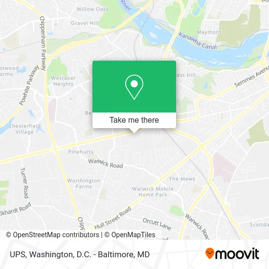
See UPS, Richmond, on the map
Public Transit to UPS in Richmond
Wondering how to get to UPS in Richmond? Moovit helps you find the best way to get to UPS with step-by-step directions from the nearest public transit station.
Moovit provides free maps and live directions to help you navigate through your city. View schedules, routes, timetables, and find out how long does it take to get to UPS in real time.
Looking for the nearest stop or station to UPS? Check out this list of stops closest to your destination: German School + 201; Midlothian Pike + Southgate Shopping Center.
Bus: 1A, 1B.
Want to see if there’s another route that gets you there at an earlier time? Moovit helps you find alternative routes or times. Get directions from and directions to UPS easily from the Moovit App or Website.
We make riding to UPS easy, which is why over 1.7 million users, including users in Richmond, trust Moovit as the best app for public transit. You don’t need to download an individual bus app or train app, Moovit is your all-in-one transit app that helps you find the best bus time or train time available.
For information on prices of bus and train, costs and ride fares to UPS, please check the Moovit app.
Use the app to navigate to popular places including to the airport, hospital, stadium, grocery store, mall, coffee shop, school, college, and university.
UPS Address: 5401 Midlothian Tpke Richmond, VA 23224 street in Richmond
- On Demand Towing & Recovery,
- Family Thrift Center,
- Nott Recycling,
- New Life Deliverance,
- El Obrero Hardware Supply,
- Daily Pawn Shop,
- Cloverleaf Inn,
- Air Monitoring Specialists,
- United Auto Repair & Sales,
- Midlothian Tire & Auto,
- Respect Richmond,
- Locksmith 24 Hour Inc,
- Liberation Church,
- Celebration Church Outreach Ministry,
- Roc Cafe,
- Qui's Cafe,
- Roc Childcare and Development Center,
- Celebrate A New You,
- Breaking Free at Celebration Church,
- Northside Coalition for Children Inc
Places Near UPS (Richmond)
- Rock Creek Tennis Center, Washington,
- M&T Bank Stadium, Baltimore,
- Amazon Hq2, Arlington County,
- National Zoo, Washington,
- Pennsylvania Ave NW (3rd st and pennsylvania), Washington,
- Camden Yards, Baltimore,
- Basilica of the National Shrine, Washington,
- Marriott Marquis Washington, DC, Washington,
- Washington DC VA Medical Center, Washington,
- PG Mall, Prince George's County,
- National Museum of African American History and Culture, Washington,
- Sibley Memorial Hospital, Washington,
- Washington National Cathedral, Washington,
- Westfield Montgomery Mall, Montgomery County,
- Museum Of The Bible, Washington,
- Georgetown, Washington,
- The Anthem, Washington,
- Warner Theatre, Washington,
- National Theatre, Washington,
- Capital One Arena, Washington
How to get to popular places in Washington, D.C. - Baltimore, MD with public transit
Get around Richmond by public transit!
Traveling around Richmond has never been so easy. See step by step directions as you travel to any attraction, street or major public transit station. View bus and train schedules, arrival times, service alerts and detailed routes on a map, so you know exactly how to get to anywhere in Richmond.
When traveling to any destination around Richmond use Moovit's Live Directions with Get Off Notifications to know exactly where and how far to walk, how long to wait for your line, and how many stops are left. Moovit will alert you when it's time to get off — no need to constantly re-check whether yours is the next stop.
Wondering how to use public transit in Richmond or how to pay for public transit in Richmond? Moovit public transit app can help you navigate your way with public transit easily, and at minimum cost. It includes public transit fees, ticket prices, and costs. Looking for a map of Richmond public transit lines? Moovit public transit app shows all public transit maps in Richmond with all Bus, Train, Metro, Light Rail and Ferry routes and stops on an interactive map.
Washington, D.C. - Baltimore, MD has 5 transit type(s), including: Bus, Train, Metro, Light Rail and Ferry, operated by several transit agencies, including WMATA, Montgomery County Ride On, Fairfax Connector, TheBus, PRTC, DASH - Alexandria, Arlington Transit (ART), RTA of Central Maryland, MDOT MTA, MDOT MTA Light RailLink, MDOT MTA Commuter Bus, MDOT MTA Local Bus, FXBGO!, Virginia Railway Express (VRE) and MARC