How to get to UPS Access Point Location by bus?
Click on the bus route to see step by step directions with maps, line arrival times and updated time schedules.
From Florida Keys Outlet Marketplace, Homestead
255 minFrom Florida City, Homestead
248 minFrom Walmart (Walmart Florida City), Homestead
248 minFrom Orlando Florida, Homestead
249 minFrom Florida Keys Outlet Center, Homestead
255 minFrom SW 187th Ave / SW 344th St, Homestead
260 minFrom Florida City, FL, Homestead
250 minFrom Homestead, FL, Homestead
255 minFrom Exit 1/Florida City/S, Homestead
302 min
Bus stop near UPS Access Point Location in Key West
- N Roosevelt & George Street, 10 min walk,VIEW
What are the closest stations to UPS Access Point Location?
The closest stations to UPS Access Point Location are:
- N Roosevelt & George Street is 761 yards away, 10 min walk.
Which bus line stops near UPS Access Point Location?
LKS (Stock Island/Key West)
What’s the nearest bus station to UPS Access Point Location in Key West?
The nearest bus station to UPS Access Point Location in Key West is N Roosevelt & George Street. It’s a 10 min walk away.
What time is the first bus to UPS Access Point Location in Key West?
The LKS is the first bus that goes to UPS Access Point Location in Key West. It stops nearby at 5:46 AM.
What time is the last bus to UPS Access Point Location in Key West?
The LKS is the last bus that goes to UPS Access Point Location in Key West. It stops nearby at 9:52 PM.
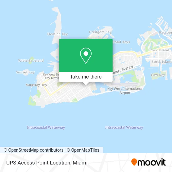
See UPS Access Point Location, Key West, on the map
Public Transit to UPS Access Point Location in Key West
Wondering how to get to UPS Access Point Location in Key West? Moovit helps you find the best way to get to UPS Access Point Location with step-by-step directions from the nearest public transit station.
Moovit provides free maps and live directions to help you navigate through your city. View schedules, routes, timetables, and find out how long does it take to get to UPS Access Point Location in real time.
Looking for the nearest stop or station to UPS Access Point Location? Check out this list of stops closest to your destination: N Roosevelt & George Street.
Bus: LKS, WFX.
Want to see if there’s another route that gets you there at an earlier time? Moovit helps you find alternative routes or times. Get directions from and directions to UPS Access Point Location easily from the Moovit App or Website.
We make riding to UPS Access Point Location easy, which is why over 1.5 million users, including users in Key West, trust Moovit as the best app for public transit. You don’t need to download an individual bus app or train app, Moovit is your all-in-one transit app that helps you find the best bus time or train time available.
For information on prices of bus, costs and ride fares to UPS Access Point Location, please check the Moovit app.
Use the app to navigate to popular places including to the airport, hospital, stadium, grocery store, mall, coffee shop, school, college, and university.
UPS Access Point Location Address: 1835 Flagler Ave Key West, FL 33040 street in Key West
- Bone Island Shuttle,
- Dredgers Key,
- Key West Trading Post,
- Amy's Liquor Store,
- Sunset Watersports Parasailing,
- Lindholm Roofing,
- Patti the Plumber,
- Popeyes Louisiana Kitchen,
- Conch Republic,
- Jolly Roger II,
- La Brisa Condominiums,
- Smoked BBQ,
- City Marina at Garrison Bight,
- GOODYEAR Tire,
- Mammography of Key West,
- Nauti Vapes,
- Banana Bay Resort of Key West,
- 1800 Atlantic Suites,
- Harborside Hotel & Marina,
- Sean Farrer, PA
Places Near UPS Access Point Location (Key West)
- Miami Design District, Miami,
- Miami Freedom Park, Miami,
- Hard Rock Stadium, Miami Gardens,
- Miami VA Hospital, Miami,
- Miami-Dade County Courthouse, Miami,
- Keiser University Flagship Campus, West Palm Beach,
- Bayside Marketplace, Miami,
- Sawgrass mall ( FL ), Miami Beach,
- Marlins Park, Miami,
- Aventura Mall, Miami,
- Dolphin Mall Bus, Miami,
- Little Havana, Miami,
- Port of Miami Cruise Terminal, Miami,
- Sawgrass Mall, Miami,
- Wynwood, Miami,
- Aventura Mall, Miami Beach,
- Dolphin Mall, Miami,
- Richard E. Gerstein Justice Building, Miami,
- Zoo Miami, Miami,
- Brickell City Centre, Miami
How to get to popular places in Miami with public transit
Get around Key West by public transit!
Traveling around Key West has never been so easy. See step by step directions as you travel to any attraction, street or major public transit station. View bus and train schedules, arrival times, service alerts and detailed routes on a map, so you know exactly how to get to anywhere in Key West.
When traveling to any destination around Key West use Moovit's Live Directions with Get Off Notifications to know exactly where and how far to walk, how long to wait for your line, and how many stops are left. Moovit will alert you when it's time to get off — no need to constantly re-check whether yours is the next stop.
Wondering how to use public transit in Key West or how to pay for public transit in Key West? Moovit public transit app can help you navigate your way with public transit easily, and at minimum cost. It includes public transit fees, ticket prices, and costs. Looking for a map of Key West public transit lines? Moovit public transit app shows all public transit maps in Key West with all Bus, Train, Light Rail and Ferry routes and stops on an interactive map.
Miami has 4 transit type(s), including: Bus, Train, Light Rail and Ferry, operated by several transit agencies, including Broward County Transit, Miami-Dade Transit, Metrorail, Palm Tran, Tri-Rail, Brightline, MARTY, City of Homestead Trolley, Key West Transit, Treasure Coast Connector, GoLine IRT, Amtrak, Greyhound-us, FlixBus-us and Aventura Express Shuttle Bus