How to get to UPS Store by bus?
Click on the bus route to see step by step directions with maps, line arrival times and updated time schedules.
From I-95 Exit 33 - Laurel/Burtonsville (Sandy Spring Rd/MD 198), Prince George's County
100 minFrom Elkridge, MD, Howard County
61 minFrom Lincoln Tech, Howard County
111 minFrom Merriweather Post Pavilion, Howard County
106 minFrom Columbia, MD, Howard County
115 minFrom Guinness Open Gate Brewery & Barrel House, Baltimore County
175 minFrom Glen Burnie, MD, Anne Arundel County
154 minFrom NSA Friendship Annex (FANX), Anne Arundel County
85 min
How to get to UPS Store by train?
Click on the train route to see step by step directions with maps, line arrival times and updated time schedules.
Train station near UPS Store in Anne Arundel County
- Jessup Marc Nb, 44 min walk,VIEW
What are the closest stations to UPS Store?
The closest stations to UPS Store are:
- Jessup Marc Nb is 3759 yards away, 44 min walk.
Which bus line stops near UPS Store?
502 (Towne Centre Laurel)
Which train line stops near UPS Store?
MARC (Inbound - Camden)
What time is the first train to UPS Store in Anne Arundel County?
The MARC is the first train that goes to UPS Store in Anne Arundel County. It stops nearby at 6:53 AM.
What time is the last train to UPS Store in Anne Arundel County?
The MARC is the last train that goes to UPS Store in Anne Arundel County. It stops nearby at 5:59 PM.
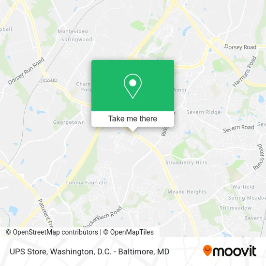
See UPS Store, Anne Arundel County, on the map
Public Transit to UPS Store in Anne Arundel County
Wondering how to get to UPS Store in Anne Arundel County? Moovit helps you find the best way to get to UPS Store with step-by-step directions from the nearest public transit station.
Moovit provides free maps and live directions to help you navigate through your city. View schedules, routes, timetables, and find out how long does it take to get to UPS Store in real time.
Looking for the nearest stop or station to UPS Store? Check out this list of stops closest to your destination: Jessup Marc Nb.
Bus: 502.Train: MARC.
Want to see if there’s another route that gets you there at an earlier time? Moovit helps you find alternative routes or times. Get directions from and directions to UPS Store easily from the Moovit App or Website.
We make riding to UPS Store easy, which is why over 1.5 million users, including users in Anne Arundel County, trust Moovit as the best app for public transit. You don’t need to download an individual bus app or train app, Moovit is your all-in-one transit app that helps you find the best bus time or train time available.
For information on prices of bus, train and light rail, costs and ride fares to UPS Store, please check the Moovit app.
Get to UPS Store with public transit and pay for the ride in the Moovit app. In addition to all info you may need for your trip to UPS Store, including live directions, real-time arrivals and fare prices, you can also buy public transit passes for your rides. No need for cash or paper tickets to get to UPS Store - everything you need is accessible in the app with a click of the button.
Use the app to navigate to popular places including to the airport, hospital, stadium, grocery store, mall, coffee shop, school, college, and university.
Location: Anne Arundel County, Washington, D.C. - Baltimore, MD
- Dollar Shop,
- Ridgeview Dental Care,
- Liberty Townhomes at Shipley Homestead,
- Farmers Market Arundel Preserve,
- Annapolis Rd y Parkside,
- Annapolis Rd McCarron Ct,
- Zips Dry Cleaners,
- ZIPS Dry Cleaners - Hanover,
- Courtside Sports Bar & Grill,
- Dunkin Donuts,
- Urban Bar-B-Que,
- Teamlogic It,
- Waltzing Matilda Labradoodle,
- Rosy Nails,
- Dixon-Moore Advisory Group, LLC.,
- Keith and Shannon French / Rent-To-Own Homes,
- Dr Gwen International Training and Empowerment Academy,
- Food Lion,
- Mobil,
- Beauty-Barber Supplies
Places Near UPS Store (Anne Arundel County)
- Georgetown, Washington,
- Marriott Marquis Washington, DC, Washington,
- Amazon Hq2, Arlington County,
- Basilica of the National Shrine, Washington,
- National Mall, Washington,
- Sibley Memorial Hospital, Washington,
- Washington DC VA Medical Center, Washington,
- Rock Creek Tennis Center, Washington,
- Pennsylvania Ave NW (3rd st and pennsylvania), Washington,
- National Museum of African American History and Culture, Washington,
- PG Mall, Prince George's County,
- Washington National Cathedral, Washington,
- Westfield Montgomery Mall, Montgomery County,
- M&T Bank Stadium, Baltimore,
- Camden Yards, Baltimore,
- Museum Of The Bible, Washington,
- Warner Theatre, Washington,
- The Anthem, Washington,
- National Zoo, Washington,
- Capital One Arena, Washington
How to get to popular places in Washington, D.C. - Baltimore, MD with public transit
Get around Anne Arundel County by public transit!
Traveling around Anne Arundel County has never been so easy. See step by step directions as you travel to any attraction, street or major public transit station. View bus and train schedules, arrival times, service alerts and detailed routes on a map, so you know exactly how to get to anywhere in Anne Arundel County.
When traveling to any destination around Anne Arundel County use Moovit's Live Directions with Get Off Notifications to know exactly where and how far to walk, how long to wait for your line, and how many stops are left. Moovit will alert you when it's time to get off — no need to constantly re-check whether yours is the next stop.
Wondering how to use public transit in Anne Arundel County or how to pay for public transit in Anne Arundel County? Moovit public transit app can help you navigate your way with public transit easily, and at minimum cost. It includes public transit fees, ticket prices, and costs. Looking for a map of Anne Arundel County public transit lines? Moovit public transit app shows all public transit maps in Anne Arundel County with all Bus, Train, Metro, Light Rail and Ferry routes and stops on an interactive map.
Washington, D.C. - Baltimore, MD has 5 transit type(s), including: Bus, Train, Metro, Light Rail and Ferry, operated by several transit agencies, including WMATA, Montgomery County Ride On, Fairfax Connector, TheBus, PRTC, DASH - Alexandria, Arlington Transit (ART), RTA of Central Maryland, MDOT MTA, MDOT MTA Light RailLink, MDOT MTA Commuter Bus, MDOT MTA Local Bus, FXBGO!, Virginia Railway Express (VRE) and MARC