Directions to USPS (Baltimore County) with public transportation
The following transit lines have routes that pass near USPS
 Bus: 31, 37, 79, CITYLINK BLUE, 40.
How to get to USPS by bus?
Click on the bus route to see step by step directions with maps, line arrival times and updated time schedules.
From Western High School, Baltimore
56 minFrom Coppin State University, Baltimore
36 minFrom Walmart Supercenter, Baltimore County
67 minFrom Randallstown, MD, Baltimore County
53 minFrom Walmart, Baltimore
38 minFrom B&O Railroad Museum, Baltimore
47 minFrom Hampden, Baltimore
68 minFrom Walmart, Baltimore County
67 minFrom University Of Maryland Baltimore (Umbc), Baltimore County
29 minFrom Baltimore Polytechnic Institute, Baltimore
55 min
Bus stops near USPS in Baltimore County
Bus lines to USPS in Baltimore County
What are the closest stations to USPS?
The closest stations to USPS are:
- Security Blvd & Belmont Ave Eb is 290 yards away, 4 min walk.
- Security Blvd & Lord Baltimore Dr FS Wb is 498 yards away, 6 min walk.
- Rolling Rd & Rolling Bend Rd FS Nb is 506 yards away, 6 min walk.
Which bus lines stop near USPS?
These bus lines stop near USPS: 31, 37, 79, CITYLINK BLUE.
What’s the nearest bus station to USPS in Baltimore County?
The nearest bus station to USPS in Baltimore County is Security Blvd & Belmont Ave Eb. It’s a 4 min walk away.
What time is the first bus to USPS in Baltimore County?
The 31 is the first bus that goes to USPS in Baltimore County. It stops nearby at 4:00 AM.
What time is the last bus to USPS in Baltimore County?
The 78 is the last bus that goes to USPS in Baltimore County. It stops nearby at 2:34 AM.
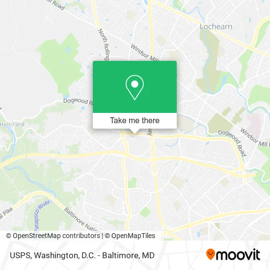
See USPS, Baltimore County, on the map
Public Transit to USPS in Baltimore County
Wondering how to get to USPS in Baltimore County? Moovit helps you find the best way to get to USPS with step-by-step directions from the nearest public transit station.
Moovit provides free maps and live directions to help you navigate through your city. View schedules, routes, timetables, and find out how long does it take to get to USPS in real time.
Looking for the nearest stop or station to USPS? Check out this list of stops closest to your destination: Security Blvd & Belmont Ave Eb; Security Blvd & Lord Baltimore Dr FS Wb; Rolling Rd & Rolling Bend Rd FS Nb.
Bus: 31, 37, 79, CITYLINK BLUE, 40, 78.
Want to see if there’s another route that gets you there at an earlier time? Moovit helps you find alternative routes or times. Get directions from and directions to USPS easily from the Moovit App or Website.
We make riding to USPS easy, which is why over 1.5 million users, including users in Baltimore County, trust Moovit as the best app for public transit. You don’t need to download an individual bus app or train app, Moovit is your all-in-one transit app that helps you find the best bus time or train time available.
For information on prices of bus, costs and ride fares to USPS, please check the Moovit app.
Use the app to navigate to popular places including to the airport, hospital, stadium, grocery store, mall, coffee shop, school, college, and university.
USPS Address: 6901 Security Blvd Windsor Mill, MD 21244 street in Baltimore County
- Mizans Bridal and Formal Wear,
- Snipes,
- Fablust Boutique,
- DTLR VILLA,
- Honeydew Selections,
- Teppanyaki Grill & Seafood Buffet,
- Soul of Memphis,
- CINNABON,
- Rally's,
- Metro by T-Mobile,
- Shaheen Restaurant (Shaheen Rest Indian Pakistani Food),
- Security Square Pizza,
- Mr Earls,
- Total Wireless Store,
- Cajun Cafe USA,
- Halal Pizza,
- Hershey's Ice Cream - Security Mall,
- Cold Stone Creamery,
- Tokyo Seafood & Hibachi Grill,
- Security Square Mall
Places Near USPS (Baltimore County)
- Marriott Marquis Washington, DC, Washington,
- The Anthem, Washington,
- Pennsylvania Ave NW (3rd st and pennsylvania), Washington,
- National Zoo, Washington,
- Westfield Montgomery Mall, Montgomery County,
- National Mall, Washington,
- M&T Bank Stadium, Baltimore,
- National Museum of African American History and Culture, Washington,
- Capital One Arena, Washington,
- Georgetown, Washington,
- Washington DC VA Medical Center, Washington,
- Rock Creek Tennis Center, Washington,
- Amazon Hq2, Arlington County,
- Warner Theatre, Washington,
- Camden Yards, Baltimore,
- Washington National Cathedral, Washington,
- Museum Of The Bible, Washington,
- Basilica of the National Shrine, Washington,
- Sibley Memorial Hospital, Washington,
- PG Mall, Prince George's County
How to get to popular places in Washington, D.C. - Baltimore, MD with public transit
Get around Baltimore County by public transit!
Traveling around Baltimore County has never been so easy. See step by step directions as you travel to any attraction, street or major public transit station. View bus and train schedules, arrival times, service alerts and detailed routes on a map, so you know exactly how to get to anywhere in Baltimore County.
When traveling to any destination around Baltimore County use Moovit's Live Directions with Get Off Notifications to know exactly where and how far to walk, how long to wait for your line, and how many stops are left. Moovit will alert you when it's time to get off — no need to constantly re-check whether yours is the next stop.
Wondering how to use public transit in Baltimore County or how to pay for public transit in Baltimore County? Moovit public transit app can help you navigate your way with public transit easily, and at minimum cost. It includes public transit fees, ticket prices, and costs. Looking for a map of Baltimore County public transit lines? Moovit public transit app shows all public transit maps in Baltimore County with all Bus, Train, Metro, Light Rail and Ferry routes and stops on an interactive map.
Washington, D.C. - Baltimore, MD has 5 transit type(s), including: Bus, Train, Metro, Light Rail and Ferry, operated by several transit agencies, including WMATA, Montgomery County Ride On, Fairfax Connector, TheBus, PRTC, DASH - Alexandria, Arlington Transit (ART), RTA of Central Maryland, MDOT MTA, MDOT MTA Light RailLink, MDOT MTA Commuter Bus, MDOT MTA Local Bus, FXBGO!, Virginia Railway Express (VRE) and MARC