How to get to USPS by bus?
Click on the bus route to see step by step directions with maps, line arrival times and updated time schedules.
From Rose Gaming Resort, Prince William County
84 minFrom U.S. Department of State SA-28, Fairfax County
83 minFrom 8604 Phoenix Drive, Manassas
114 minFrom Lorton, VA, Fairfax County
133 minFrom Burke, VA, Fairfax County
357 minFrom Department of State SA 34, Fairfax County
175 minFrom Manassas, VA, Manassas
67 minFrom Woodbridge, VA, Prince William County
43 minFrom Lorton, VA - Amtrak Auto Train Station (LOR), Fairfax County
137 min
Bus stops near USPS in Prince William County
Bus lines to USPS in Prince William County
- 971, Horner / Telegraph / Dale City Lots Via Minnieville,VIEW
- 972-C, Pentagon / Crystal City,VIEW
- 972-R, Pentagon / Horner / Telegraph / Dale City Lots Via Minnieville,VIEW
- 91, 91 - Hub @ Gavelston Court,VIEW
- 953, 234 Lot / Montclair,VIEW
- 972-M, Eastern Lot Connector,VIEW
- 182, Dulles Airport And Leesburg,VIEW
- 582, Dale City Lot Via Dulles And Manassas Park,VIEW
What are the closest stations to USPS?
The closest stations to USPS are:
- Dale Blvd @ N Forestdale Ave is 145 yards away, 2 min walk.
- Dale Blvd @ Minnieville Rd is 831 yards away, 10 min walk.
- Dale City Commuter Lot is 1204 yards away, 15 min walk.
Which bus lines stop near USPS?
These bus lines stop near USPS: 91, 96.
What’s the nearest bus station to USPS in Prince William County?
The nearest bus station to USPS in Prince William County is Dale Blvd @ N Forestdale Ave. It’s a 2 min walk away.
What time is the first bus to USPS in Prince William County?
The 972-R is the first bus that goes to USPS in Prince William County. It stops nearby at 4:08 AM.
What time is the last bus to USPS in Prince William County?
The 91 is the last bus that goes to USPS in Prince William County. It stops nearby at 10:14 PM.
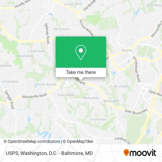
See USPS, Prince William County, on the map
Public Transit to USPS in Prince William County
Wondering how to get to USPS in Prince William County? Moovit helps you find the best way to get to USPS with step-by-step directions from the nearest public transit station.
Moovit provides free maps and live directions to help you navigate through your city. View schedules, routes, timetables, and find out how long does it take to get to USPS in real time.
Looking for the nearest stop or station to USPS? Check out this list of stops closest to your destination: Dale Blvd @ N Forestdale Ave; Dale Blvd @ Minnieville Rd; Dale City Commuter Lot.
Bus: 91, 96, 971, 972-C, 972-R, 953, 972-M, 182, 582.
Want to see if there’s another route that gets you there at an earlier time? Moovit helps you find alternative routes or times. Get directions from and directions to USPS easily from the Moovit App or Website.
We make riding to USPS easy, which is why over 1.5 million users, including users in Prince William County, trust Moovit as the best app for public transit. You don’t need to download an individual bus app or train app, Moovit is your all-in-one transit app that helps you find the best bus time or train time available.
For information on prices of bus, costs and ride fares to USPS, please check the Moovit app.
Use the app to navigate to popular places including to the airport, hospital, stadium, grocery store, mall, coffee shop, school, college, and university.
USPS Address: 4116 Dale Blvd Woodbridge, VA 22193 street in Prince William County
- Super Selectos Grocery & Deli,
- Dunkin',
- Scottish Kilt,
- Eclergys,
- Murphys,
- Friendly Maid,
- Locksmith Woodbridge,
- TDS Health Pharmacy,
- GBSD,
- SSCS,
- Drilled Heating & Cooling Repair,
- JS Professional Painting,
- GC Cleaning Service,
- Octah,
- All A Girl Wants,
- Migo Cutz,
- Haskey Mosque,
- Amazon Locker-Brink,
- Coinstar,
- Coinstar - Bitcoin ATM
Places Near USPS (Prince William County)
- Marriott Marquis Washington, DC, Washington,
- Camden Yards, Baltimore,
- Basilica of the National Shrine, Washington,
- Sibley Memorial Hospital, Washington,
- Georgetown, Washington,
- Westfield Montgomery Mall, Montgomery County,
- Museum Of The Bible, Washington,
- Washington DC VA Medical Center, Washington,
- Warner Theatre, Washington,
- Rock Creek Tennis Center, Washington,
- M&T Bank Stadium, Baltimore,
- The Anthem, Washington,
- National Mall, Washington,
- National Museum of African American History and Culture, Washington,
- Amazon Hq2, Arlington County,
- Washington National Cathedral, Washington,
- PG Mall, Prince George's County,
- National Zoo, Washington,
- Capital One Arena, Washington,
- Pennsylvania Ave NW (3rd st and pennsylvania), Washington
How to get to popular places in Washington, D.C. - Baltimore, MD with public transit
Get around Prince William County by public transit!
Traveling around Prince William County has never been so easy. See step by step directions as you travel to any attraction, street or major public transit station. View bus and train schedules, arrival times, service alerts and detailed routes on a map, so you know exactly how to get to anywhere in Prince William County.
When traveling to any destination around Prince William County use Moovit's Live Directions with Get Off Notifications to know exactly where and how far to walk, how long to wait for your line, and how many stops are left. Moovit will alert you when it's time to get off — no need to constantly re-check whether yours is the next stop.
Wondering how to use public transit in Prince William County or how to pay for public transit in Prince William County? Moovit public transit app can help you navigate your way with public transit easily, and at minimum cost. It includes public transit fees, ticket prices, and costs. Looking for a map of Prince William County public transit lines? Moovit public transit app shows all public transit maps in Prince William County with all Bus, Train, Metro, Light Rail and Ferry routes and stops on an interactive map.
Washington, D.C. - Baltimore, MD has 5 transit type(s), including: Bus, Train, Metro, Light Rail and Ferry, operated by several transit agencies, including WMATA, Montgomery County Ride On, Fairfax Connector, TheBus, PRTC, DASH - Alexandria, Arlington Transit (ART), RTA of Central Maryland, MDOT MTA, MDOT MTA Light RailLink, MDOT MTA Commuter Bus, MDOT MTA Local Bus, FXBGO!, Virginia Railway Express (VRE) and MARC