How to get to US Reputable Product by bus?
Click on the bus route to see step by step directions with maps, line arrival times and updated time schedules.
From Massachusetts Ave NW, Washington
49 minFrom Chinese Embassy, Washington
67 minFrom Rock Creek Park, Washington
74 minFrom British Embassy, Washington
79 minFrom Knollwood, Washington
64 minFrom Mt. Pleasant, Washington
64 minFrom Glover Park Hotel Georgetown, Washington
60 minFrom Chinese Embassy Visa Section, Washington
66 minFrom Fannie Mae, Washington
50 minFrom Georgetown University Hospital, Washington
64 min
How to get to US Reputable Product by metro?
Click on the metro route to see step by step directions with maps, line arrival times and updated time schedules.
Bus stops near US Reputable Product in Montgomery County
Train station near US Reputable Product in Montgomery County
- Kensington Marc Eb, 31 min walk,VIEW
Bus lines to US Reputable Product in Montgomery County
What are the closest stations to US Reputable Product?
The closest stations to US Reputable Product are:
- West Cedar La & Old Georgetown Rd is 131 yards away, 2 min walk.
- Beech Ave & Forest Rd is 273 yards away, 4 min walk.
- Old Georgetown Rd & Greentree Rd is 796 yards away, 10 min walk.
- Kensington Marc Eb is 2603 yards away, 31 min walk.
Which bus line stops near US Reputable Product?
M70 (West To Montgomery Mall)
Which metro line stops near US Reputable Product?
RED (Shady Grove)
What’s the nearest bus station to US Reputable Product in Montgomery County?
The nearest bus station to US Reputable Product in Montgomery County is West Cedar La & Old Georgetown Rd. It’s a 2 min walk away.
What time is the first train to US Reputable Product in Montgomery County?
The MARC is the first train that goes to US Reputable Product in Montgomery County. It stops nearby at 5:45 AM.
What time is the last train to US Reputable Product in Montgomery County?
The MARC is the last train that goes to US Reputable Product in Montgomery County. It stops nearby at 7:42 PM.
What time is the first bus to US Reputable Product in Montgomery County?
The M70 is the first bus that goes to US Reputable Product in Montgomery County. It stops nearby at 5:03 AM.
What time is the last bus to US Reputable Product in Montgomery County?
The M70 is the last bus that goes to US Reputable Product in Montgomery County. It stops nearby at 2:10 AM.
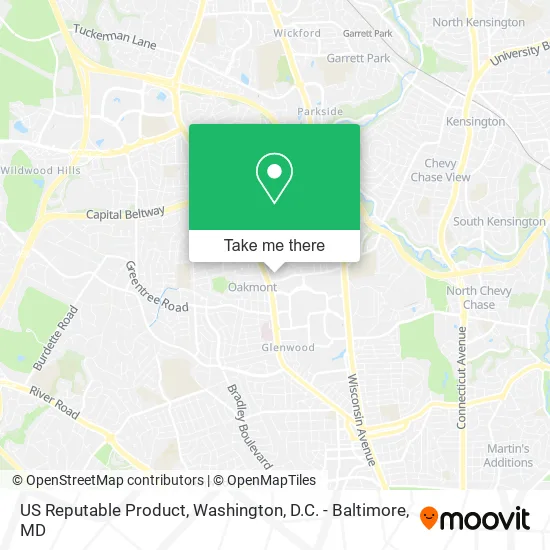
See US Reputable Product, Montgomery County, on the map
Public Transit to US Reputable Product in Montgomery County
Wondering how to get to US Reputable Product in Montgomery County? Moovit helps you find the best way to get to US Reputable Product with step-by-step directions from the nearest public transit station.
Moovit provides free maps and live directions to help you navigate through your city. View schedules, routes, timetables, and find out how long does it take to get to US Reputable Product in real time.
Looking for the nearest stop or station to US Reputable Product? Check out this list of stops closest to your destination: West Cedar La & Old Georgetown Rd; Beech Ave & Forest Rd; Old Georgetown Rd & Greentree Rd; Kensington Marc Eb.
Bus: M70, 70, 30, 47.Train: MARC.Metro: RED.
Want to see if there’s another route that gets you there at an earlier time? Moovit helps you find alternative routes or times. Get directions from and directions to US Reputable Product easily from the Moovit App or Website.
We make riding to US Reputable Product easy, which is why over 1.5 million users, including users in Montgomery County, trust Moovit as the best app for public transit. You don’t need to download an individual bus app or train app, Moovit is your all-in-one transit app that helps you find the best bus time or train time available.
For information on prices of bus and metro, costs and ride fares to US Reputable Product, please check the Moovit app.
Use the app to navigate to popular places including to the airport, hospital, stadium, grocery store, mall, coffee shop, school, college, and university.
US Reputable Product Address: 5417 W Cedar Ln Bethesda, MD 20814 street in Montgomery County
- Welcome Wellness Care Centers Customers,
- Locksmith Als 24 Hr 7 Day,
- Nci Information Systems,
- Coempower,
- Howard Hughes Medical Institute,
- Alan Squire Publishing,
- Lawrence Hankins Images,
- WMATA Bus Stop #2000265 (J2, J3),
- NIH Building 82,
- Safra Family Lodge,
- Newcare Spa,
- Eng Grand,
- Edmond J. Safra Family Lodge,
- Wyngate Dental of Bethesda,
- The Coffee Place,
- NIH Building 60 - The Cloisters,
- Office of Nih History,
- Aflac,
- NIH Building 10 Mark O. Hatfield Clinical Research Center Atrium,
- Nih Clinical Center - Valet
Places Near US Reputable Product (Montgomery County)
- Camden Yards, Baltimore,
- The Anthem, Washington,
- Capital One Arena, Washington,
- National Museum of African American History and Culture, Washington,
- National Zoo, Washington,
- Washington DC VA Medical Center, Washington,
- National Mall, Washington,
- Basilica of the National Shrine, Washington,
- Museum Of The Bible, Washington,
- Pennsylvania Ave NW (3rd st and pennsylvania), Washington,
- Warner Theatre, Washington,
- Westfield Montgomery Mall, Montgomery County,
- Rock Creek Tennis Center, Washington,
- Marriott Marquis Washington, DC, Washington,
- Washington National Cathedral, Washington,
- Georgetown, Washington,
- PG Mall, Prince George's County,
- Sibley Memorial Hospital, Washington,
- Amazon Hq2, Arlington County,
- M&T Bank Stadium, Baltimore
How to get to popular places in Washington, D.C. - Baltimore, MD with public transit
Get around Montgomery County by public transit!
Traveling around Montgomery County has never been so easy. See step by step directions as you travel to any attraction, street or major public transit station. View bus and train schedules, arrival times, service alerts and detailed routes on a map, so you know exactly how to get to anywhere in Montgomery County.
When traveling to any destination around Montgomery County use Moovit's Live Directions with Get Off Notifications to know exactly where and how far to walk, how long to wait for your line, and how many stops are left. Moovit will alert you when it's time to get off — no need to constantly re-check whether yours is the next stop.
Wondering how to use public transit in Montgomery County or how to pay for public transit in Montgomery County? Moovit public transit app can help you navigate your way with public transit easily, and at minimum cost. It includes public transit fees, ticket prices, and costs. Looking for a map of Montgomery County public transit lines? Moovit public transit app shows all public transit maps in Montgomery County with all Bus, Train, Metro, Light Rail and Ferry routes and stops on an interactive map.
Washington, D.C. - Baltimore, MD has 5 transit type(s), including: Bus, Train, Metro, Light Rail and Ferry, operated by several transit agencies, including WMATA, Montgomery County Ride On, Fairfax Connector, TheBus, PRTC, DASH - Alexandria, Arlington Transit (ART), RTA of Central Maryland, MDOT MTA, MDOT MTA Light RailLink, MDOT MTA Commuter Bus, MDOT MTA Local Bus, FXBGO!, Virginia Railway Express (VRE) and MARC