How to get to Ucodep - Nonprofit by bus?
Click on the bus route to see step by step directions with maps, line arrival times and updated time schedules.
From Rondine, Arezzo
38 minFrom Valdichiana Outlet Village, Foiano Della Chiana
55 minFrom Fratta Hospital, Arezzo
87 minFrom Arezzo Equestrian Center, Arezzo
36 minFrom Prada - Space Outlet, Arezzo
58 minFrom La Verna (Sanctuary), Arezzo
345 minFrom Monterchi, Monterchi
50 minFrom Gruccia Hospital, Montevarchi
333 minFrom Pieve Santo Stefano, Pieve Santo Stefano
104 minFrom Caprese Michelangelo, Caprese Michelangelo
87 min
Bus stops near Ucodep - Nonprofit in Arezzo
- Masaccio Street 15, 2 min walk,VIEW
- Via Veneto 127 - Corner N. Sauro, 4 min walk,VIEW
- Via Veneto 66/A, 4 min walk,VIEW
- 52 Masaccio St Corner Curtatone, 5 min walk,VIEW
- Veneto Street 37 - Railway Underpass, 5 min walk,VIEW
- Citizens Avenue, 5 min walk,VIEW
- Railway Station Via Side, 6 min walk,VIEW
- Arezzo Terminal (External), 7 min walk,VIEW
- Arezzo Terminal (Interior), 7 min walk,VIEW
Train stations near Ucodep - Nonprofit in Arezzo
Bus lines to Ucodep - Nonprofit in Arezzo
- F, Viciomaggio-Chiani-Hospital-Station-Hospital-Chiani-Valle Del Vingone-Ruscello-Viciomaggio,VIEW
- H, Rigutino-Olmo-Dante Street-Masaccio Street-Station,VIEW
- I, San Zeno-Ripa Dell'olmo-Via Dante-Via Masaccio-Station,VIEW
- L, Il Poggiolo-Agazzi-Dante Street-Masaccio Street-Station,VIEW
- M, Indicatore-Ponte A Chiani-Calamandrei Street-Hospital-Masaccio Street-Station,VIEW
- H/1, Frassineto-Rigutino-Olmo-Via Dante-Via Masaccio-Station,VIEW
- N/2, Pratantico-Hospital-Station,VIEW
- A+, Oriental Village,VIEW
- B+, New Hospital,VIEW
- T, Railway Station Via Side,VIEW
- LS5, Arezzo Terminal (Interior),VIEW
- LS5, Bettolle People's Square,VIEW
- LS6, Camucia Station,VIEW
- 21S, Arezzo Terminal (Interior),VIEW
- 22S, Arezzo G.Monaco (Gallery Side),VIEW
- 138, Arezzo Terminal (Interior),VIEW
- 138, Tozzi Street,VIEW
- SI381, Sansepolcro Marconi Street (Bus Station),VIEW
- S, Arezzo G.Monaco (Insurance Side),VIEW
- N/1, Pratantico Church,VIEW
What are the closest stations to Ucodep - Nonprofit?
The closest stations to Ucodep - Nonprofit are:
- Masaccio Street 15 is 60 meters away, 2 min walk.
- Via Veneto 127 - Corner N. Sauro is 259 meters away, 4 min walk.
- Via Veneto 66/A is 274 meters away, 4 min walk.
- 52 Masaccio St Corner Curtatone is 290 meters away, 5 min walk.
- Veneto Street 37 - Railway Underpass is 296 meters away, 5 min walk.
- Citizens Avenue is 341 meters away, 5 min walk.
- Railway Station Via Side is 389 meters away, 6 min walk.
- Arezzo Terminal (External) is 463 meters away, 7 min walk.
- Arezzo Terminal (Interior) is 466 meters away, 7 min walk.
- Puglia-Ceciliano is 518 meters away, 7 min walk.
- Arezzo is 2793 meters away, 36 min walk.
Which bus lines stop near Ucodep - Nonprofit?
These bus lines stop near Ucodep - Nonprofit: 911, BAAS, H, L, P/1, SI330, SI381.
Which train lines stop near Ucodep - Nonprofit?
These train lines stop near Ucodep - Nonprofit: R, RL.
What’s the nearest train station to Ucodep - Nonprofit in Arezzo?
The nearest train station to Ucodep - Nonprofit in Arezzo is Puglia-Ceciliano. It’s a 7 min walk away.
What’s the nearest bus station to Ucodep - Nonprofit in Arezzo?
The nearest bus station to Ucodep - Nonprofit in Arezzo is Masaccio Street 15. It’s a 2 min walk away.
What time is the first train to Ucodep - Nonprofit in Arezzo?
The R is the first train that goes to Ucodep - Nonprofit in Arezzo. It stops nearby at 5:43 AM.
What time is the last train to Ucodep - Nonprofit in Arezzo?
The R is the last train that goes to Ucodep - Nonprofit in Arezzo. It stops nearby at 12:50 AM.
What time is the first bus to Ucodep - Nonprofit in Arezzo?
The B+ is the first bus that goes to Ucodep - Nonprofit in Arezzo. It stops nearby at 7:56 AM.
What time is the last bus to Ucodep - Nonprofit in Arezzo?
The 911 is the last bus that goes to Ucodep - Nonprofit in Arezzo. It stops nearby at 2:55 AM.
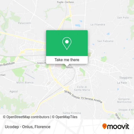
See Ucodep - Nonprofit, Arezzo, on the map
Public Transit to Ucodep - Nonprofit in Arezzo
Wondering how to get to Ucodep - Nonprofit in Arezzo? Moovit helps you find the best way to get to Ucodep - Nonprofit with step-by-step directions from the nearest public transit station.
Moovit provides free maps and live directions to help you navigate through your city. View schedules, routes, timetables, and find out how long does it take to get to Ucodep - Nonprofit in real time.
Looking for the nearest stop or station to Ucodep - Nonprofit? Check out this list of stops closest to your destination: Masaccio Street 15; Via Veneto 127 - Corner N. Sauro; Via Veneto 66/A; 52 Masaccio St Corner Curtatone; Veneto Street 37 - Railway Underpass; Citizens Avenue; Railway Station Via Side; Arezzo Terminal (External); Arezzo Terminal (Interior); Puglia-Ceciliano; Arezzo.
Bus: 911, BAAS, H, L, P/1, SI330, SI381, F, I, M, A+, B+, T, LS5, LS5, LS5.Train: R, RL.
Want to see if there’s another route that gets you there at an earlier time? Moovit helps you find alternative routes or times. Get directions from and directions to Ucodep - Nonprofit easily from the Moovit App or Website.
We make riding to Ucodep - Nonprofit easy, which is why over 1.5 million users, including users in Arezzo, trust Moovit as the best app for public transit. You don’t need to download an individual bus app or train app, Moovit is your all-in-one transit app that helps you find the best bus time or train time available.
For information on prices of bus and train, costs and ride fares to Ucodep - Nonprofit, please check the Moovit app.
Use the app to navigate to popular places including to the airport, hospital, stadium, grocery store, mall, coffee shop, school, college, and university.
Ucodep - Nonprofit Address: Via Masaccio, 6 52100 Arezzo street in Arezzo
- Masaccio Nursery School,
- Elderly Center Colle del Pionta,
- Public Schools,
- Il Masaccio,
- Regional Environmental Protection Agency of Tuscany,
- Toscana Real Estate by Faltoni Elisabetta,
- Arpat - Environmental Protection,
- Global Aisten Problem by Mangano Niki,
- Corsi Mario,
- Occasional Rental,
- Alfa Ballet,
- Abubakar Mariamo,
- FedEx,
- Giuseppe Vincenzo Viola,
- Beatrice Fumagalli,
- Campo Di Marte 2,
- Reklam Studio,
- Arte Tenda Distribution Center Arquati by Rino Gresta,
- Etruscan Farm,
- Campo di Marte Parking
Places Near Ucodep - Nonprofit (Arezzo)
- Michelangelo Square, Florence,
- Asmana, Campi Bisenzio,
- Cascine Park, Florence,
- Torregalli Hospital Scandicci *, Scandicci,
- Visarno Arena, Florence,
- Mandela Forum (Nelson Mandela Forum), Florence,
- IKEA Florence, Sesto Fiorentino,
- I Gigli, Campi Bisenzio,
- Artemio Franchi Municipal Stadium, Florence,
- Visarno Hippodrome, Florence,
- Tobacco Manufacture, Florence,
- OOO, Florence,
- Santa Maria Nuova Hospital, Florence,
- Piero Palagi Hospital Facility-Florence, Florence,
- Nelson Mandela Forum, Florence,
- Michelangelo Square, Florence,
- Field of Mars, Florence,
- Campi Bisenzio, Campi Bisenzio,
- Verdi Theater, Florence,
- Santa Maria Novella Station, Florence
How to get to popular places in Florence with public transit
Get around Arezzo by public transit!
Traveling around Arezzo has never been so easy. See step by step directions as you travel to any attraction, street or major public transit station. View bus and train schedules, arrival times, service alerts and detailed routes on a map, so you know exactly how to get to anywhere in Arezzo.
When traveling to any destination around Arezzo use Moovit's Live Directions with Get Off Notifications to know exactly where and how far to walk, how long to wait for your line, and how many stops are left. Moovit will alert you when it's time to get off — no need to constantly re-check whether yours is the next stop.
Wondering how to use public transit in Arezzo or how to pay for public transit in Arezzo? Moovit public transit app can help you navigate your way with public transit easily, and at minimum cost. It includes public transit fees, ticket prices, and costs. Looking for a map of Arezzo public transit lines? Moovit public transit app shows all public transit maps in Arezzo with all Bus, Train, Light Rail, Ferry and Funicular routes and stops on an interactive map.
Florence has 5 transit type(s), including: Bus, Train, Light Rail, Ferry and Funicular, operated by several transit agencies, including Florence Urban - Tuscan Bus Lines, GEST, Livorno and Province - Tuscan Bus Lines, Arezzo, Florence and Provinces - Tuscan Bus Lines, Prato and Province - Tuscan Bus Lines, Lucca and Province - Tuscan Bus Lines, Massa, Carrara and Province - Tuscan Bus Lines, Pisa and Province - Tuscan Bus Lines, Grosseto, Siena and Provinces - Tuscan Bus Lines, Arezzo, Siena and Provinces - Tuscan Bus Lines, Florence and Province - Tuscan Bus Lines, Pistoia and Province - Tuscan Bus Lines, Siena and Province - Tuscan Bus Lines, Arezzo and Province - Tuscan Bus Lines and Trenitalia
Public transit lines with stations closest to Ucodep - Nonprofit in Arezzo
Train lines with stations closest to Ucodep - Nonprofit in Arezzo
Bus lines with stations closest to Ucodep - Nonprofit in Arezzo
Masaccio Street 15
 FViciomaggio-Chiani-Hospital-Station-Hospital-Chiani-Valle Del Vingone-Ruscello-Viciomaggio
- HRigutino-Olmo-Dante Street-Masaccio Street-Station
- ISan Zeno-Ripa Dell'olmo-Via Dante-Via Masaccio-Station
- LIl Poggiolo-Agazzi-Dante Street-Masaccio Street-Station
- MIndicatore-Ponte A Chiani-Calamandrei Street-Hospital-Masaccio Street-Station