Directions to Ultra Net (Hagerstown) with public transportation
The following transit lines have routes that pass near Ultra Net
 Bus: PREMIUM OUTLETS, MAUGANSVILLE.
How to get to Ultra Net by bus?
Click on the bus route to see step by step directions with maps, line arrival times and updated time schedules.
From Montgomery Village, Maryland, Montgomery County
201 minFrom Clarksburg Premium Outlets, Montgomery County
372 minFrom Kentlands, Montgomery County
193 minFrom Montgomery County Fairgrounds, Montgomery County
188 minFrom Kaiser Permanente - Gaithersburg Medical Center, Montgomery County
190 minFrom Clarksburg Premium Outlets, Montgomery County
415 minFrom Walmart Supercenter, Montgomery County
243 min
Bus stop near Ultra Net in Hagerstown
- Hamilton Park, 14 min walk,VIEW
Bus lines to Ultra Net in Hagerstown
- MAUGANSVILLE, Transfer Center,VIEW
What are the closest stations to Ultra Net?
The closest stations to Ultra Net are:
- Hamilton Park is 1149 yards away, 14 min walk.
Which bus line stops near Ultra Net?
PREMIUM OUTLETS (Transfer Center)
What’s the nearest bus station to Ultra Net in Hagerstown?
The nearest bus station to Ultra Net in Hagerstown is Hamilton Park. It’s a 14 min walk away.
What time is the first bus to Ultra Net in Hagerstown?
The MAUGANSVILLE is the first bus that goes to Ultra Net in Hagerstown. It stops nearby at 7:00 AM.
What time is the last bus to Ultra Net in Hagerstown?
The MAUGANSVILLE is the last bus that goes to Ultra Net in Hagerstown. It stops nearby at 6:30 PM.
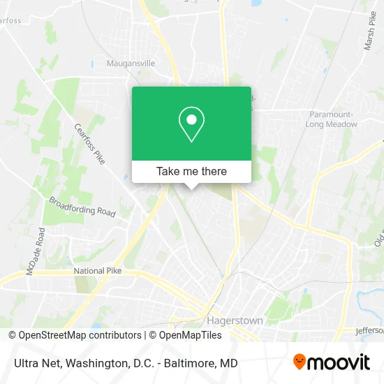
See Ultra Net, Hagerstown, on the map
Public Transit to Ultra Net in Hagerstown
Wondering how to get to Ultra Net in Hagerstown? Moovit helps you find the best way to get to Ultra Net with step-by-step directions from the nearest public transit station.
Moovit provides free maps and live directions to help you navigate through your city. View schedules, routes, timetables, and find out how long does it take to get to Ultra Net in real time.
Looking for the nearest stop or station to Ultra Net? Check out this list of stops closest to your destination: Hamilton Park.
Bus: PREMIUM OUTLETS, MAUGANSVILLE.
Want to see if there’s another route that gets you there at an earlier time? Moovit helps you find alternative routes or times. Get directions from and directions to Ultra Net easily from the Moovit App or Website.
We make riding to Ultra Net easy, which is why over 1.7 million users, including users in Hagerstown, trust Moovit as the best app for public transit. You don’t need to download an individual bus app or train app, Moovit is your all-in-one transit app that helps you find the best bus time or train time available.
For information on prices of bus, costs and ride fares to Ultra Net, please check the Moovit app.
Use the app to navigate to popular places including to the airport, hospital, stadium, grocery store, mall, coffee shop, school, college, and university.
Ultra Net Address: 1412 Kensington Dr street in Hagerstown
- NCP Envios,
- North Hagerstown High School,
- FM Seamstress and Curtains Designer LLC,
- Kelli Ashby, Pharm, D,
- Christopher Nelson Wallcovering and Painting,
- The Shoe Doctor,
- The Slow Down Barbershop + Lounge (Slow Down Barber Lounge),
- Greater Campher Temple,
- Johns Hopkins Community Physicians,
- New Creation Anglican Church,
- Amazon Locker-Muslo,
- District Court,
- The Foundry,
- Barbara Ingram School For the Arts,
- Post Office,
- Sro2 Handyman Services,
- Paws & Relax,
- Jean Banzhoff Graphic Design,
- Pennsylvania Avenue,
- Lowe's Distribution Center
Places Near Ultra Net (Hagerstown)
- PG Mall, Prince George's County,
- Rock Creek Tennis Center, Washington,
- Marriott Marquis Washington, DC, Washington,
- Westfield Montgomery Mall, Montgomery County,
- Washington National Cathedral, Washington,
- Washington DC VA Medical Center, Washington,
- Basilica of the National Shrine, Washington,
- Capital One Arena, Washington,
- Sibley Memorial Hospital, Washington,
- Museum Of The Bible, Washington,
- Warner Theatre, Washington,
- Pennsylvania Ave NW (3rd st and pennsylvania), Washington,
- Camden Yards, Baltimore,
- Georgetown, Washington,
- National Theatre, Washington,
- National Zoo, Washington,
- M&T Bank Stadium, Baltimore,
- Amazon Hq2, Arlington County,
- The Anthem, Washington,
- National Museum of African American History and Culture, Washington
How to get to popular places in Washington, D.C. - Baltimore, MD with public transit
Get around Hagerstown by public transit!
Traveling around Hagerstown has never been so easy. See step by step directions as you travel to any attraction, street or major public transit station. View bus and train schedules, arrival times, service alerts and detailed routes on a map, so you know exactly how to get to anywhere in Hagerstown.
When traveling to any destination around Hagerstown use Moovit's Live Directions with Get Off Notifications to know exactly where and how far to walk, how long to wait for your line, and how many stops are left. Moovit will alert you when it's time to get off — no need to constantly re-check whether yours is the next stop.
Wondering how to use public transit in Hagerstown or how to pay for public transit in Hagerstown? Moovit public transit app can help you navigate your way with public transit easily, and at minimum cost. It includes public transit fees, ticket prices, and costs. Looking for a map of Hagerstown public transit lines? Moovit public transit app shows all public transit maps in Hagerstown with all Bus, Train, Metro, Light Rail and Ferry routes and stops on an interactive map.
Washington, D.C. - Baltimore, MD has 5 transit type(s), including: Bus, Train, Metro, Light Rail and Ferry, operated by several transit agencies, including WMATA, Montgomery County Ride On, Fairfax Connector, TheBus, PRTC, DASH - Alexandria, Arlington Transit (ART), RTA of Central Maryland, MDOT MTA, MDOT MTA Light RailLink, MDOT MTA Commuter Bus, MDOT MTA Local Bus, FXBGO!, Virginia Railway Express (VRE) and MARC