How to get to Un Plus Bio by bus?
Click on the bus route to see step by step directions with maps, line arrival times and updated time schedules.
From Gare SNCF de Manduel - Redessan, Manduel
47 minFrom 30980, Saint-Dionizy
72 minFrom La Biscuiterie de Nelly, Caveirac
29 minFrom Zone aéroportuaire de Nîmes-Garons, Saint-Gilles
65 minFrom F Bassery, Bernis
37 minFrom Bernis, Bernis
37 minFrom Ancienne Gare De Manduel-Redessan, Manduel
47 minFrom Poulx, Poulx
53 minFrom D42, Saint-Gilles
54 min
Bus stops near Un Plus Bio in Nimes
Bus lines to Un Plus Bio in Nimes
- 16, Ville Active,VIEW
- 61, Nîmes Gare Feucheres,VIEW
- 51, Nîmes Gare Routiere,VIEW
- 52, Saint Come Et Maruejols,VIEW
- T2, Paloma,VIEW
- T3, Gare Feucheres,VIEW
- 70, HAUTS DE NIMES - JAURES,VIEW
- 77, MONTAURY - JAURES,VIEW
- 78, CAMPLANIER - JAURES,VIEW
- 227, Nîmes Gare Routiere,VIEW
- 105, Mas Roman,VIEW
- 804B, Nîmes Gare Routiere,VIEW
What are the closest stations to Un Plus Bio?
The closest stations to Un Plus Bio are:
- Jaurès is 155 meters away, 3 min walk.
- Verdun is 363 meters away, 5 min walk.
- Emilien Dumas is 388 meters away, 6 min walk.
Which bus lines stop near Un Plus Bio?
These bus lines stop near Un Plus Bio: 16, 51, T1, T3.
What’s the nearest bus station to Un Plus Bio in Nimes?
The nearest bus station to Un Plus Bio in Nimes is Jaurès. It’s a 3 min walk away.
What time is the first bus to Un Plus Bio in Nimes?
The T3 is the first bus that goes to Un Plus Bio in Nimes. It stops nearby at 5:39 AM.
What time is the last bus to Un Plus Bio in Nimes?
The T2 is the last bus that goes to Un Plus Bio in Nimes. It stops nearby at 1:04 AM.
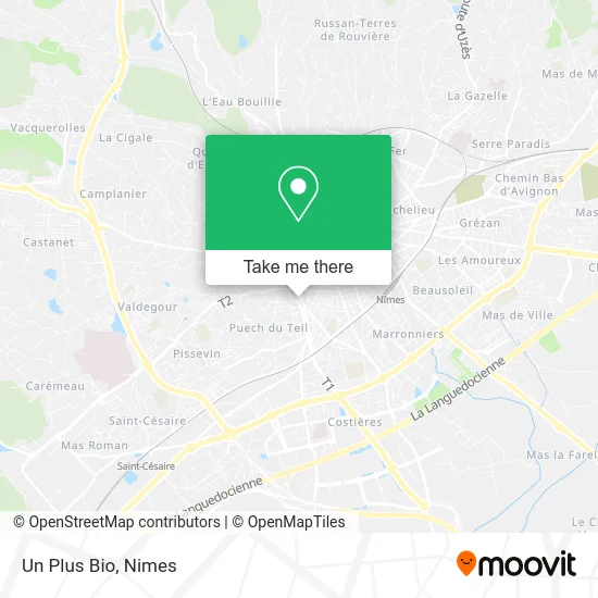
See Un Plus Bio, Nimes, on the map
Public Transit to Un Plus Bio in Nimes
Wondering how to get to Un Plus Bio in Nimes? Moovit helps you find the best way to get to Un Plus Bio with step-by-step directions from the nearest public transit station.
Moovit provides free maps and live directions to help you navigate through your city. View schedules, routes, timetables, and find out how long does it take to get to Un Plus Bio in real time.
Looking for the nearest stop or station to Un Plus Bio? Check out this list of stops closest to your destination: Jaurès; Verdun; Emilien Dumas.
Bus: 16, 51, T1, T3, 61, 52, T2, 70, 77, 78, 227, 105, 804B.
Want to see if there’s another route that gets you there at an earlier time? Moovit helps you find alternative routes or times. Get directions from and directions to Un Plus Bio easily from the Moovit App or Website.
We make riding to Un Plus Bio easy, which is why over 1.5 million users, including users in Nimes, trust Moovit as the best app for public transit. You don’t need to download an individual bus app or train app, Moovit is your all-in-one transit app that helps you find the best bus time or train time available.
For information on prices of bus, costs and ride fares to Un Plus Bio, please check the Moovit app.
Use the app to navigate to popular places including to the airport, hospital, stadium, grocery store, mall, coffee shop, school, college, and university.
Un Plus Bio Address: 68 Avenue Jean Jaurès 30900 Nîmes street in Nimes
- Bienvenue sur le Site de l'Observatoire,
- La Maison de la Beauté,
- Sigma Architecture,
- Tpr,
- 30 Agence Dupont,
- Dr Celine Monfourny le Vaccares,
- L' Association des Usagers de Carre d'Art,
- Pharmacie Mauro Hubert,
- Pharmacie & Optique Jean Jaurès,
- Pub & Co 30,
- Basilic & Co Nîmes Séverine,
- Sud Ortho,
- Côté Pierres Immobilier,
- Avenue Jean Jaurès 64,
- Audit Expertise Comptable Associes,
- Dr. Deambrogio Graziella,
- Immeuble le Tortoni,
- Hypnotherapeut,
- Patrick Gérard,
- Eissautier Bertrand
Places Near Un Plus Bio (Nimes)
- Geant Casino,
- Carrefour Nîmes Sud,
- École Nationale De Police,
- Centre hospitalier Caremeau,
- Jardins de la Fontaine,
- Saint-Césaire,
- Aire De Covoiturage Nîmes Ouest,
- VILLE ACTIVE, Nîmes,
- Les 7 Collines,
- Kinepolis,
- Rond-Point Kilomètre Delta, Nîmes,
- Hôpital Privé Les Franciscaines,
- La Galerie - Cap Costières,
- Le Parnasse, Nîmes,
- Polyclinique Du Grand Sud,
- E.Leclerc,
- Clinique Franciscaine,
- Parc Kennedy,
- CHU de Nîmes - Hôpital universitaire Carémeau,
- Rue Gilles Roberval 285
How to get to popular places in Nimes with public transit
Get around Nimes by public transit!
Traveling around Nimes has never been so easy. See step by step directions as you travel to any attraction, street or major public transit station. View bus and train schedules, arrival times, service alerts and detailed routes on a map, so you know exactly how to get to anywhere in Nimes.
When traveling to any destination around Nimes use Moovit's Live Directions with Get Off Notifications to know exactly where and how far to walk, how long to wait for your line, and how many stops are left. Moovit will alert you when it's time to get off — no need to constantly re-check whether yours is the next stop.
Wondering how to use public transit in Nimes or how to pay for public transit in Nimes? Moovit public transit app can help you navigate your way with public transit easily, and at minimum cost. It includes public transit fees, ticket prices, and costs. Looking for a map of Nimes public transit lines? Moovit public transit app shows all public transit maps in Nimes with all bus routes and stops on an interactive map.
Nimes has 1 transit type(s), including: bus, operated by several transit agencies, including TANGO