Directions to Under Armour (Tel Aviv-Yafo) with public transportation
The following transit lines have routes that pass near Under Armour
 Bus: 10, 115, 172, 4, 48.
- Israel Railways: Be'er Sheva Center - Herzliya, Ofakim - Herzliya, Ashdod Ad Halom - Herzliya, Ashkelon - Binyamina, Ashkelon - Herzliya.
How to get to Under Armour by bus?
Click on the bus route to see step by step directions with maps, line arrival times and updated time schedules.
From Harokmim Street 26, Holon
54 minFrom Sheba Medical Center, Tel HaShomer, Ramat Gan
49 minFrom Naomi Shemer, Holon
47 minFrom Regional Labor Court, Bat Yam
44 minFrom Petah Tikva Market, Petah Tikva
46 minFrom Bat Yam Magistrate Court, Bat Yam
44 minFrom Hatikva Neighborhood, Tel Aviv-Yafo
39 minFrom Ministry of Defense - Haim Israeli Building, Kiryat Ono
52 minFrom 0ff, Bnei Brak
36 minFrom Kiryat Shaul Cemetery, Tel Aviv-Yafo
41 min
How to get to Under Armour by Israel Railways?
Click on the Israel Railways route to see step by step directions with maps, line arrival times and updated time schedules.
Bus stops near Under Armour in Tel Aviv-Yafo
Israel Railways stations near Under Armour in Tel Aviv-Yafo
Light Rail stations near Under Armour in Tel Aviv-Yafo
- Arlozorov Light Rail Station, 47 min walk,VIEW
Bus lines to Under Armour in Tel Aviv-Yafo
- 55, Kiryat Ono,VIEW
- 62, Ramat Gan,VIEW
- 115, Tel Aviv-Yafo,VIEW
- 174, Rehovot,VIEW
- 418, Tel Aviv-Yafo,VIEW
- Green Savbus, Ramat Gan,VIEW
- Blue Savbus, Ramat Gan,VIEW
- 4, Tel Aviv-Yafo,VIEW
- 10, Bat Yam,VIEW
- 36, Or Yehuda,VIEW
- 230, Kfar Saba,VIEW
- 231, Kfar Saba,VIEW
- 296, Beit Dagan,VIEW
- 333, Ashdod,VIEW
- 445, Ben Gurion Airport,VIEW
- 463, Givat Shmuel,VIEW
- 466, Petah Tikva,VIEW
- 489, Holon,VIEW
- 599, Petah Tikva,VIEW
- 2, Prof. Yeshayahu Leibowitz/Rabbi Yaakov Trab,VIEW
What are the closest stations to Under Armour?
The closest stations to Under Armour are:
- HaYarkon/Sha'ar Zion is 407 meters away, 6 min walk.
- Tel Aviv Port/Dizengoff is 477 meters away, 7 min walk.
- Dizengoff/Ben Yehuda is 478 meters away, 7 min walk.
- Ironi Hey/Ben Yehuda is 638 meters away, 9 min walk.
- Tel Aviv University Train Station is 3250 meters away, 42 min walk.
- Tel Aviv Savidor Central Station is 3346 meters away, 43 min walk.
- Arlozorov Light Rail Station is 3656 meters away, 47 min walk.
Which bus lines stop near Under Armour?
These bus lines stop near Under Armour: 10, 115, 172, 4, 48, 55, 68.
Which Israel Railways line stops near Under Armour?
Be'er Sheva Center - Herzliya (Beer Sheva Central→Herzliya)
What’s the nearest bus station to Under Armour in Tel Aviv-Yafo?
The nearest bus station to Under Armour in Tel Aviv-Yafo is HaYarkon/Sha'ar Zion. It’s a 6 min walk away.
What time is the first light rail to Under Armour in Tel Aviv-Yafo?
The R3 is the first light rail that goes to Under Armour in Tel Aviv-Yafo. It stops nearby at 5:38 AM.
What time is the last light rail to Under Armour in Tel Aviv-Yafo?
The R2 is the last light rail that goes to Under Armour in Tel Aviv-Yafo. It stops nearby at 12:57 AM.
What time is the first Israel Railways to Under Armour in Tel Aviv-Yafo?
The Jerusalem/Yitzhak Navon - Herzliya is the first Israel Railways that goes to Under Armour in Tel Aviv-Yafo. It stops nearby at 3:09 AM.
What time is the last Israel Railways to Under Armour in Tel Aviv-Yafo?
The Nahariya - Ben Gurion Airport is the last Israel Railways that goes to Under Armour in Tel Aviv-Yafo. It stops nearby at 4:34 AM.
What time is the first bus to Under Armour in Tel Aviv-Yafo?
The 445 is the first bus that goes to Under Armour in Tel Aviv-Yafo. It stops nearby at 3:21 AM.
What time is the last bus to Under Armour in Tel Aviv-Yafo?
The 445 is the last bus that goes to Under Armour in Tel Aviv-Yafo. It stops nearby at 3:22 AM.
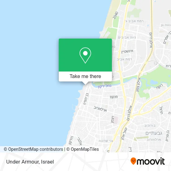
See Under Armour, Tel Aviv-Yafo, on the map
Public Transit to Under Armour in Tel Aviv-Yafo
Wondering how to get to Under Armour in Tel Aviv-Yafo? Moovit helps you find the best way to get to Under Armour with step-by-step directions from the nearest public transit station.
Moovit provides free maps and live directions to help you navigate through your city. View schedules, routes, timetables, and find out how long does it take to get to Under Armour in real time.
Looking for the nearest stop or station to Under Armour? Check out this list of stops closest to your destination: HaYarkon/Sha'ar Zion; Tel Aviv Port/Dizengoff; Dizengoff/Ben Yehuda; Ironi Hey/Ben Yehuda; Tel Aviv University Train Station; Tel Aviv Savidor Central Station; Arlozorov Light Rail Station.
Bus: 10, 115, 172, 4, 48, 55, 68, 62, 174, 418, 2, 8, 39, 222, Green Savbus, Blue Savbus, 36, 709, 710, 715, 716, 717.Israel Railways: Be'er Sheva Center - Herzliya, Ofakim - Herzliya, Ashdod Ad Halom - Herzliya, Ashkelon - Binyamina, Ashkelon - Herzliya, Beer Sheva Center - Bnei Brak, Ashkelon - Tel Aviv Center, Beer Sheva Center - Tel Aviv Center, Beit Shemesh - Tel Aviv Center, בנימינה - מודיעין מרכז, Herzliya - Airport ✈.
Want to see if there’s another route that gets you there at an earlier time? Moovit helps you find alternative routes or times. Get directions from and directions to Under Armour easily from the Moovit App or Website.
We make riding to Under Armour easy, which is why over 1.5 million users, including users in Tel Aviv-Yafo, trust Moovit as the best app for public transit. You don’t need to download an individual bus app or train app, Moovit is your all-in-one transit app that helps you find the best bus time or train time available.
For information on prices of bus and Israel Railways, costs and ride fares to Under Armour, please check the Moovit app.
Use the app to navigate to popular places including to the airport, hospital, stadium, grocery store, mall, coffee shop, school, college, and university.
Location: Tel Aviv-Yafo, Israel
- Bedulina Tel Aviv Port,
- Kviskal,
- Yordei Hasira 1,
- Shaked Cafe - Tel Aviv Port,
- Shaked Ice Cream,
- Sisense,
- Port Tel Aviv Residence,
- ACE,
- Beer Dr. Adi,
- Nimrod Cafe-Tel Aviv Port,
- Hanamal 36,
- Old Port Complex in Tel Aviv,
- Tokhaus,
- Posiket,
- Tel Aviv Port,
- L'ITALIA,
- Moon Child,
- Yakimono Hilton Tel Aviv,
- Dalit Levi - Eyebrow Design and Beauty Professions,
- WIX Offices
Places Near Under Armour (Tel Aviv-Yafo)
- Ramat Gan Stadium, Ramat Gan,
- Menora Mivtachim Arena, Tel Aviv-Yafo,
- Bloomfield Stadium, Tel Aviv-Yafo,
- Ichilov Hospital, Tel Aviv-Yafo,
- Beilinson Hospital, Petah Tikva,
- Tel Hashomer Base, Ramat Gan,
- Glilot Complex, Hof HaSharon Regional Council,
- HaKotel, Jerusalem,
- Yarkon Park, Tel Aviv-Yafo,
- Expo Tel Aviv, Tel Aviv-Yafo,
- Assuta Hospital - Ramat HaHayal, Tel Aviv-Yafo,
- Dizengoff Center, Tel Aviv-Yafo,
- Tel HaShomer North Gate, Ramat Gan,
- Carmel Market, Tel Aviv-Yafo,
- Azrieli, Tel Aviv-Yafo,
- Moovit Office, Nes Ziona,
- Gideon Camp - Military Base 7, Emek Lod Regional Council,
- Bislach 17, Ramat Negev Regional Council,
- Kashcafe, Kiryat Ata,
- Southern Medical Center, Ramat Negev Regional Council
How to get to popular places in Israel with public transit
Get around Tel Aviv-Yafo by public transit!
Traveling around Tel Aviv-Yafo has never been so easy. See step by step directions as you travel to any attraction, street or major public transit station. View bus and train schedules, arrival times, service alerts and detailed routes on a map, so you know exactly how to get to anywhere in Tel Aviv-Yafo.
When traveling to any destination around Tel Aviv-Yafo use Moovit's Live Directions with Get Off Notifications to know exactly where and how far to walk, how long to wait for your line, and how many stops are left. Moovit will alert you when it's time to get off — no need to constantly re-check whether yours is the next stop.
Wondering how to use public transit in Tel Aviv-Yafo or how to pay for public transit in Tel Aviv-Yafo? Moovit public transit app can help you navigate your way with public transit easily, and at minimum cost. It includes public transit fees, ticket prices, and costs. Looking for a map of Tel Aviv-Yafo public transit lines? Moovit public transit app shows all public transit maps in Tel Aviv-Yafo with all Bus, Israel Railways, Light Rail, Carmelit / Rachbalit and Shuttle routes and stops on an interactive map.
Israel has 5 transit type(s), including: Bus, Israel Railways, Light Rail, Carmelit / Rachbalit and Shuttle, operated by several transit agencies, including Dan, Tel Aviv Light Rail - Tevel - Red Line, Israel Railways, Egged, Metropoline, Kavim, Electra Afikim, Nateev Express, Extra, Extra Jerusalem, Jerusalem Light Rail - Kfir, Egged Jerusalem Envelope Route, Dan Badarom, Dan Beer-Sheva and Electra Afikim Transport
