How to get to Under Pressure Power Washing SFL by bus?
Click on the bus route to see step by step directions with maps, line arrival times and updated time schedules.
From 79th street and nw 17th ave., Miami
77 minFrom Ross Dress for Less, Miami
66 minFrom Northwest 1st Avenue & Northwest 1st Street, Miami
38 minFrom Pérez Art Museum Miami (PAMM), Miami
55 minFrom Miami Northwestern Senior High School, Miami
89 minFrom Jungle Island, Miami
54 minFrom Hialeah, FL, Hialeah
86 minFrom University of Miami, Miami
88 minFrom Calle Ocho, Miami
36 minFrom Florida International University-Modesto A. Maidique Campus, South Westside
66 min
Bus stops near Under Pressure Power Washing SFL in Miami
Bus lines to Under Pressure Power Washing SFL in Miami
What are the closest stations to Under Pressure Power Washing SFL?
The closest stations to Under Pressure Power Washing SFL are:
- Sw 49th Ave @ Sw 4th St is 269 yards away, 4 min walk.
- Sw 8 St @ Wallace St is 487 yards away, 6 min walk.
- W Flagler St & Nw 49 Av is 761 yards away, 9 min walk.
Which bus lines stop near Under Pressure Power Washing SFL?
These bus lines stop near Under Pressure Power Washing SFL: 11, 211, 8, MIAFLAG.
What’s the nearest bus station to Under Pressure Power Washing SFL in Miami?
The nearest bus station to Under Pressure Power Washing SFL in Miami is Sw 49th Ave @ Sw 4th St. It’s a 4 min walk away.
What time is the first bus to Under Pressure Power Washing SFL in Miami?
The 11 is the first bus that goes to Under Pressure Power Washing SFL in Miami. It stops nearby at 3:21 AM.
What time is the last bus to Under Pressure Power Washing SFL in Miami?
The 11 is the last bus that goes to Under Pressure Power Washing SFL in Miami. It stops nearby at 2:26 AM.
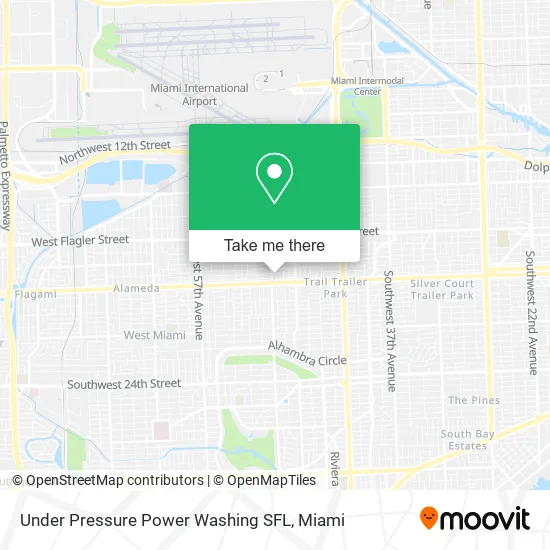
See Under Pressure Power Washing SFL, Miami, on the map
Public Transit to Under Pressure Power Washing SFL in Miami
Wondering how to get to Under Pressure Power Washing SFL in Miami? Moovit helps you find the best way to get to Under Pressure Power Washing SFL with step-by-step directions from the nearest public transit station.
Moovit provides free maps and live directions to help you navigate through your city. View schedules, routes, timetables, and find out how long does it take to get to Under Pressure Power Washing SFL in real time.
Looking for the nearest stop or station to Under Pressure Power Washing SFL? Check out this list of stops closest to your destination: Sw 49th Ave @ Sw 4th St; Sw 8 St @ Wallace St; W Flagler St & Nw 49 Av.
Bus: 11, 211, 8, MIAFLAG.
Want to see if there’s another route that gets you there at an earlier time? Moovit helps you find alternative routes or times. Get directions from and directions to Under Pressure Power Washing SFL easily from the Moovit App or Website.
We make riding to Under Pressure Power Washing SFL easy, which is why over 1.5 million users, including users in Miami, trust Moovit as the best app for public transit. You don’t need to download an individual bus app or train app, Moovit is your all-in-one transit app that helps you find the best bus time or train time available.
For information on prices of bus, light rail and train, costs and ride fares to Under Pressure Power Washing SFL, please check the Moovit app.
Use the app to navigate to popular places including to the airport, hospital, stadium, grocery store, mall, coffee shop, school, college, and university.
Under Pressure Power Washing SFL Address: 4880 SW 6th St Miami, FL 33134 street in Miami
- Metro PCS,
- Cicero Ortho - Med Center,
- Miami Fl,
- Total Connection Group,
- smart Start Ignition Interlock,
- Estrella Insurance #108,
- BMO Harris Bank,
- Miccosukee Indian Village,
- Francisco Oliva DPM,
- Friends Dental Studio,
- Francisco J Oliva, DPM Pa,
- Podiatry Foot & Ankle,
- Cano Health,
- Metro Comic Books,
- Infusions & Body by J Inc.,
- Paella Y Pa TI Chef: Dennis Fernandez,
- Nayara Magalhães Salon,
- Seduction Cosmetic Center,
- Computer Repair Miami,
- FIU
Places Near Under Pressure Power Washing SFL (Miami)
- Aventura Mall, Miami,
- Dolphin Mall Bus, Miami,
- Little Havana, Miami,
- Bayside Marketplace, Miami,
- Sawgrass mall ( FL ), Miami Beach,
- Sawgrass Mall, Miami,
- Keiser University Flagship Campus, West Palm Beach,
- Aventura Mall, Miami Beach,
- Zoo Miami, Miami,
- Dolphin Mall, Miami,
- Richard E. Gerstein Justice Building, Miami,
- 1351 NW 12th St, Miami,
- Marlins Park, Miami,
- Hard Rock Stadium, Miami Gardens,
- Miami Freedom Park, Miami,
- Port of Miami Cruise Terminal, Miami,
- Wynwood, Miami,
- Brickell City Centre, Miami,
- Miami Design District, Miami,
- Miami-Dade County Courthouse, Miami
How to get to popular places in Miami with public transit
Get around Miami by public transit!
Traveling around Miami has never been so easy. See step by step directions as you travel to any attraction, street or major public transit station. View bus and train schedules, arrival times, service alerts and detailed routes on a map, so you know exactly how to get to anywhere in Miami.
When traveling to any destination around Miami use Moovit's Live Directions with Get Off Notifications to know exactly where and how far to walk, how long to wait for your line, and how many stops are left. Moovit will alert you when it's time to get off — no need to constantly re-check whether yours is the next stop.
Wondering how to use public transit in Miami or how to pay for public transit in Miami? Moovit public transit app can help you navigate your way with public transit easily, and at minimum cost. It includes public transit fees, ticket prices, and costs. Looking for a map of Miami public transit lines? Moovit public transit app shows all public transit maps in Miami with all Bus, Train, Light Rail and Ferry routes and stops on an interactive map.
Miami has 4 transit type(s), including: Bus, Train, Light Rail and Ferry, operated by several transit agencies, including Broward County Transit, Miami-Dade Transit, Metrorail, Palm Tran, Tri-Rail, Brightline, MARTY, City of Homestead Trolley, Key West Transit, Treasure Coast Connector, GoLine IRT, Amtrak, Greyhound-us, FlixBus-us and Aventura Express Shuttle Bus