Directions to Unimed (São José Dos Pinhais) with public transportation
The following transit lines have routes that pass near Unimed
How to get to Unimed by bus?
Click on the bus route to see step by step directions with maps, line arrival times and updated time schedules.
From Mexico 70, Sítio Cercado
46 minFrom Estação Tubo São Pedro, Capão Raso
52 minFrom Capão Raso, Capão Raso
71 minFrom Rua Waldemar Loureiro Campos, Boqueirão
34 minFrom Avenida Winston Churchill, Capão Raso
67 minFrom Avenida Iraí, Pinhais
80 minFrom Shopping & Sports, Alto Boqueirão
48 minFrom Hospital Erasto Gaertner, Jardim Das Américas
39 minFrom Shopping Jardim Das Américas, Jardim Das Américas
53 minFrom Centro Politécnico - UFPR, Jardim Das Américas
53 min
Bus stops near Unimed in São José Dos Pinhais
Bus lines to Unimed in São José Dos Pinhais
- E21 CENTRO SÃO JOSÉ / BOQUEIRÃO, CENTRO SÃO JOSÉ / BOQUEIRÃO,VIEW
- Y96 FAZENDA / SÃO JOSÉ, FAZENDA / SÃO JOSÉ,VIEW
- E99 SÃO JOSÉ / GUADALUPE (VIA T. CENTRAL), SÃO JOSÉ / GUADALUPE (via T. CENTRAL),VIEW
- 301 COLÔNIA RIO GRANDE, COLÔNIA RIO GRANDE,VIEW
- 304 ZANIOLO, ZANIOLO,VIEW
- 311 SÃO MARCOS / AQUARIUS, SÃO MARCOS / AQUARIUS,VIEW
- 312 JARDIM CARMEM, JARDIM CARMEM,VIEW
- 398 JARDIM CARMEM - SÃO MARCOS (AQUARIUS), JARDIM CARMEM - SÃO MARCOS (AQUARIUS),VIEW
- 399 COLÔNIA RIO GRANDE / ELDORADO, COLÔNIA RIO GRANDE / ELDORADO,VIEW
- 401 CONTENDA, CONTENDA,VIEW
- 402 CAMPO LARGO, CAMPO LARGO,VIEW
- 403 CAMPINA, CAMPINA,VIEW
- 405 MARCELINO (VIA CACHOEIRA), MARCELINO (via CACHOEIRA),VIEW
- 406 COTIA (VIA CAMPO LARGO), COTIA (via CAMPO LARGO),VIEW
- 407 REFRIKO, REFRIKO,VIEW
- 409 FAXINA / QUEBRADA FUNDA, FAXINA / QUEBRADA FUNDA,VIEW
- 410 CASTELHANO, CASTELHANO,VIEW
- 411 CONTENDA (VIA CAMPO LARGO), CONTENDA (via CAMPO LARGO),VIEW
- 412 CAMPESTRE DA FAXINA, CAMPESTRE DA FAXINA,VIEW
- 420 MALHADA / ROÇA VELHA, MALHADA / ROÇA VELHA,VIEW
What are the closest stations to Unimed?
The closest stations to Unimed are:
- R. Voluntários da Pátria, 212 is 18 meters away, 1 min walk.
- R. Mendes Leitão, 2694 is 169 meters away, 3 min walk.
- R. Mendes Leitão, 2541 is 281 meters away, 4 min walk.
- R. Dona Izabel A Redentora, 1531 is 286 meters away, 4 min walk.
- Av. Rui Barbosa, 9295 is 360 meters away, 5 min walk.
- R. Joaquim Nabuco, 2331 is 491 meters away, 7 min walk.
- R. Passos de Oliveira, 1391 is 522 meters away, 7 min walk.
Which bus lines stop near Unimed?
These bus lines stop near Unimed: 200 PIT PRAÇA DA JUVENTUDE / CENTRO (VIA IZABEL REDENTORA), 304 ZANIOLO, 506 INTERBAIRROS 2, E21 CENTRO SÃO JOSÉ / BOQUEIRÃO, E99 SÃO JOSÉ / GUADALUPE (VIA T. CENTRAL).
What’s the nearest bus station to Unimed in São José Dos Pinhais?
The nearest bus station to Unimed in São José Dos Pinhais is R. Voluntários da Pátria, 212. It’s a 1 min walk away.
What time is the first bus to Unimed in São José Dos Pinhais?
The 530 BAIRRO A BAIRRO - 2 is the first bus that goes to Unimed in São José Dos Pinhais. It stops nearby at 4:01 AM.
What time is the last bus to Unimed in São José Dos Pinhais?
The 530 BAIRRO A BAIRRO - 2 is the last bus that goes to Unimed in São José Dos Pinhais. It stops nearby at 1:16 AM.
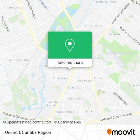
See Unimed, São José Dos Pinhais, on the map
Public Transit to Unimed in São José Dos Pinhais
Wondering how to get to Unimed in São José Dos Pinhais? Moovit helps you find the best way to get to Unimed with step-by-step directions from the nearest public transit station.
Moovit provides free maps and live directions to help you navigate through your city. View schedules, routes, timetables, and find out how long does it take to get to Unimed in real time.
Looking for the nearest stop or station to Unimed? Check out this list of stops closest to your destination: R. Voluntários da Pátria; R. Mendes Leitão; R. Mendes Leitão; R. Dona Izabel A Redentora; Av. Rui Barbosa; R. Joaquim Nabuco; R. Passos de Oliveira.
Bus: 200 PIT PRAÇA DA JUVENTUDE / CENTRO (VIA IZABEL REDENTORA), 304 ZANIOLO, 506 INTERBAIRROS 2, E21 CENTRO SÃO JOSÉ / BOQUEIRÃO, E99 SÃO JOSÉ / GUADALUPE (VIA T. CENTRAL), Y96 FAZENDA / SÃO JOSÉ, 301 COLÔNIA RIO GRANDE, 305 SÃO DOMINGOS / ARISTOCRATA, 302 ELDORADO, 303 JARDIM ITÁLIA, 510 RIO PEQUENO, 0263-500 SÃO JOSÉ DOS PINHAIS / LAGOINHA, 300 BAIRRO A BAIRRO - 4, 526 T. CENTRAL / MONTE LÍBANO.
Want to see if there’s another route that gets you there at an earlier time? Moovit helps you find alternative routes or times. Get directions from and directions to Unimed easily from the Moovit App or Website.
We make riding to Unimed easy, which is why over 1.5 million users, including users in São José Dos Pinhais, trust Moovit as the best app for public transit. You don’t need to download an individual bus app or train app, Moovit is your all-in-one transit app that helps you find the best bus time or train time available.
For information on prices of bus, costs and ride fares to Unimed, please check the Moovit app.
Use the app to navigate to popular places including to the airport, hospital, stadium, grocery store, mall, coffee shop, school, college, and university.
Unimed Address: Rua Voluntários da Pátria, Centro São José dos Pinhais-PR 83005-020 street in São José Dos Pinhais
- Rico Bordados e Serigrafia,
- CEDIP - Clínica de Diagnóstico por Imagem,
- Jack Music Bar,
- Os Bichinhos Pet Drive,
- Vara da Fazenda Pública de São José dos Pinhais,
- Pink Biju,
- Ceebja,
- Capela Mortuária Municipal Natalina Berti,
- Cia do Terno,
- Rua Dona Izabel A Redentora 1434,
- Cartório De Registro Civil Títulos E Documentos Lídia Kruppizak,
- Rua Ângelo Zen 53,
- Shopping São José - Loja 277,
- O Boticário,
- Farmácias Panvel,
- Quiosque Chopp Brahma,
- OAB / PR - Subseção São José dos Pinhais,
- Rua Voluntários da Pátria 70,
- Otica Boa Visao,
- Ministério da Fazenda
Places Near Unimed (São José Dos Pinhais)
- Hospital Erasto Gaertner, Jardim Das Américas,
- Shopping Palladium, Portão,
- Pontifícia Universidade Católica do Paraná (PUCPR), Prado Velho,
- Rua Martim Afonso 558, Mercês,
- Jardim Botânico de Curitiba PR, Centro,
- Hospital Universitário Evangélico de Curitiba, Bigorrilho,
- Hospital do Rocio, Campo,
- Hospital Angelina Caron, Campina Grande Do Sul,
- Hospital de Clínicas (HC - UFPR), Centro,
- Arena Da Baixada - Curitiba,
- Park Shopping Barigüi, Mossunguê,
- Hospital Madalena Sofia, Bairro Alto,
- Hhhhh, Fazendinha,
- Rua General Mário Tourinho, Campina Do Siqueira,
- Jockey Plaza Shopping Center, Tarumã,
- Shopping Estação, Rebouças,
- Campo Largo, Campo,
- Parque Barigui, Mercês,
- Hospital Nossa Senhora Das Graças, Mercês,
- Hospital Da Cruz Vermelha, Batel
How to get to popular places in Curitiba Region with public transit
Get around São José Dos Pinhais by public transit!
Traveling around São José Dos Pinhais has never been so easy. See step by step directions as you travel to any attraction, street or major public transit station. View bus and train schedules, arrival times, service alerts and detailed routes on a map, so you know exactly how to get to anywhere in São José Dos Pinhais.
When traveling to any destination around São José Dos Pinhais use Moovit's Live Directions with Get Off Notifications to know exactly where and how far to walk, how long to wait for your line, and how many stops are left. Moovit will alert you when it's time to get off — no need to constantly re-check whether yours is the next stop.
Wondering how to use public transit in São José Dos Pinhais or how to pay for public transit in São José Dos Pinhais? Moovit public transit app can help you navigate your way with public transit easily, and at minimum cost. It includes public transit fees, ticket prices, and costs. Looking for a map of São José Dos Pinhais public transit lines? Moovit public transit app shows all public transit maps in São José Dos Pinhais with all Bus and Cable Car routes and stops on an interactive map.
Curitiba Region has 2 transit type(s), including: Bus and Cable Car, operated by several transit agencies, including Sistema Integrado de Mobilidade (URBS), Sistema Integrado de Mobilidade (AMEP), URBS (Cartões bancários e Dinheiro), URBS (Cartões bancários / Cartão URBS), AMEP (Cartões bancários / Cartão MetroCard), AMEP (Cartões bancários / Cartão MetroCard / Dinheiro), Viação Colombo (Dinheiro), TRIAR (Cartão TRIAR / Dinheiro), Empresa Curitiba Cerro Azul (Dinheiro), Expresso Nossa Senhora da Penha (Dinheiro), Empresa Campo Alto Tijucas (Dinheiro), Auto Viação São José (Cartão VEM / Dinheiro), BRT S/A (Cartão VEM / Dinheiro), TransPiedade (Cartão Cidadão / Dinheiro) and Oceânica Sul (Cartão Transporte / Dinheiro)