Directions to Unisphere X (Fairfax County) with public transportation
The following transit lines have routes that pass near Unisphere X
 Bus: 171, 371.
- Train: FREDERICKSBURG LINE.
How to get to Unisphere X by bus?
Click on the bus route to see step by step directions with maps, line arrival times and updated time schedules.
From Burke, VA, Fairfax County
84 minFrom Springfield Mall, Fairfax County
47 minFrom Kingstowne, VA, Fairfax County
54 minFrom Woodbridge, VA, Prince William County
133 minFrom [I-495] Exit 54 - Braddock Road, Fairfax County
112 minFrom Potomac Mills Mall, Prince William County
94 minFrom Inova Mount Vernon Hospital, Fairfax County
49 minFrom Franconia-Springfield Metro Station, Fairfax County
28 minFrom Lego Discovery Center Washington, D.C., Fairfax County
37 min
How to get to Unisphere X by train?
Click on the train route to see step by step directions with maps, line arrival times and updated time schedules.
Bus stop near Unisphere X in Fairfax County
- Telegraph Rd @ Lockport Pl, 4 min walk,VIEW
Train station near Unisphere X in Fairfax County
- Lorton Station, 28 min walk,VIEW
Bus lines to Unisphere X in Fairfax County
- 171, 171 Lorton V.R.E.,VIEW
What are the closest stations to Unisphere X?
The closest stations to Unisphere X are:
- Telegraph Rd @ Lockport Pl is 223 yards away, 4 min walk.
- Lorton Station is 2338 yards away, 28 min walk.
Which bus lines stop near Unisphere X?
These bus lines stop near Unisphere X: 171, 371.
Which train line stops near Unisphere X?
FREDERICKSBURG LINE (Spotsylvania)
What’s the nearest train station to Unisphere X in Fairfax County?
The nearest train station to Unisphere X in Fairfax County is Lorton Station. It’s a 28 min walk away.
What’s the nearest bus station to Unisphere X in Fairfax County?
The nearest bus station to Unisphere X in Fairfax County is Telegraph Rd @ Lockport Pl. It’s a 4 min walk away.
What time is the first train to Unisphere X in Fairfax County?
The FREDERICKSBURG LINE is the first train that goes to Unisphere X in Fairfax County. It stops nearby at 6:05 AM.
What time is the last train to Unisphere X in Fairfax County?
The FREDERICKSBURG LINE is the last train that goes to Unisphere X in Fairfax County. It stops nearby at 7:31 PM.
What time is the first bus to Unisphere X in Fairfax County?
The 171 is the first bus that goes to Unisphere X in Fairfax County. It stops nearby at 3:23 AM.
What time is the last bus to Unisphere X in Fairfax County?
The 171 is the last bus that goes to Unisphere X in Fairfax County. It stops nearby at 2:19 AM.
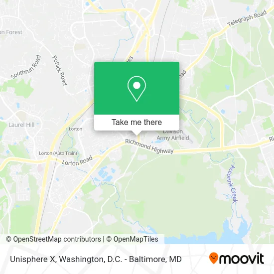
See Unisphere X, Fairfax County, on the map
Public Transit to Unisphere X in Fairfax County
Wondering how to get to Unisphere X in Fairfax County? Moovit helps you find the best way to get to Unisphere X with step-by-step directions from the nearest public transit station.
Moovit provides free maps and live directions to help you navigate through your city. View schedules, routes, timetables, and find out how long does it take to get to Unisphere X in real time.
Looking for the nearest stop or station to Unisphere X? Check out this list of stops closest to your destination: Telegraph Rd @ Lockport Pl; Lorton Station.
Bus: 171, 371.Train: FREDERICKSBURG LINE.
Want to see if there’s another route that gets you there at an earlier time? Moovit helps you find alternative routes or times. Get directions from and directions to Unisphere X easily from the Moovit App or Website.
We make riding to Unisphere X easy, which is why over 1.7 million users, including users in Fairfax County, trust Moovit as the best app for public transit. You don’t need to download an individual bus app or train app, Moovit is your all-in-one transit app that helps you find the best bus time or train time available.
For information on prices of bus and train, costs and ride fares to Unisphere X, please check the Moovit app.
Use the app to navigate to popular places including to the airport, hospital, stadium, grocery store, mall, coffee shop, school, college, and university.
Unisphere X Address: 7300 Old Pohick Way street in Fairfax County
- Global Express,
- Defense Threat Reduction Agency,
- Lorton DMV Hell,
- 8988 Belvoir View Place,
- Divya Bansal, Pac,
- Department of State SA 34,
- Lorton VRE Station,
- Lorton VA,
- Iglesia del Nazareno Santidad a Jehová,
- Iglesia Apostoles Y Profetas Peniel USA, Springfield VA,
- National Museum Of the United States Army,
- Amtrak (Auto Train) - LOR,
- Lorton, VA - Amtrak Auto Train Station (LOR),
- US Dept Of State, Springfield, VA SA-21,
- WING STOP,
- I-95 Exit 163: Lorton Rd,
- Lorton Marketplace Medical Center,
- Lorton Station,
- HQC DLA Fitness Center,
- U.S. Department of State SA-28
Places Near Unisphere X (Fairfax County)
- Amazon Hq2, Arlington County,
- Marriott Marquis Washington, DC, Washington,
- Rock Creek Tennis Center, Washington,
- Westfield Montgomery Mall, Montgomery County,
- National Theatre, Washington,
- Capital One Arena, Washington,
- Washington DC VA Medical Center, Washington,
- M&T Bank Stadium, Baltimore,
- Warner Theatre, Washington,
- Georgetown, Washington,
- National Museum of African American History and Culture, Washington,
- Pennsylvania Ave NW (3rd st and pennsylvania), Washington,
- Camden Yards, Baltimore,
- Sibley Memorial Hospital, Washington,
- Museum Of The Bible, Washington,
- Washington National Cathedral, Washington,
- National Zoo, Washington,
- Basilica of the National Shrine, Washington,
- PG Mall, Prince George's County,
- The Anthem, Washington
How to get to popular places in Washington, D.C. - Baltimore, MD with public transit
Get around Fairfax County by public transit!
Traveling around Fairfax County has never been so easy. See step by step directions as you travel to any attraction, street or major public transit station. View bus and train schedules, arrival times, service alerts and detailed routes on a map, so you know exactly how to get to anywhere in Fairfax County.
When traveling to any destination around Fairfax County use Moovit's Live Directions with Get Off Notifications to know exactly where and how far to walk, how long to wait for your line, and how many stops are left. Moovit will alert you when it's time to get off — no need to constantly re-check whether yours is the next stop.
Wondering how to use public transit in Fairfax County or how to pay for public transit in Fairfax County? Moovit public transit app can help you navigate your way with public transit easily, and at minimum cost. It includes public transit fees, ticket prices, and costs. Looking for a map of Fairfax County public transit lines? Moovit public transit app shows all public transit maps in Fairfax County with all Bus, Train, Metro, Light Rail and Ferry routes and stops on an interactive map.
Washington, D.C. - Baltimore, MD has 5 transit type(s), including: Bus, Train, Metro, Light Rail and Ferry, operated by several transit agencies, including WMATA, Montgomery County Ride On, Fairfax Connector, TheBus, PRTC, DASH - Alexandria, Arlington Transit (ART), RTA of Central Maryland, MDOT MTA, MDOT MTA Light RailLink, MDOT MTA Commuter Bus, MDOT MTA Local Bus, FXBGO!, Virginia Railway Express (VRE) and MARC