How to get to United States Postal Service by bus?
Click on the bus route to see step by step directions with maps, line arrival times and updated time schedules.
From Annapolis Mall, Anne Arundel County
92 minFrom Dundalk, Maryland, Baltimore County
203 minFrom Pasadena, Maryland, Anne Arundel County
176 minFrom Amazon Fulfillment Center-DCA1, Baltimore County
201 minFrom Glen Burnie, MD, Anne Arundel County
199 minFrom Anne Arundel Community College, Anne Arundel County
158 minFrom Archbishop Spalding High School, Severn
228 min
Bus stop near United States Postal Service in Queen Anne's County
- Queenstown Premium Outlets, 15 min walk,VIEW
Bus lines to United States Postal Service in Queen Anne's County
What are the closest stations to United States Postal Service?
The closest stations to United States Postal Service are:
- Queenstown Premium Outlets is 1288 yards away, 15 min walk.
Which bus line stops near United States Postal Service?
3 (Annapolis)
What’s the nearest bus station to United States Postal Service in Queen Anne's County?
The nearest bus station to United States Postal Service in Queen Anne's County is Queenstown Premium Outlets. It’s a 15 min walk away.
What time is the first bus to United States Postal Service in Queen Anne's County?
The 3 is the first bus that goes to United States Postal Service in Queen Anne's County. It stops nearby at 6:30 AM.
What time is the last bus to United States Postal Service in Queen Anne's County?
The 3 is the last bus that goes to United States Postal Service in Queen Anne's County. It stops nearby at 5:33 PM.
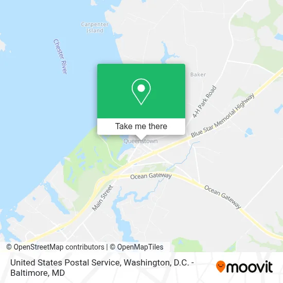
See United States Postal Service, Queen Anne's County, on the map
Public Transit to United States Postal Service in Queen Anne's County
Wondering how to get to United States Postal Service in Queen Anne's County? Moovit helps you find the best way to get to United States Postal Service with step-by-step directions from the nearest public transit station.
Moovit provides free maps and live directions to help you navigate through your city. View schedules, routes, timetables, and find out how long does it take to get to United States Postal Service in real time.
Looking for the nearest stop or station to United States Postal Service? Check out this list of stops closest to your destination: Queenstown Premium Outlets.
Bus: 3, 1, 2.
Want to see if there’s another route that gets you there at an earlier time? Moovit helps you find alternative routes or times. Get directions from and directions to United States Postal Service easily from the Moovit App or Website.
We make riding to United States Postal Service easy, which is why over 1.7 million users, including users in Queen Anne's County, trust Moovit as the best app for public transit. You don’t need to download an individual bus app or train app, Moovit is your all-in-one transit app that helps you find the best bus time or train time available.
For information on prices of bus, costs and ride fares to United States Postal Service, please check the Moovit app.
Use the app to navigate to popular places including to the airport, hospital, stadium, grocery store, mall, coffee shop, school, college, and university.
United States Postal Service Address: 7100 Main St street in Queen Anne's County
- Grasonville, Maryland,
- Narrows Pointe Homeowners,
- Annie's Paramount Steak & Seafood House,
- Red Eye's Dock Bar,
- Safe Harbor Narrows Point,
- Marinemax Kent Island,
- Galahad Marine,
- Mid-Atlantic - Maryland - Kent Island,
- Total Marine Of Maryland, Inc.,
- Nauti Mermaid,
- Chesapeake Cars And Coffee,
- Harrisons Marina,
- Bodywork by Allison,
- Fisherman's Village,
- Shore Tackle And Custom Rods,
- Custom Canvas Coverings Inc,
- Maryland Waterman's Memorial,
- Kodiak Charters,
- Red Eye's Dock Bar,
- Harris Seafood Co.
Places Near United States Postal Service (Queen Anne's County)
- National Zoo, Washington,
- Pennsylvania Ave NW (3rd st and pennsylvania), Washington,
- Museum Of The Bible, Washington,
- Rock Creek Tennis Center, Washington,
- Sibley Memorial Hospital, Washington,
- National Theatre, Washington,
- The Anthem, Washington,
- Amazon Hq2, Arlington County,
- M&T Bank Stadium, Baltimore,
- Washington National Cathedral, Washington,
- PG Mall, Prince George's County,
- Westfield Montgomery Mall, Montgomery County,
- Capital One Arena, Washington,
- National Museum of African American History and Culture, Washington,
- Camden Yards, Baltimore,
- Marriott Marquis Washington, DC, Washington,
- Basilica of the National Shrine, Washington,
- Washington DC VA Medical Center, Washington,
- Georgetown, Washington,
- Warner Theatre, Washington
How to get to popular places in Washington, D.C. - Baltimore, MD with public transit
Get around Queen Anne's County by public transit!
Traveling around Queen Anne's County has never been so easy. See step by step directions as you travel to any attraction, street or major public transit station. View bus and train schedules, arrival times, service alerts and detailed routes on a map, so you know exactly how to get to anywhere in Queen Anne's County.
When traveling to any destination around Queen Anne's County use Moovit's Live Directions with Get Off Notifications to know exactly where and how far to walk, how long to wait for your line, and how many stops are left. Moovit will alert you when it's time to get off — no need to constantly re-check whether yours is the next stop.
Wondering how to use public transit in Queen Anne's County or how to pay for public transit in Queen Anne's County? Moovit public transit app can help you navigate your way with public transit easily, and at minimum cost. It includes public transit fees, ticket prices, and costs. Looking for a map of Queen Anne's County public transit lines? Moovit public transit app shows all public transit maps in Queen Anne's County with all Bus, Train, Metro, Light Rail and Ferry routes and stops on an interactive map.
Washington, D.C. - Baltimore, MD has 5 transit type(s), including: Bus, Train, Metro, Light Rail and Ferry, operated by several transit agencies, including WMATA, Montgomery County Ride On, Fairfax Connector, TheBus, PRTC, DASH - Alexandria, Arlington Transit (ART), RTA of Central Maryland, MDOT MTA, MDOT MTA Light RailLink, MDOT MTA Commuter Bus, MDOT MTA Local Bus, FXBGO!, Virginia Railway Express (VRE) and MARC