How to get to United States Postal Service by bus?
Click on the bus route to see step by step directions with maps, line arrival times and updated time schedules.
Bus stops near United States Postal Service in Worcester County
Bus lines to United States Postal Service in Worcester County
What are the closest stations to United States Postal Service?
The closest stations to United States Postal Service are:
- Pocomoke Family Medical Ctr. @ 5th St. is 798 yards away, 10 min walk.
- Pocomoke Plaza is 1285 yards away, 15 min walk.
Which bus line stops near United States Postal Service?
503S (Pocomoke)
What’s the nearest bus station to United States Postal Service in Worcester County?
The nearest bus station to United States Postal Service in Worcester County is Pocomoke Family Medical Ctr. @ 5th St.. It’s a 10 min walk away.
What time is the first bus to United States Postal Service in Worcester County?
The 503N is the first bus that goes to United States Postal Service in Worcester County. It stops nearby at 5:05 AM.
What time is the last bus to United States Postal Service in Worcester County?
The 503S is the last bus that goes to United States Postal Service in Worcester County. It stops nearby at 1:21 AM.
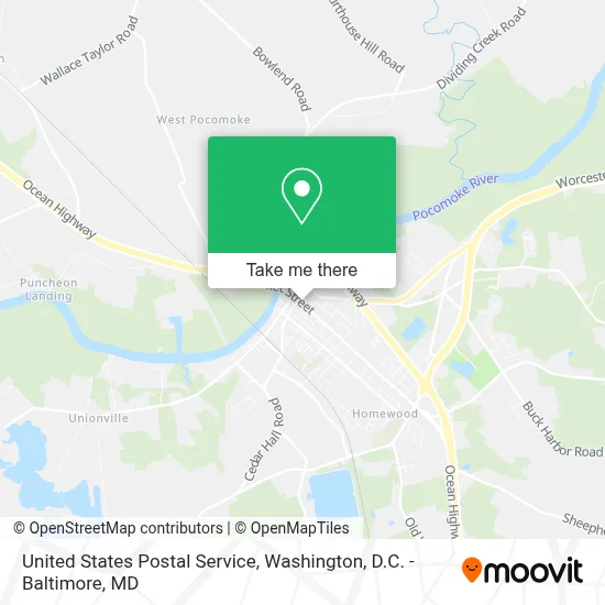
See United States Postal Service, Worcester County, on the map
Public Transit to United States Postal Service in Worcester County
Wondering how to get to United States Postal Service in Worcester County? Moovit helps you find the best way to get to United States Postal Service with step-by-step directions from the nearest public transit station.
Moovit provides free maps and live directions to help you navigate through your city. View schedules, routes, timetables, and find out how long does it take to get to United States Postal Service in real time.
Looking for the nearest stop or station to United States Postal Service? Check out this list of stops closest to your destination: Pocomoke Family Medical Ctr. @ 5th St.; Pocomoke Plaza.
Bus: 503S, 503N.
Want to see if there’s another route that gets you there at an earlier time? Moovit helps you find alternative routes or times. Get directions from and directions to United States Postal Service easily from the Moovit App or Website.
We make riding to United States Postal Service easy, which is why over 1.7 million users, including users in Worcester County, trust Moovit as the best app for public transit. You don’t need to download an individual bus app or train app, Moovit is your all-in-one transit app that helps you find the best bus time or train time available.
For information on prices of bus, costs and ride fares to United States Postal Service, please check the Moovit app.
Use the app to navigate to popular places including to the airport, hospital, stadium, grocery store, mall, coffee shop, school, college, and university.
United States Postal Service Address: 207 Market St street in Worcester County
- Oxford MD-371,
- Sensei Tobacco Vape,
- Commonwealth Chesapeake,
- Virginia Welcome Center at New Church,
- Cars Today,
- Blue Rhino Propane Exchange,
- Westover Goose Creek,
- Goose Creek,
- Somerset County Sheriffs Department - Westover Maryland,
- Virginia's Eastern Shore,
- Westover, Maryland,
- Western Union,
- Children Of Destiny Child Care,
- Bank Of America Atm,
- St Paul's Methodist Episcopal Church,
- Atm Westover Shell (Old Dash In #1108),
- Blue Rhino Propane Exchange,
- Westover,
- United States Postal Service,
- William T. Tull House
Places Near United States Postal Service (Worcester County)
- National Zoo, Washington,
- Westfield Montgomery Mall, Montgomery County,
- Basilica of the National Shrine, Washington,
- National Theatre, Washington,
- Rock Creek Tennis Center, Washington,
- M&T Bank Stadium, Baltimore,
- Washington DC VA Medical Center, Washington,
- Museum Of The Bible, Washington,
- Georgetown, Washington,
- Warner Theatre, Washington,
- Sibley Memorial Hospital, Washington,
- National Museum of African American History and Culture, Washington,
- PG Mall, Prince George's County,
- Pennsylvania Ave NW (3rd st and pennsylvania), Washington,
- The Anthem, Washington,
- Marriott Marquis Washington, DC, Washington,
- Capital One Arena, Washington,
- Camden Yards, Baltimore,
- Washington National Cathedral, Washington,
- Amazon Hq2, Arlington County
How to get to popular places in Washington, D.C. - Baltimore, MD with public transit
Get around Worcester County by public transit!
Traveling around Worcester County has never been so easy. See step by step directions as you travel to any attraction, street or major public transit station. View bus and train schedules, arrival times, service alerts and detailed routes on a map, so you know exactly how to get to anywhere in Worcester County.
When traveling to any destination around Worcester County use Moovit's Live Directions with Get Off Notifications to know exactly where and how far to walk, how long to wait for your line, and how many stops are left. Moovit will alert you when it's time to get off — no need to constantly re-check whether yours is the next stop.
Wondering how to use public transit in Worcester County or how to pay for public transit in Worcester County? Moovit public transit app can help you navigate your way with public transit easily, and at minimum cost. It includes public transit fees, ticket prices, and costs. Looking for a map of Worcester County public transit lines? Moovit public transit app shows all public transit maps in Worcester County with all Bus, Train, Metro, Light Rail and Ferry routes and stops on an interactive map.
Washington, D.C. - Baltimore, MD has 5 transit type(s), including: Bus, Train, Metro, Light Rail and Ferry, operated by several transit agencies, including WMATA, Montgomery County Ride On, Fairfax Connector, TheBus, PRTC, DASH - Alexandria, Arlington Transit (ART), RTA of Central Maryland, MDOT MTA, MDOT MTA Light RailLink, MDOT MTA Commuter Bus, MDOT MTA Local Bus, FXBGO!, Virginia Railway Express (VRE) and MARC