How to get to Unity Baptist Church by bus?
Click on the bus route to see step by step directions with maps, line arrival times and updated time schedules.
From Hartford Healthcare Amphitheater, Bridgeport
83 minFrom Danbury, CT, Danbury
103 minFrom GFFF, Stamford
89 minFrom Rye Playland, Rye
194 minFrom NBC Sports Shuttle, Stamford
63 minFrom Westchester Mall, White Plains
113 minFrom the bee-line system Bus Stop - Rye Playland (13, 75, 91), Rye
193 minFrom Port Chester, NY, Port Chester
125 min
How to get to Unity Baptist Church by train?
Click on the train route to see step by step directions with maps, line arrival times and updated time schedules.
Bus stop near Unity Baptist Church in Norwalk
- Health Park, 3 min walk,VIEW
Train stations near Unity Baptist Church in Norwalk
Bus lines to Unity Baptist Church in Norwalk
- 3, Walmart Shopping Center,VIEW
What are the closest stations to Unity Baptist Church?
The closest stations to Unity Baptist Church are:
- Health Park is 175 yards away, 3 min walk.
- East Norwalk is 2150 yards away, 26 min walk.
- Merrit 7 is 5423 yards away, 64 min walk.
Which bus lines stop near Unity Baptist Church?
These bus lines stop near Unity Baptist Church: 3, 341.
Which train line stops near Unity Baptist Church?
5 (1849#| Stamford)
What’s the nearest train station to Unity Baptist Church in Norwalk?
The nearest train station to Unity Baptist Church in Norwalk is East Norwalk. It’s a 26 min walk away.
What’s the nearest bus station to Unity Baptist Church in Norwalk?
The nearest bus station to Unity Baptist Church in Norwalk is Health Park. It’s a 3 min walk away.
What time is the first train to Unity Baptist Church in Norwalk?
The 3 is the first train that goes to Unity Baptist Church in Norwalk. It stops nearby at 5:17 AM.
What time is the last train to Unity Baptist Church in Norwalk?
The 3 is the last train that goes to Unity Baptist Church in Norwalk. It stops nearby at 2:54 AM.
What time is the first bus to Unity Baptist Church in Norwalk?
The 3 is the first bus that goes to Unity Baptist Church in Norwalk. It stops nearby at 5:16 AM.
What time is the last bus to Unity Baptist Church in Norwalk?
The 3 is the last bus that goes to Unity Baptist Church in Norwalk. It stops nearby at 10:42 PM.
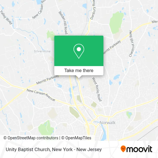
See Unity Baptist Church, Norwalk, on the map
Public Transit to Unity Baptist Church in Norwalk
Wondering how to get to Unity Baptist Church in Norwalk? Moovit helps you find the best way to get to Unity Baptist Church with step-by-step directions from the nearest public transit station.
Moovit provides free maps and live directions to help you navigate through your city. View schedules, routes, timetables, and find out how long does it take to get to Unity Baptist Church in real time.
Looking for the nearest stop or station to Unity Baptist Church? Check out this list of stops closest to your destination: Health Park; East Norwalk; Merrit 7.
Bus: 3, 341.Train: 5, 3.
Want to see if there’s another route that gets you there at an earlier time? Moovit helps you find alternative routes or times. Get directions from and directions to Unity Baptist Church easily from the Moovit App or Website.
We make riding to Unity Baptist Church easy, which is why over 1.5 million users, including users in Norwalk, trust Moovit as the best app for public transit. You don’t need to download an individual bus app or train app, Moovit is your all-in-one transit app that helps you find the best bus time or train time available.
For information on prices of bus and train, costs and ride fares to Unity Baptist Church, please check the Moovit app.
Use the app to navigate to popular places including to the airport, hospital, stadium, grocery store, mall, coffee shop, school, college, and university.
Unity Baptist Church Address: 346 Main Ave street in Norwalk
- MYGYM,
- Norwalk Islamic Community Center,
- Tabernacle De Louange Norwalk,
- Calasanz Martial Arts & Fitness System,
- Primary Medical Care Center,
- Professional Physical Therapy - Norwalk Ct,
- Magical Beauty Spa,
- Yale New Haven Health Urgent Care Norwalk,
- City Of Norwalk,
- Blue Rhino Propane Exchange,
- Seven Pharmacy,
- Signarama Norwalk,
- Badaracco Plumbing & Heating,
- Papa Johns Pizza,
- Hotel Zero Degrees Norwalk,
- Health Mart Pharmacy,
- Discount Car Insurance | Lowered Rates Of Norwalk,
- Papa John's,
- Marmiso Graphic Design,
- Sound Paws Canine Physical Rehabilitation and Conditioning
Places Near Unity Baptist Church (Norwalk)
- 66 John Street, Manhattan,
- Wall Street, Manhattan,
- 911 Memorial, Manhattan,
- Pier 83, Manhattan,
- Times Square, Manhattan,
- qqqq, Manhattan,
- Mountainside Hospital, Glen Ridge,
- 26 Federal Plaza, Manhattan,
- Queens Center Mall, Queens,
- 376 Hudson Street, Manhattan,
- 3 Stone St, Manhattan,
- Hudson Yards, Manhattan,
- San Gennaro Feast, Manhattan,
- 111 Centre New York City Supreme Court, Manhattan,
- Chinatown, Manhattan,
- SoHo, Manhattan,
- 1 Police Plaza, Manhattan,
- Katz's Deli, Manhattan,
- Rockefeller Center, Manhattan,
- Bellevue Hospital, Manhattan
How to get to popular places in New York - New Jersey with public transit
Get around Norwalk by public transit!
Traveling around Norwalk has never been so easy. See step by step directions as you travel to any attraction, street or major public transit station. View bus and train schedules, arrival times, service alerts and detailed routes on a map, so you know exactly how to get to anywhere in Norwalk.
When traveling to any destination around Norwalk use Moovit's Live Directions with Get Off Notifications to know exactly where and how far to walk, how long to wait for your line, and how many stops are left. Moovit will alert you when it's time to get off — no need to constantly re-check whether yours is the next stop.
Wondering how to use public transit in Norwalk or how to pay for public transit in Norwalk? Moovit public transit app can help you navigate your way with public transit easily, and at minimum cost. It includes public transit fees, ticket prices, and costs. Looking for a map of Norwalk public transit lines? Moovit public transit app shows all public transit maps in Norwalk with all Bus, Train, Subway, Light Rail, Ferry and Cable Car routes and stops on an interactive map.
New York - New Jersey has 6 transit type(s), including: Bus, Train, Subway, Light Rail, Ferry and Cable Car, operated by several transit agencies, including MTA Subway, Metro-North Railroad, LIRR, PATH, MTA New York City Transit - Express routes, MTA Bus, NJ Transit, NYC Ferry, NICE bus, Bee-Line Bus, NJ Transit Rail, Norwalk Transit District, Hartford Line, River Valley Transit and HART