How to get to Unity Chiropractic & Wellness by bus?
Click on the bus route to see step by step directions with maps, line arrival times and updated time schedules.
From Carpenters International Training Center Gym, Enterprise
63 minFrom The Grand Canal Shoppes (Grand Canal Shoppes at The Venetian), Paradise
43 minFrom Dolby Live at Park MGM, Paradise
49 minFrom Hilton Grand Vacations at the Flamingo Las Vegas, Paradise
46 minFrom Cannery Hotel & Casino, North Las Vegas
70 minFrom Cardio Center at Mandalay Bay Resort and Casino, Paradise
68 minFrom SLAM Nevada, Henderson
59 minFrom CIRCLE K, Paradise
47 minFrom Tru by Hilton Las Vegas Airport, Enterprise
50 minFrom Judgment Issues, Enterprise
51 min
Bus stops near Unity Chiropractic & Wellness in Las Vegas
Monorail station near Unity Chiropractic & Wellness in Las Vegas
- Westgate Station, 58 min walk,VIEW
Bus lines to Unity Chiropractic & Wellness in Las Vegas
What are the closest stations to Unity Chiropractic & Wellness?
The closest stations to Unity Chiropractic & Wellness are:
- Sb Mcleod After Scarlet Oak is 318 yards away, 5 min walk.
- Eb Sahara After Atlantic is 341 yards away, 5 min walk.
- Nb Eastern After Karen is 733 yards away, 9 min walk.
- Westgate Station is 4916 yards away, 58 min walk.
Which bus lines stop near Unity Chiropractic & Wellness?
These bus lines stop near Unity Chiropractic & Wellness: 110, 111, SX.
What’s the nearest bus station to Unity Chiropractic & Wellness in Las Vegas?
The nearest bus stations to Unity Chiropractic & Wellness in Las Vegas are Sb Mcleod After Scarlet Oak and Eb Sahara After Atlantic. The closest one is a 5 min walk away.
What time is the first bus to Unity Chiropractic & Wellness in Las Vegas?
The SX is the first bus that goes to Unity Chiropractic & Wellness in Las Vegas. It stops nearby at 3:00 AM.
What time is the last bus to Unity Chiropractic & Wellness in Las Vegas?
The SX is the last bus that goes to Unity Chiropractic & Wellness in Las Vegas. It stops nearby at 3:29 AM.
What time is the first Monorail to Unity Chiropractic & Wellness in Las Vegas?
The LVM is the first Monorail that goes to Unity Chiropractic & Wellness in Las Vegas. It stops nearby at 7:00 AM.
What time is the last Monorail to Unity Chiropractic & Wellness in Las Vegas?
The LVM is the last Monorail that goes to Unity Chiropractic & Wellness in Las Vegas. It stops nearby at 12:02 AM.
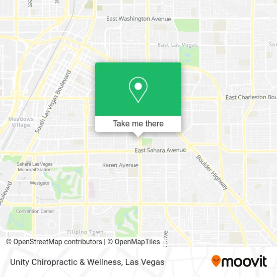
See Unity Chiropractic & Wellness, Las Vegas, on the map
Public Transit to Unity Chiropractic & Wellness in Las Vegas
Wondering how to get to Unity Chiropractic & Wellness in Las Vegas? Moovit helps you find the best way to get to Unity Chiropractic & Wellness with step-by-step directions from the nearest public transit station.
Moovit provides free maps and live directions to help you navigate through your city. View schedules, routes, timetables, and find out how long does it take to get to Unity Chiropractic & Wellness in real time.
Looking for the nearest stop or station to Unity Chiropractic & Wellness? Check out this list of stops closest to your destination: Sb Mcleod After Scarlet Oak; Eb Sahara After Atlantic; Nb Eastern After Karen; Westgate Station.
Bus: 110, 111, SX.Monorail: LVM.
Want to see if there’s another route that gets you there at an earlier time? Moovit helps you find alternative routes or times. Get directions from and directions to Unity Chiropractic & Wellness easily from the Moovit App or Website.
We make riding to Unity Chiropractic & Wellness easy, which is why over 1.7 million users, including users in Las Vegas, trust Moovit as the best app for public transit. You don’t need to download an individual bus app or train app, Moovit is your all-in-one transit app that helps you find the best bus time or train time available.
For information on prices of bus and Monorail, costs and ride fares to Unity Chiropractic & Wellness, please check the Moovit app.
Use the app to navigate to popular places including to the airport, hospital, stadium, grocery store, mall, coffee shop, school, college, and university.
Unity Chiropractic & Wellness Address: 2000 S Eastern Ave street in Las Vegas
- Justice Myron E. Leavitt Family Park - Jaycee Park,
- La Pulga de Las Vegas,
- Saint Viator Catholic Church,
- K. O. Knudson Middle School,
- Siglo Professional Tax Software,
- Taylor Hall Army Reserve Center,
- RTC Transit Stop - 204 WB Sahara/ McLeod,
- Southern Nevada Health District Fremont Public Health Center,
- Catholic Charities,
- Disneyland,
- Dollar Tree,
- 206 Bus @ Eastern And Charleston,
- Charleston And Eastern,
- Intermex,
- Azteca,
- Los Paisanos Bus Company,
- Autobuses Los Paisanos,
- Albertsons,
- Best Buy,
- Sunrise
Places Near Unity Chiropractic & Wellness (Las Vegas)
- Las Vegas South Premium Outlets, Enterprise,
- Trump International Hotel Las Vegas, Paradise,
- Koolsville Tattoos, Las Vegas,
- Welcome To Fabulous Las Vegas Sign, Paradise,
- Walmart Supercenter, Las Vegas,
- Las Vegas Premium Outlets-North, Enterprise,
- Town Square, Enterprise,
- Walmart, Las Vegas,
- Meow Wolf - Las Vegas (Meow Wolf's Omega Mart), Las Vegas,
- Gold & Silver Pawn Shop, Las Vegas,
- Arte Museum Las Vegas, Paradise,
- Lee Canyon, Las Vegas,
- Omega Mart, Las Vegas,
- Las Vegas North Premium Outlets, Las Vegas,
- The Deuce Bus Stop at Fremont St, Las Vegas,
- Allegiant Stadium, Paradise,
- Area15, Las Vegas,
- Zak Bagans Haunted Museum, Las Vegas,
- The Neon Museum, Las Vegas,
- The Palms Casino Resort, Paradise
How to get to popular places in Las Vegas with public transit
Get around Las Vegas by public transit!
Traveling around Las Vegas has never been so easy. See step by step directions as you travel to any attraction, street or major public transit station. View bus and train schedules, arrival times, service alerts and detailed routes on a map, so you know exactly how to get to anywhere in Las Vegas.
When traveling to any destination around Las Vegas use Moovit's Live Directions with Get Off Notifications to know exactly where and how far to walk, how long to wait for your line, and how many stops are left. Moovit will alert you when it's time to get off — no need to constantly re-check whether yours is the next stop.
Wondering how to use public transit in Las Vegas or how to pay for public transit in Las Vegas? Moovit public transit app can help you navigate your way with public transit easily, and at minimum cost. It includes public transit fees, ticket prices, and costs. Looking for a map of Las Vegas public transit lines? Moovit public transit app shows all public transit maps in Las Vegas with all Bus and Monorail routes and stops on an interactive map.
Las Vegas has 2 transit type(s), including: Bus and Monorail, operated by several transit agencies, including RTCSNV, City of Las Vegas, Alvand Transportation, Vegas Airporter, Las Vegas Monorail, FlixBus-us and Greyhound-us