Directions to Unity Life Christian Ministries Center (Charles County) with public transportation
The following transit lines have routes that pass near Unity Life Christian Ministries Center
How to get to Unity Life Christian Ministries Center by bus?
Click on the bus route to see step by step directions with maps, line arrival times and updated time schedules.
From Tanger Outlets, Prince George's County
171 minFrom Tanger Outlet National Harbor, Prince George's County
175 minFrom The Capital Wheel at the National Harbor, Prince George's County
351 minFrom Inova Mount Vernon Hospital, Fairfax County
345 minFrom Andrews Air Force Base, Prince George's County
208 minFrom Clinton, MD, Prince George's County
209 minFrom Fort Washington, MD, Prince George's County
202 minFrom Joint Base Andrews, Prince George's County
209 min
Bus stop near Unity Life Christian Ministries Center in Charles County
- Mattawoman-Beantown Rd & Council Oak Dr, 10 min walk,VIEW
Bus lines to Unity Life Christian Ministries Center in Charles County
- 301 PARK & RIDE TRANSFER POINT - WALDORF TRANSFER POINT, Waldorf Transfer Point,VIEW
What are the closest stations to Unity Life Christian Ministries Center?
The closest stations to Unity Life Christian Ministries Center are:
- Mattawoman-Beantown Rd & Council Oak Dr is 753 yards away, 10 min walk.
Which bus lines stop near Unity Life Christian Ministries Center?
These bus lines stop near Unity Life Christian Ministries Center: 301 PARK & RIDE TRANSFER POINT - WALDORF TRANSFER POINT, 715.
What’s the nearest bus station to Unity Life Christian Ministries Center in Charles County?
The nearest bus station to Unity Life Christian Ministries Center in Charles County is Mattawoman-Beantown Rd & Council Oak Dr. It’s a 10 min walk away.
What time is the first bus to Unity Life Christian Ministries Center in Charles County?
The 301 PARK & RIDE TRANSFER POINT - WALDORF TRANSFER POINT is the first bus that goes to Unity Life Christian Ministries Center in Charles County. It stops nearby at 7:12 AM.
What time is the last bus to Unity Life Christian Ministries Center in Charles County?
The 301 PARK & RIDE TRANSFER POINT - WALDORF TRANSFER POINT is the last bus that goes to Unity Life Christian Ministries Center in Charles County. It stops nearby at 10:11 PM.
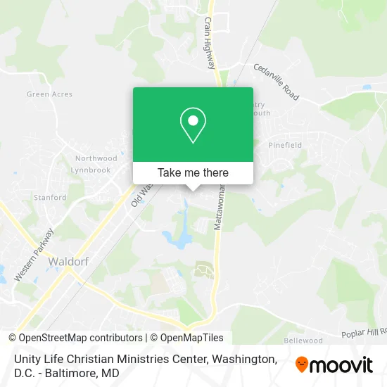
See Unity Life Christian Ministries Center, Charles County, on the map
Public Transit to Unity Life Christian Ministries Center in Charles County
Wondering how to get to Unity Life Christian Ministries Center in Charles County? Moovit helps you find the best way to get to Unity Life Christian Ministries Center with step-by-step directions from the nearest public transit station.
Moovit provides free maps and live directions to help you navigate through your city. View schedules, routes, timetables, and find out how long does it take to get to Unity Life Christian Ministries Center in real time.
Looking for the nearest stop or station to Unity Life Christian Ministries Center? Check out this list of stops closest to your destination: Mattawoman-Beantown Rd & Council Oak Dr.
Bus: 301 PARK & RIDE TRANSFER POINT - WALDORF TRANSFER POINT, 715.
Want to see if there’s another route that gets you there at an earlier time? Moovit helps you find alternative routes or times. Get directions from and directions to Unity Life Christian Ministries Center easily from the Moovit App or Website.
We make riding to Unity Life Christian Ministries Center easy, which is why over 1.5 million users, including users in Charles County, trust Moovit as the best app for public transit. You don’t need to download an individual bus app or train app, Moovit is your all-in-one transit app that helps you find the best bus time or train time available.
For information on prices of bus and metro, costs and ride fares to Unity Life Christian Ministries Center, please check the Moovit app.
Use the app to navigate to popular places including to the airport, hospital, stadium, grocery store, mall, coffee shop, school, college, and university.
Unity Life Christian Ministries Center Address: 2355 Hazelwood Ct Waldorf, MD 20601 street in Charles County
- Dawn Victoria Photography,
- Baked with Love by Tammie,
- Big Mouth Liquor,
- Renoxx Caregivers,
- Soria Home Improvement,
- Epiphany Ministries,
- Nina Maria Salon,
- 3D Self Defense,
- Damon's Smoke Palace,
- Superior Power Washing,
- Idlewood Trailer Park,
- One Church DMV,
- Sky Bar,
- The Church of Greater Love,
- Anchor Fellowship RFRMD Presbyterian CH,
- Liberty Christian Church,
- Mach 5 Towing,
- Flagship Car Wash of W,
- JNJ Towing & Recovery,
- Stylessbyyona
Places Near Unity Life Christian Ministries Center (Charles County)
- National Mall, Washington,
- PG Mall, Prince George's County,
- Washington DC VA Medical Center, Washington,
- National Museum of African American History and Culture, Washington,
- The Anthem, Washington,
- Basilica of the National Shrine, Washington,
- M&T Bank Stadium, Baltimore,
- Marriott Marquis Washington, DC, Washington,
- Warner Theatre, Washington,
- National Zoo, Washington,
- Pennsylvania Ave NW (3rd st and pennsylvania), Washington,
- Sibley Memorial Hospital, Washington,
- Westfield Montgomery Mall, Montgomery County,
- Capital One Arena, Washington,
- Museum Of The Bible, Washington,
- Camden Yards, Baltimore,
- Amazon Hq2, Arlington County,
- Rock Creek Tennis Center, Washington,
- Washington National Cathedral, Washington,
- Georgetown, Washington
How to get to popular places in Washington, D.C. - Baltimore, MD with public transit
Get around Charles County by public transit!
Traveling around Charles County has never been so easy. See step by step directions as you travel to any attraction, street or major public transit station. View bus and train schedules, arrival times, service alerts and detailed routes on a map, so you know exactly how to get to anywhere in Charles County.
When traveling to any destination around Charles County use Moovit's Live Directions with Get Off Notifications to know exactly where and how far to walk, how long to wait for your line, and how many stops are left. Moovit will alert you when it's time to get off — no need to constantly re-check whether yours is the next stop.
Wondering how to use public transit in Charles County or how to pay for public transit in Charles County? Moovit public transit app can help you navigate your way with public transit easily, and at minimum cost. It includes public transit fees, ticket prices, and costs. Looking for a map of Charles County public transit lines? Moovit public transit app shows all public transit maps in Charles County with all Bus, Train, Metro, Light Rail and Ferry routes and stops on an interactive map.
Washington, D.C. - Baltimore, MD has 5 transit type(s), including: Bus, Train, Metro, Light Rail and Ferry, operated by several transit agencies, including WMATA, Montgomery County Ride On, Fairfax Connector, TheBus, PRTC, DASH - Alexandria, Arlington Transit (ART), RTA of Central Maryland, MDOT MTA, MDOT MTA Light RailLink, MDOT MTA Commuter Bus, MDOT MTA Local Bus, FXBGO!, Virginia Railway Express (VRE) and MARC