How to get to University Health Services Complex by bus?
Click on the bus route to see step by step directions with maps, line arrival times and updated time schedules.
From Mall Of The Americas Food Court, North Westside
41 minFrom Consulado General de Honduras en Miami, Miami
33 minFrom Miami Dade College West Campus, North Westside
57 minFrom Baptist Health South Florida South Miami Hospital, Miami
71 minFrom Larkin Community Hospital, Miami
77 minFrom Sunset Dr, Miami
69 minFrom METRORail-Dadeland South Station, Kendall-Palmetto Bay
64 minFrom The Institute of Contemporary Art Miami, North Westside
56 minFrom Waterford Business District, Miami
53 minFrom South Miami Hospital Victor E. Clark Building, Miami
73 min
Bus stops near University Health Services Complex in South Westside
Bus lines to University Health Services Complex in South Westside
What are the closest stations to University Health Services Complex?
The closest stations to University Health Services Complex are:
- Fiu is 1037 yards away, 13 min walk.
- Fiu Univ Campus@Sw 107 Av-17 St is 1088 yards away, 14 min walk.
Which bus lines stop near University Health Services Complex?
These bus lines stop near University Health Services Complex: 107, 11, 24, DLOOP4.
What’s the nearest bus station to University Health Services Complex in South Westside?
The nearest bus station to University Health Services Complex in South Westside is Fiu. It’s a 13 min walk away.
What time is the first bus to University Health Services Complex in South Westside?
The 11 is the first bus that goes to University Health Services Complex in South Westside. It stops nearby at 3:07 AM.
What time is the last bus to University Health Services Complex in South Westside?
The 11 is the last bus that goes to University Health Services Complex in South Westside. It stops nearby at 2:49 AM.
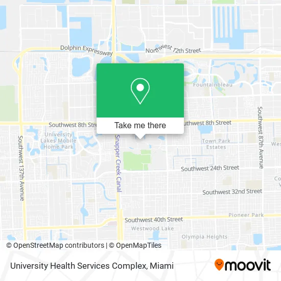
See University Health Services Complex, South Westside, on the map
Public Transit to University Health Services Complex in South Westside
Wondering how to get to University Health Services Complex in South Westside? Moovit helps you find the best way to get to University Health Services Complex with step-by-step directions from the nearest public transit station.
Moovit provides free maps and live directions to help you navigate through your city. View schedules, routes, timetables, and find out how long does it take to get to University Health Services Complex in real time.
Looking for the nearest stop or station to University Health Services Complex? Check out this list of stops closest to your destination: Fiu; Fiu Univ Campus@Sw 107 Av-17 St.
Bus: 107, 11, 24, DLOOP4, 8, SWTWTA.
Want to see if there’s another route that gets you there at an earlier time? Moovit helps you find alternative routes or times. Get directions from and directions to University Health Services Complex easily from the Moovit App or Website.
We make riding to University Health Services Complex easy, which is why over 1.5 million users, including users in South Westside, trust Moovit as the best app for public transit. You don’t need to download an individual bus app or train app, Moovit is your all-in-one transit app that helps you find the best bus time or train time available.
For information on prices of bus, costs and ride fares to University Health Services Complex, please check the Moovit app.
Use the app to navigate to popular places including to the airport, hospital, stadium, grocery store, mall, coffee shop, school, college, and university.
University Health Services Complex Address: SW 14th St Miami, FL 33199 street in South Westside
- Fiu Theater Miami,
- Florida International University-Modesto A. Maidique Campus (Fiu-Modesto A Maidique),
- Florida International University-Modesto A. Maidique Campus,
- Pollo Tropical,
- Jamba,
- Kool's Ice Cream,
- Papa John's,
- Saladcreationsfiu,
- Terrafly,
- Fiu Herbert Wertheim College of Medicine,
- US Century Bank Arena,
- Moe's Southwest Grill,
- Faculty Club,
- Cafe Bustelo,
- Fiu Stadium,
- Police Department,
- Denisha S. Fergusson, ATC,
- Miami Childrens Hospital,
- After-School All-Stars South Florida,
- Children's Creative LRNG Center at Fiu
Places Near University Health Services Complex (South Westside)
- Keiser University Flagship Campus, West Palm Beach,
- Hard Rock Stadium, Miami Gardens,
- Zoo Miami, Miami,
- Port of Miami Cruise Terminal, Miami,
- Miami Freedom Park, Miami,
- Brickell City Centre, Miami,
- Aventura Mall, Miami Beach,
- Miami VA Hospital, Miami,
- Little Havana, Miami,
- Sawgrass Mall, Miami,
- Aventura Mall, Miami,
- Wynwood, Miami,
- Miami Design District, Miami,
- Dolphin Mall, Miami,
- Richard E. Gerstein Justice Building, Miami,
- Marlins Park, Miami,
- Bayside Marketplace, Miami,
- Sawgrass mall ( FL ), Miami Beach,
- Dolphin Mall Bus, Miami,
- Miami-Dade County Courthouse, Miami
How to get to popular places in Miami with public transit
Get around South Westside by public transit!
Traveling around South Westside has never been so easy. See step by step directions as you travel to any attraction, street or major public transit station. View bus and train schedules, arrival times, service alerts and detailed routes on a map, so you know exactly how to get to anywhere in South Westside.
When traveling to any destination around South Westside use Moovit's Live Directions with Get Off Notifications to know exactly where and how far to walk, how long to wait for your line, and how many stops are left. Moovit will alert you when it's time to get off — no need to constantly re-check whether yours is the next stop.
Wondering how to use public transit in South Westside or how to pay for public transit in South Westside? Moovit public transit app can help you navigate your way with public transit easily, and at minimum cost. It includes public transit fees, ticket prices, and costs. Looking for a map of South Westside public transit lines? Moovit public transit app shows all public transit maps in South Westside with all Bus, Train, Light Rail and Ferry routes and stops on an interactive map.
Miami has 4 transit type(s), including: Bus, Train, Light Rail and Ferry, operated by several transit agencies, including Broward County Transit, Miami-Dade Transit, Metrorail, Palm Tran, Tri-Rail, Brightline, MARTY, City of Homestead Trolley, Key West Transit, Treasure Coast Connector, GoLine IRT, Amtrak, Greyhound-us, FlixBus-us and Aventura Express Shuttle Bus