How to get to University of Alberta Council Chambers by bus?
Click on the bus route to see step by step directions with maps, line arrival times and updated time schedules.
From Avanica Furniture, Edmonton
28 minFrom Alberta Justice And Solicitor General Training Academy, Edmonton
68 minFrom Edmonton River Valley, Edmonton
36 minFrom Insight Medical Imaging - Hermitage X-Ray & Ultrasound, Edmonton
92 minFrom Holy Trinity Catholic High School, Edmonton
59 minFrom Snow Valley Guest Serv, Edmonton
51 minFrom NS Phone Repair, Edmonton
92 minFrom ULine, Edmonton
92 minFrom Minchau School, Edmonton
83 minFrom M & M Food Market, Edmonton
57 min
Bus stops near University of Alberta Council Chambers in Edmonton
Light Rail stations near University of Alberta Council Chambers in Edmonton
- University Station, 5 min walk,VIEW
Bus lines to University of Alberta Council Chambers in Edmonton
- 004, Lewis Farms - University - Capilano,VIEW
- 008, Abbottsfield - Downtown - University,VIEW
- 031, Leger - University,VIEW
- 051, Castle Downs - University,VIEW
- 637, Braemar - University,VIEW
- 723, University - Parkallen,VIEW
- 902, Nait - University,VIEW
- 920X, Lewis Farms - University Express,VIEW
- 203, U Of A Via Westmount,VIEW
- 404, U Of A,VIEW
- 414, U Of A | Express,VIEW
- 654, 104 Street & 73 Avenue,VIEW
What are the closest stations to University of Alberta Council Chambers?
The closest stations to University of Alberta Council Chambers are:
- 114 Street & 89 Avenue is 62 meters away, 1 min walk.
- 114 Street & 87 Avenue is 194 meters away, 3 min walk.
- University Station is 330 meters away, 5 min walk.
- 116 Street & 87 Avenue is 336 meters away, 5 min walk.
Which bus lines stop near University of Alberta Council Chambers?
These bus lines stop near University of Alberta Council Chambers: 004, 008, 051.
Which light rail line stops near University of Alberta Council Chambers?
METRO (Nait Blatchford Market)
What’s the nearest light rail station to University of Alberta Council Chambers in Edmonton?
The nearest light rail station to University of Alberta Council Chambers in Edmonton is University Station. It’s a 5 min walk away.
What’s the nearest bus station to University of Alberta Council Chambers in Edmonton?
The nearest bus station to University of Alberta Council Chambers in Edmonton is 114 Street & 89 Avenue. It’s a 1 min walk away.
What time is the first light rail to University of Alberta Council Chambers in Edmonton?
The METRO is the first light rail that goes to University of Alberta Council Chambers in Edmonton. It stops nearby at 5:52 AM.
What time is the last light rail to University of Alberta Council Chambers in Edmonton?
The METRO is the last light rail that goes to University of Alberta Council Chambers in Edmonton. It stops nearby at 12:25 AM.
What time is the first bus to University of Alberta Council Chambers in Edmonton?
The 004 is the first bus that goes to University of Alberta Council Chambers in Edmonton. It stops nearby at 3:13 AM.
What time is the last bus to University of Alberta Council Chambers in Edmonton?
The 008 is the last bus that goes to University of Alberta Council Chambers in Edmonton. It stops nearby at 3:27 AM.
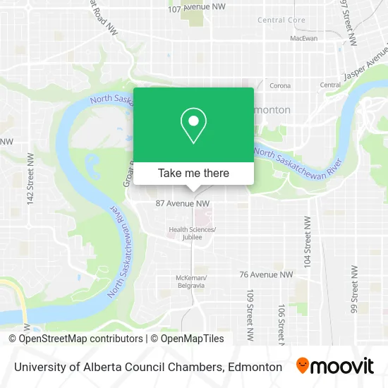
See University of Alberta Council Chambers, Edmonton, on the map
Public Transit to University of Alberta Council Chambers in Edmonton
Wondering how to get to University of Alberta Council Chambers in Edmonton? Moovit helps you find the best way to get to University of Alberta Council Chambers with step-by-step directions from the nearest public transit station.
Moovit provides free maps and live directions to help you navigate through your city. View schedules, routes, timetables, and find out how long does it take to get to University of Alberta Council Chambers in real time.
Looking for the nearest stop or station to University of Alberta Council Chambers? Check out this list of stops closest to your destination: 114 Street & 89 Avenue; 114 Street & 87 Avenue; University Station; 116 Street & 87 Avenue.
Bus: 004, 008, 051, 031, 637, 203, 404, 414, 654.Light Rail: METRO.
Want to see if there’s another route that gets you there at an earlier time? Moovit helps you find alternative routes or times. Get directions from and directions to University of Alberta Council Chambers easily from the Moovit App or Website.
We make riding to University of Alberta Council Chambers easy, which is why over 1.5 million users, including users in Edmonton, trust Moovit as the best app for public transit. You don’t need to download an individual bus app or train app, Moovit is your all-in-one transit app that helps you find the best bus time or train time available.
For information on prices of bus and light rail, costs and ride fares to University of Alberta Council Chambers, please check the Moovit app.
Use the app to navigate to popular places including to the airport, hospital, stadium, grocery store, mall, coffee shop, school, college, and university.
University of Alberta Council Chambers Address: 114St. 89Ave. (2-1 University Hall) street in Edmonton
- Glen Sather University of Alberta Sports Medicine CL,
- Van Vliet Centre - Powerlifting Facility,
- Butterdome (Universiade Pavilion),
- Ed North 4th Floor Lounge,
- Bear's Den at Clare Drake Arena,
- Butterdome Craft Sale,
- Heritage Medical Research Centre,
- Univ of Alberta-Student Union Building,
- Coutts Library,
- Univ of Alberta-St Stephen's College,
- Decima Robinson Support Centre For Mathematical And Statistical Sciences,
- Clare Drake Arena,
- Univ of Alberta-Jubilee Auditorium,
- John W. Scott Health Sciences Library,
- University of Alberta - Medical Sciences Building,
- U of A Hospital-HMRC,
- University Terrace,
- LRT-University Station,
- University of Alberta,
- Jubilee Auditorium
Places Near University of Alberta Council Chambers (Edmonton)
- University of Alberta, Edmonton,
- Fort Edmonton Park, Edmonton,
- Cross Cancer Institute, Edmonton,
- Canada Place Service Canada Centre, Edmonton,
- West Edmonton Mall, Edmonton,
- Royal Alexandra Hospital, Edmonton,
- Edmonton EXPO Centre, Edmonton,
- Kaye Edmonton Clinic, Edmonton,
- Kingsway Mall, Edmonton,
- MacEwan University, Edmonton,
- Whyte Avenue, Edmonton,
- Edmonton VIA Rail Station, Edmonton,
- Edmonton Valley Zoo, Edmonton,
- Northgate Centre, Edmonton,
- Londonderry Mall, Edmonton,
- Edmonton Commonwealth Stadium, Edmonton,
- Alberta Legislature Building, Edmonton,
- Grey Nuns Community Hospital, Edmonton,
- Rogers Place, Edmonton,
- Borden Park, Edmonton
How to get to popular places in Edmonton with public transit
Get around Edmonton by public transit!
Traveling around Edmonton has never been so easy. See step by step directions as you travel to any attraction, street or major public transit station. View bus and train schedules, arrival times, service alerts and detailed routes on a map, so you know exactly how to get to anywhere in Edmonton.
When traveling to any destination around Edmonton use Moovit's Live Directions with Get Off Notifications to know exactly where and how far to walk, how long to wait for your line, and how many stops are left. Moovit will alert you when it's time to get off — no need to constantly re-check whether yours is the next stop.
Wondering how to use public transit in Edmonton or how to pay for public transit in Edmonton? Moovit public transit app can help you navigate your way with public transit easily, and at minimum cost. It includes public transit fees, ticket prices, and costs. Looking for a map of Edmonton public transit lines? Moovit public transit app shows all public transit maps in Edmonton with all Bus and Light Rail routes and stops on an interactive map.
Edmonton has 2 transit type(s), including: Bus and Light Rail, operated by several transit agencies, including ETS LRT, ETS, Strathcona County Transit, St. Albert Transit, Spruce Grove Transit, Fort Saskatchewan Transit, Beaumont Transit and Leduc Transit