How to get to Untuckit by bus?
Click on the bus route to see step by step directions with maps, line arrival times and updated time schedules.
From BAYSHORE, Miami
83 minFrom Miami Marriott Biscayne Bay, Miami
83 minFrom Bascom Palmer Eye Institute, Miami
73 minFrom Miami - Dade County Turner Guilford Knight Correctional Center, North Westside
67 minFrom Bayside Marketplace, Miami
69 minFrom Wilkie D. Ferguson, Jr. United States Courthouse, Miami
65 minFrom DoubleTree by Hilton Grand Hotel Biscayne Bay, Miami
82 minFrom Stage 305 (Magic City Casino), Miami
41 minFrom Slam Academy, Miami
54 minFrom Biscayne Bay, Miami
83 min
How to get to Untuckit by train?
Click on the train route to see step by step directions with maps, line arrival times and updated time schedules.
Bus stops near Untuckit in Miami
Train station near Untuckit in Miami
- South Miami, 5 min walk,VIEW
Bus lines to Untuckit in Miami
What are the closest stations to Untuckit?
The closest stations to Untuckit are:
- Sw 42 Av & San Lorenzo Av is 116 yards away, 2 min walk.
- Sw 42 Av & Granello Av is 316 yards away, 4 min walk.
- South Miami is 348 yards away, 5 min walk.
- Sw 40 St & Le Jeune Rd is 471 yards away, 6 min walk.
- Ponce De Leon Blvd & San Lorenzo Av is 535 yards away, 7 min walk.
- Grand Av & Lincoln Dr is 752 yards away, 10 min walk.
Which bus lines stop near Untuckit?
These bus lines stop near Untuckit: 37, 42, CGABLE.
Which train lines stop near Untuckit?
These train lines stop near Untuckit: GREEN, ORANGE.
What’s the nearest train station to Untuckit in Miami?
The nearest train station to Untuckit in Miami is South Miami. It’s a 5 min walk away.
What’s the nearest bus station to Untuckit in Miami?
The nearest bus station to Untuckit in Miami is Sw 42 Av & San Lorenzo Av. It’s a 2 min walk away.
What time is the first train to Untuckit in Miami?
The GREEN is the first train that goes to Untuckit in Miami. It stops nearby at 5:04 AM.
What time is the last train to Untuckit in Miami?
The GREEN is the last train that goes to Untuckit in Miami. It stops nearby at 1:00 AM.
What time is the first bus to Untuckit in Miami?
The 40 is the first bus that goes to Untuckit in Miami. It stops nearby at 5:31 AM.
What time is the last bus to Untuckit in Miami?
The 40 is the last bus that goes to Untuckit in Miami. It stops nearby at 10:37 PM.
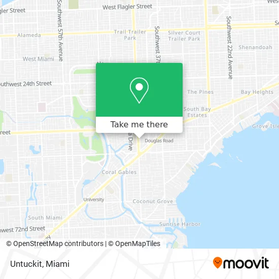
See Untuckit, Miami, on the map
Public Transit to Untuckit in Miami
Wondering how to get to Untuckit in Miami? Moovit helps you find the best way to get to Untuckit with step-by-step directions from the nearest public transit station.
Moovit provides free maps and live directions to help you navigate through your city. View schedules, routes, timetables, and find out how long does it take to get to Untuckit in real time.
Looking for the nearest stop or station to Untuckit? Check out this list of stops closest to your destination: Sw 42 Av & San Lorenzo Av; Sw 42 Av & Granello Av; South Miami; Sw 40 St & Le Jeune Rd; Ponce De Leon Blvd & San Lorenzo Av; Grand Av & Lincoln Dr.
Bus: 37, 42, CGABLE, 57, CGABGA, 40, CGABDT, 136.Train: GREEN, ORANGE.
Want to see if there’s another route that gets you there at an earlier time? Moovit helps you find alternative routes or times. Get directions from and directions to Untuckit easily from the Moovit App or Website.
We make riding to Untuckit easy, which is why over 1.5 million users, including users in Miami, trust Moovit as the best app for public transit. You don’t need to download an individual bus app or train app, Moovit is your all-in-one transit app that helps you find the best bus time or train time available.
For information on prices of bus, train and light rail, costs and ride fares to Untuckit, please check the Moovit app.
Use the app to navigate to popular places including to the airport, hospital, stadium, grocery store, mall, coffee shop, school, college, and university.
Untuckit Address: 358 San Lorenzo Ave Miami, FL 33146 street in Miami
- Shops at Merrick Park - Premium Parking Lot #P2508,
- Sushi Lolita,
- Sephora,
- Tumi Store - Merrick Park,
- Mocali,
- Landmark at Merrick Park,
- L'Voyage,
- Altar'd State,
- Tiffany,
- Johnny Was,
- Parking,
- POTTERY BARN,
- Nordstrom (Nordstrom Shops at Merrick Park),
- Crate & Barrel,
- Village of Merrick Park (Vlg Of Merrick Pk Coral Gables),
- Shops at Merrick Park,
- Sweat 440,
- Gallery Cafe,
- Watermark at Coral Gables,
- Grand Living at Coral Gables
Places Near Untuckit (Miami)
- Miami-Dade County Courthouse, Miami,
- Dolphin Mall Bus, Miami,
- 1351 NW 12th St, Miami,
- Aventura Mall, Miami Beach,
- Brickell City Centre, Miami,
- Zoo Miami, Miami,
- Miami Design District, Miami,
- Little Havana, Miami,
- Sawgrass Mall, Miami,
- Port of Miami Cruise Terminal, Miami,
- Wynwood, Miami,
- Miami Freedom Park, Miami,
- Marlins Park, Miami,
- Hard Rock Stadium, Miami Gardens,
- Dolphin Mall, Miami,
- Aventura Mall, Miami,
- Sawgrass mall ( FL ), Miami Beach,
- Keiser University Flagship Campus, West Palm Beach,
- Bayside Marketplace, Miami,
- Richard E. Gerstein Justice Building, Miami
How to get to popular places in Miami with public transit
Get around Miami by public transit!
Traveling around Miami has never been so easy. See step by step directions as you travel to any attraction, street or major public transit station. View bus and train schedules, arrival times, service alerts and detailed routes on a map, so you know exactly how to get to anywhere in Miami.
When traveling to any destination around Miami use Moovit's Live Directions with Get Off Notifications to know exactly where and how far to walk, how long to wait for your line, and how many stops are left. Moovit will alert you when it's time to get off — no need to constantly re-check whether yours is the next stop.
Wondering how to use public transit in Miami or how to pay for public transit in Miami? Moovit public transit app can help you navigate your way with public transit easily, and at minimum cost. It includes public transit fees, ticket prices, and costs. Looking for a map of Miami public transit lines? Moovit public transit app shows all public transit maps in Miami with all Bus, Train, Light Rail and Ferry routes and stops on an interactive map.
Miami has 4 transit type(s), including: Bus, Train, Light Rail and Ferry, operated by several transit agencies, including Broward County Transit, Miami-Dade Transit, Metrorail, Palm Tran, Tri-Rail, Brightline, MARTY, City of Homestead Trolley, Key West Transit, Treasure Coast Connector, GoLine IRT, Amtrak, Greyhound-us, FlixBus-us and Aventura Express Shuttle Bus