How to get to Updash by bus?
Click on the bus route to see step by step directions with maps, line arrival times and updated time schedules.
From US 1@SW 248 St, Princeton-Goulds
27 minFrom BrandsMart USA, Kendall-Palmetto Bay
38 minFrom SW 104th St / US-1, Kendall-Palmetto Bay
26 minFrom miami dade College Kendall Campus, Kendall-Palmetto Bay
56 minFrom TERRA Environmental Research Institute, Kendale Lakes-Tamiami
62 minFrom Baptist Hospital of Miami, Kendall-Palmetto Bay
80 minFrom Miami Cancer Institute, Kendall-Palmetto Bay
80 minFrom SW 88th St / SW 107th Ave, Kendall-Palmetto Bay
54 minFrom METRORail-Dadeland South Station, Kendall-Palmetto Bay
36 minFrom Falls (Mall), Kendall-Palmetto Bay
21 min
Bus stops near Updash in Kendall-Palmetto Bay
Bus lines to Updash in Kendall-Palmetto Bay
What are the closest stations to Updash?
The closest stations to Updash are:
- Sw 184 St @ S Dixie Hwy (Us1) is 203 yards away, 3 min walk.
- Us 1 & Sw 186 St is 265 yards away, 4 min walk.
- Eureka Dr Station is 371 yards away, 5 min walk.
- Transitway & Eureka Dr Station is 409 yards away, 6 min walk.
- Franjo Rd @ Sw 186 St is 834 yards away, 11 min walk.
Which bus lines stop near Updash?
These bus lines stop near Updash: 107, 601, 602.
What’s the nearest bus station to Updash in Kendall-Palmetto Bay?
The nearest bus station to Updash in Kendall-Palmetto Bay is Sw 184 St @ S Dixie Hwy (Us1). It’s a 3 min walk away.
What time is the first bus to Updash in Kendall-Palmetto Bay?
The 602 is the first bus that goes to Updash in Kendall-Palmetto Bay. It stops nearby at 3:51 AM.
What time is the last bus to Updash in Kendall-Palmetto Bay?
The 602 is the last bus that goes to Updash in Kendall-Palmetto Bay. It stops nearby at 2:50 AM.
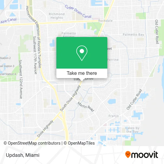
See Updash, Kendall-Palmetto Bay, on the map
Public Transit to Updash in Kendall-Palmetto Bay
Wondering how to get to Updash in Kendall-Palmetto Bay? Moovit helps you find the best way to get to Updash with step-by-step directions from the nearest public transit station.
Moovit provides free maps and live directions to help you navigate through your city. View schedules, routes, timetables, and find out how long does it take to get to Updash in real time.
Looking for the nearest stop or station to Updash? Check out this list of stops closest to your destination: Sw 184 St @ S Dixie Hwy (Us1); Us 1 & Sw 186 St; Eureka Dr Station; Transitway & Eureka Dr Station; Franjo Rd @ Sw 186 St.
Bus: 107, 601, 602, 500, 97.
Want to see if there’s another route that gets you there at an earlier time? Moovit helps you find alternative routes or times. Get directions from and directions to Updash easily from the Moovit App or Website.
We make riding to Updash easy, which is why over 1.5 million users, including users in Kendall-Palmetto Bay, trust Moovit as the best app for public transit. You don’t need to download an individual bus app or train app, Moovit is your all-in-one transit app that helps you find the best bus time or train time available.
For information on prices of bus, costs and ride fares to Updash, please check the Moovit app.
Use the app to navigate to popular places including to the airport, hospital, stadium, grocery store, mall, coffee shop, school, college, and university.
Updash Address: S Dixie Hwy Miami, FL 33157 street in Kendall-Palmetto Bay
- Amazon Locker-Evita,
- Photography by Santy Martinez,
- Services Global Ed Tor,
- Trajan Commercial Real Estate,
- Yoel Joyeria II,
- Yume,
- SKECHERS Factory Outlet,
- The World of Insurance,
- Mapa International Group,
- Shred Nations,
- Colonial Freight Brokerage Corporation,
- Betterway Claim Adjusters,
- Ace Transportation,
- Vincent Bell Services,
- Dade Social,
- CR Pro Home Inspections,
- Mighty Grab Bars,
- Table for Two Events and Catering,
- Lady of America Fitness Center,
- Miami Household (Miami Doll House)
Places Near Updash (Kendall-Palmetto Bay)
- Marlins Park, Miami,
- Brickell City Centre, Miami,
- Miami Design District, Miami,
- Little Havana, Miami,
- Aventura Mall, Miami,
- Miami VA Hospital, Miami,
- Aventura Mall, Miami Beach,
- Miami Freedom Park, Miami,
- Port of Miami Cruise Terminal, Miami,
- Wynwood, Miami,
- Dolphin Mall Bus, Miami,
- Richard E. Gerstein Justice Building, Miami,
- Keiser University Flagship Campus, West Palm Beach,
- Bayside Marketplace, Miami,
- Miami-Dade County Courthouse, Miami,
- Dolphin Mall, Miami,
- Sawgrass mall ( FL ), Miami Beach,
- Zoo Miami, Miami,
- Hard Rock Stadium, Miami Gardens,
- Sawgrass Mall, Miami
How to get to popular places in Miami with public transit
Get around Kendall-Palmetto Bay by public transit!
Traveling around Kendall-Palmetto Bay has never been so easy. See step by step directions as you travel to any attraction, street or major public transit station. View bus and train schedules, arrival times, service alerts and detailed routes on a map, so you know exactly how to get to anywhere in Kendall-Palmetto Bay.
When traveling to any destination around Kendall-Palmetto Bay use Moovit's Live Directions with Get Off Notifications to know exactly where and how far to walk, how long to wait for your line, and how many stops are left. Moovit will alert you when it's time to get off — no need to constantly re-check whether yours is the next stop.
Wondering how to use public transit in Kendall-Palmetto Bay or how to pay for public transit in Kendall-Palmetto Bay? Moovit public transit app can help you navigate your way with public transit easily, and at minimum cost. It includes public transit fees, ticket prices, and costs. Looking for a map of Kendall-Palmetto Bay public transit lines? Moovit public transit app shows all public transit maps in Kendall-Palmetto Bay with all Bus, Train, Light Rail and Ferry routes and stops on an interactive map.
Miami has 4 transit type(s), including: Bus, Train, Light Rail and Ferry, operated by several transit agencies, including Broward County Transit, Miami-Dade Transit, Metrorail, Palm Tran, Tri-Rail, Brightline, MARTY, City of Homestead Trolley, Key West Transit, Treasure Coast Connector, GoLine IRT, Amtrak, Greyhound-us, FlixBus-us and Aventura Express Shuttle Bus