Directions to Ups Access Point Location (Grand Rapids) with public transportation
The following transit lines have routes that pass near Ups Access Point Location
 Bus: 11.
How to get to Ups Access Point Location by bus?
Click on the bus route to see step by step directions with maps, line arrival times and updated time schedules.
From Entrance US-131 N, Grand Rapids
57 minFrom SBC, Grand Rapids
68 minFrom CDH Virtual Solutions, Grand Rapids
68 minFrom Great Giant Supermarket, Grand Rapids
55 minFrom Gerald R. Ford Job Corps Center, Grand Rapids
55 minFrom Michigan and Maryland, Grand Rapids
57 minFrom DeVos Pediatric Ophthalmology, Grand Rapids
26 minFrom St Marys Health Care Healthlink, Grand Rapids
56 minFrom Kent Isd Conference Center, Grand Rapids
63 min
Bus stop near Ups Access Point Location in Grand Rapids
- Plainfield/Rupert (Nb), 6 min walk,VIEW
Bus lines to Ups Access Point Location in Grand Rapids
- 11, Meijer-Plainfield,VIEW
What are the closest stations to Ups Access Point Location?
The closest stations to Ups Access Point Location are:
- Plainfield/Rupert (Nb) is 406 yards away, 6 min walk.
Which bus line stops near Ups Access Point Location?
11 (Meijer-Plainfield)
What’s the nearest bus station to Ups Access Point Location in Grand Rapids?
The nearest bus station to Ups Access Point Location in Grand Rapids is Plainfield/Rupert (Nb). It’s a 6 min walk away.
What time is the first bus to Ups Access Point Location in Grand Rapids?
The 11 is the first bus that goes to Ups Access Point Location in Grand Rapids. It stops nearby at 5:10 AM.
What time is the last bus to Ups Access Point Location in Grand Rapids?
The 11 is the last bus that goes to Ups Access Point Location in Grand Rapids. It stops nearby at 11:46 PM.
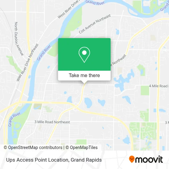
See Ups Access Point Location, Grand Rapids, on the map
Public Transit to Ups Access Point Location in Grand Rapids
Wondering how to get to Ups Access Point Location in Grand Rapids? Moovit helps you find the best way to get to Ups Access Point Location with step-by-step directions from the nearest public transit station.
Moovit provides free maps and live directions to help you navigate through your city. View schedules, routes, timetables, and find out how long does it take to get to Ups Access Point Location in real time.
Looking for the nearest stop or station to Ups Access Point Location? Check out this list of stops closest to your destination: Plainfield/Rupert (Nb).
Bus: 11.
Want to see if there’s another route that gets you there at an earlier time? Moovit helps you find alternative routes or times. Get directions from and directions to Ups Access Point Location easily from the Moovit App or Website.
We make riding to Ups Access Point Location easy, which is why over 1.5 million users, including users in Grand Rapids, trust Moovit as the best app for public transit. You don’t need to download an individual bus app or train app, Moovit is your all-in-one transit app that helps you find the best bus time or train time available.
For information on prices of bus, costs and ride fares to Ups Access Point Location, please check the Moovit app.
Use the app to navigate to popular places including to the airport, hospital, stadium, grocery store, mall, coffee shop, school, college, and university.
Ups Access Point Location Address: 3590 Plainfield Ave NE street in Grand Rapids
- Michigan Department of State Secretary of State,
- Michigan Lottery Office,
- TACO BELL,
- I-96 & Plainfield Ave NE (M-44 Connector),
- Exit 33/Plainfield Ave/E,
- Deborah Fragel Advocate,
- Mary Michelle McGee,
- Paper Moon Decorating,
- Plainfield Ave NE & 3 Mile Rd NE,
- American Legion Boat & Canoe Club,
- Jasmine Ave NE,
- Northview Laundry,
- Northville Park Association Park,
- Provin Trails Parking Lot,
- Provin Trails 4 Mile Entrance,
- Kdl - Plainfield Township Branch,
- Kent District Library,
- Provin Trails Park,
- Provin Trails Sand Dune,
- Manitou Dr NE
Places Near Ups Access Point Location (Grand Rapids)
- Woodland Mall, Kentwood,
- Spectrum Health Butterworth Hospital, Grand Rapids,
- Union High School, Grand Rapids,
- Helel DeVos Children's Hospital Food Court, Grand Rapids,
- YMCA - David D. Hunting, Grand Rapids,
- John Ball Zoo, Grand Rapids,
- Frederik Meijer Gardens, Grand Rapids,
- Grandville, MI, Grandville,
- Spectrum Health-Blodgett Hospital, East Grand Rapids,
- University of Michigan Health Metro Health Hospital, Wyoming,
- Blodgett Hospital, East Grand Rapids,
- Grand Rapids Community College, Grand Rapids,
- Metro Cascade,
- Butterworth Hospital Internal Radiology, Grand Rapids,
- Kent County Courthouse, Grand Rapids,
- Hudsonville,
- Van Andel Arena, Grand Rapids,
- Byron Center,
- Lemmen-Holton Cancer Pavilion, Grand Rapids,
- Pine Rest Mental Health, Grand Rapids
How to get to popular places in Grand Rapids with public transit
Get around Grand Rapids by public transit!
Traveling around Grand Rapids has never been so easy. See step by step directions as you travel to any attraction, street or major public transit station. View bus and train schedules, arrival times, service alerts and detailed routes on a map, so you know exactly how to get to anywhere in Grand Rapids.
When traveling to any destination around Grand Rapids use Moovit's Live Directions with Get Off Notifications to know exactly where and how far to walk, how long to wait for your line, and how many stops are left. Moovit will alert you when it's time to get off — no need to constantly re-check whether yours is the next stop.
Wondering how to use public transit in Grand Rapids or how to pay for public transit in Grand Rapids? Moovit public transit app can help you navigate your way with public transit easily, and at minimum cost. It includes public transit fees, ticket prices, and costs. Looking for a map of Grand Rapids public transit lines? Moovit public transit app shows all public transit maps in Grand Rapids with all Bus and Train routes and stops on an interactive map.
Grand Rapids has 2 transit type(s), including: Bus and Train, operated by several transit agencies, including The Rapid, Amtrak and FlixBus-us