Directions to Ups Access Point Location (Henderson) with public transportation
The following transit lines have routes that pass near Ups Access Point Location
 Bus: 212.
How to get to Ups Access Point Location by bus?
Click on the bus route to see step by step directions with maps, line arrival times and updated time schedules.
From Las Vegas Sensual Erotic Tantra Massage, Winchester
61 minFrom Risque Vegas Estate Swingers Club, Paradise
49 minFrom JCK Las Vegas Jewelry Show Turkish Pavilion, Paradise
46 minFrom Where Tupac Got Shot, Paradise
74 minFrom Shark Reef Aquarium, Paradise
45 minFrom McCarran Airport Employee Terminal 3 Parking, Paradise
33 minFrom Mandalay Bay Loading Dock, Paradise
42 minFrom Sea Mountain Couples Massage, Paradise
56 minFrom Shrine Of the Most Holy Redeemer, Paradise
51 minFrom Hilton Vacation Club Cancun Resort Las Vegas, Enterprise
57 min
Bus stop near Ups Access Point Location in Henderson
- Nb Sunset After Scimitar, 4 min walk,VIEW
Bus lines to Ups Access Point Location in Henderson
- 212, 212 Sunset Westbound,VIEW
What are the closest stations to Ups Access Point Location?
The closest stations to Ups Access Point Location are:
- Nb Sunset After Scimitar is 320 yards away, 4 min walk.
Which bus line stops near Ups Access Point Location?
212 (212 Sunset Eastbound)
What’s the nearest bus station to Ups Access Point Location in Henderson?
The nearest bus station to Ups Access Point Location in Henderson is Nb Sunset After Scimitar. It’s a 4 min walk away.
What time is the first bus to Ups Access Point Location in Henderson?
The 212 is the first bus that goes to Ups Access Point Location in Henderson. It stops nearby at 4:36 AM.
What time is the last bus to Ups Access Point Location in Henderson?
The 212 is the last bus that goes to Ups Access Point Location in Henderson. It stops nearby at 1:27 AM.
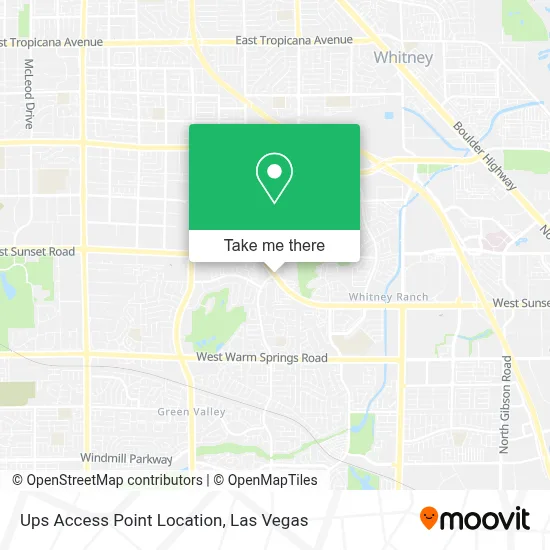
See Ups Access Point Location, Henderson, on the map
Public Transit to Ups Access Point Location in Henderson
Wondering how to get to Ups Access Point Location in Henderson? Moovit helps you find the best way to get to Ups Access Point Location with step-by-step directions from the nearest public transit station.
Moovit provides free maps and live directions to help you navigate through your city. View schedules, routes, timetables, and find out how long does it take to get to Ups Access Point Location in real time.
Looking for the nearest stop or station to Ups Access Point Location? Check out this list of stops closest to your destination: Nb Sunset After Scimitar.
Bus: 212.
Want to see if there’s another route that gets you there at an earlier time? Moovit helps you find alternative routes or times. Get directions from and directions to Ups Access Point Location easily from the Moovit App or Website.
We make riding to Ups Access Point Location easy, which is why over 1.7 million users, including users in Henderson, trust Moovit as the best app for public transit. You don’t need to download an individual bus app or train app, Moovit is your all-in-one transit app that helps you find the best bus time or train time available.
For information on prices of bus, costs and ride fares to Ups Access Point Location, please check the Moovit app.
Use the app to navigate to popular places including to the airport, hospital, stadium, grocery store, mall, coffee shop, school, college, and university.
Ups Access Point Location Address: 1990 W Sunset Rd street in Henderson
- We Are the Locksmith,
- Selena Nails,
- Vegas Glass Hq Aka D's Smoke And Gifts,
- Dollar General,
- Sunset Dry Cleaners,
- Sunset Dry Cleaner,
- Shell,
- Butterfly Kissed Beauty Las Vegas,
- Henderson (Green Valley) - 701 N. Valle Verde Dr.,
- Amazon Locker - Crisol,
- Bitcoin Depot | Bitcoin Atm,
- Ecreditadvisor,
- Lgp Cpas,
- The King Art Studio,
- Anthem Realty Group Llc,
- Bruce Badia Real Estate,
- The Maids In Henderson,
- Brandi Bradshaw - Realtor - Pathway Realty,
- United States Department Of Agriculture,
- Essential Legal Services, Llc
Places Near Ups Access Point Location (Henderson)
- Walmart, Las Vegas,
- Walmart Supercenter, Las Vegas,
- Omega Mart, Las Vegas,
- The Neon Museum, Las Vegas,
- Arte Museum Las Vegas, Paradise,
- Las Vegas Premium Outlets-North, Enterprise,
- Meow Wolf - Las Vegas (Meow Wolf's Omega Mart), Las Vegas,
- Lee Canyon, Las Vegas,
- The Palms Casino Resort, Paradise,
- Zak Bagans Haunted Museum, Las Vegas,
- Town Square, Enterprise,
- Welcome To Fabulous Las Vegas Sign, Paradise,
- Las Vegas South Premium Outlets, Enterprise,
- Area15, Las Vegas,
- Trump International Hotel Las Vegas, Paradise,
- Las Vegas North Premium Outlets, Las Vegas,
- Koolsville Tattoos, Las Vegas,
- Allegiant Stadium, Paradise,
- The Deuce Bus Stop at Fremont St, Las Vegas,
- Gold & Silver Pawn Shop, Las Vegas
How to get to popular places in Las Vegas with public transit
Get around Henderson by public transit!
Traveling around Henderson has never been so easy. See step by step directions as you travel to any attraction, street or major public transit station. View bus and train schedules, arrival times, service alerts and detailed routes on a map, so you know exactly how to get to anywhere in Henderson.
When traveling to any destination around Henderson use Moovit's Live Directions with Get Off Notifications to know exactly where and how far to walk, how long to wait for your line, and how many stops are left. Moovit will alert you when it's time to get off — no need to constantly re-check whether yours is the next stop.
Wondering how to use public transit in Henderson or how to pay for public transit in Henderson? Moovit public transit app can help you navigate your way with public transit easily, and at minimum cost. It includes public transit fees, ticket prices, and costs. Looking for a map of Henderson public transit lines? Moovit public transit app shows all public transit maps in Henderson with all Bus and Monorail routes and stops on an interactive map.
Las Vegas has 2 transit type(s), including: Bus and Monorail, operated by several transit agencies, including RTCSNV, City of Las Vegas, Alvand Transportation, Vegas Airporter, Las Vegas Monorail, FlixBus-us and Greyhound-us