Directions to Ups Access Point Location (Yonkers) with public transportation
The following transit lines have routes that pass near Ups Access Point Location
 Bus: 1, 2, 4, BX7, BXM3.
- Train: 1, ADIRONDACK, BERKSHIRE FLYER, EMPIRE SERVICE, ETHAN ALLEN EXPRESS.
- Subway: 1.
How to get to Ups Access Point Location by bus?
Click on the bus route to see step by step directions with maps, line arrival times and updated time schedules.
From Washington Heights, Manhattan
52 minFrom Calvary Hospital, Bronx
75 minFrom Franklin Ave, Bronx
65 minFrom Yankee Stadium, Bronx
74 minFrom Rucker Park, Manhattan
88 minFrom 168 St, Manhattan
60 minFrom The Bronx, NY, Bronx
77 minFrom Washington Heights, Manhattan
60 minFrom Empire City Casino Yonkers, Bronx
57 minFrom Holy Name Hospital, Teaneck
86 min
How to get to Ups Access Point Location by train?
Click on the train route to see step by step directions with maps, line arrival times and updated time schedules.
How to get to Ups Access Point Location by subway?
Click on the subway route to see step by step directions with maps, line arrival times and updated time schedules.
From Washington Heights, Manhattan
59 minFrom Calvary Hospital, Bronx
151 minFrom Franklin Ave, Bronx
98 minFrom Yankee Stadium, Bronx
81 minFrom Rucker Park, Manhattan
74 minFrom 168 St, Manhattan
60 minFrom The Bronx, NY, Bronx
90 minFrom Washington Heights, Manhattan
59 minFrom Empire City Casino Yonkers, Bronx
91 min
Bus stops near Ups Access Point Location in Yonkers
Train stations near Ups Access Point Location in Yonkers
Subway station near Ups Access Point Location in Yonkers
- Van Cortlandt Park-242 St, 44 min walk,VIEW
Bus lines to Ups Access Point Location in Yonkers
What are the closest stations to Ups Access Point Location?
The closest stations to Ups Access Point Location are:
- McLean Ave @ S Broadway is 153 yards away, 2 min walk.
- S Broadway @ Post St is 166 yards away, 3 min walk.
- S Broadway/McLean Av is 220 yards away, 3 min walk.
- Valentine La @ S Broadway is 529 yards away, 7 min walk.
- Glenwood is 2299 yards away, 27 min walk.
- Yonkers is 3403 yards away, 40 min walk.
- Van Cortlandt Park-242 St is 3667 yards away, 44 min walk.
Which bus lines stop near Ups Access Point Location?
These bus lines stop near Ups Access Point Location: 1, 2, 4, BX7, BXM3.
Which train line stops near Ups Access Point Location?
1 (717#| Croton-Harmon)
Which subway line stops near Ups Access Point Location?
1 (Uptown & The Bronx)
What’s the nearest train station to Ups Access Point Location in Yonkers?
The nearest train station to Ups Access Point Location in Yonkers is Glenwood. It’s a 27 min walk away.
What’s the nearest bus station to Ups Access Point Location in Yonkers?
The nearest bus station to Ups Access Point Location in Yonkers is McLean Ave @ S Broadway. It’s a 2 min walk away.
What time is the first subway to Ups Access Point Location in Yonkers?
The 1 is the first subway that goes to Ups Access Point Location in Yonkers. It stops nearby at 5:09 AM.
What time is the last subway to Ups Access Point Location in Yonkers?
The 1 is the last subway that goes to Ups Access Point Location in Yonkers. It stops nearby at 3:52 AM.
What time is the first train to Ups Access Point Location in Yonkers?
The 1 is the first train that goes to Ups Access Point Location in Yonkers. It stops nearby at 5:10 AM.
What time is the last train to Ups Access Point Location in Yonkers?
The 1 is the last train that goes to Ups Access Point Location in Yonkers. It stops nearby at 2:27 AM.
What time is the first bus to Ups Access Point Location in Yonkers?
The 4 is the first bus that goes to Ups Access Point Location in Yonkers. It stops nearby at 4:48 AM.
What time is the last bus to Ups Access Point Location in Yonkers?
The BXM3 is the last bus that goes to Ups Access Point Location in Yonkers. It stops nearby at 1:00 AM.
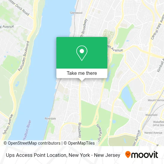
See Ups Access Point Location, Yonkers, on the map
Public Transit to Ups Access Point Location in Yonkers
Wondering how to get to Ups Access Point Location in Yonkers? Moovit helps you find the best way to get to Ups Access Point Location with step-by-step directions from the nearest public transit station.
Moovit provides free maps and live directions to help you navigate through your city. View schedules, routes, timetables, and find out how long does it take to get to Ups Access Point Location in real time.
Looking for the nearest stop or station to Ups Access Point Location? Check out this list of stops closest to your destination: McLean Ave @ S Broadway; S Broadway @ Post St; S Broadway/McLean Av; Valentine La @ S Broadway; Glenwood; Yonkers; Van Cortlandt Park-242 St.
Bus: 1, 2, 4, BX7, BXM3, 3.Train: 1, ADIRONDACK, BERKSHIRE FLYER, EMPIRE SERVICE, ETHAN ALLEN EXPRESS, MAPLE LEAF.Subway: 1.
Want to see if there’s another route that gets you there at an earlier time? Moovit helps you find alternative routes or times. Get directions from and directions to Ups Access Point Location easily from the Moovit App or Website.
We make riding to Ups Access Point Location easy, which is why over 1.5 million users, including users in Yonkers, trust Moovit as the best app for public transit. You don’t need to download an individual bus app or train app, Moovit is your all-in-one transit app that helps you find the best bus time or train time available.
For information on prices of bus, subway and train, costs and ride fares to Ups Access Point Location, please check the Moovit app.
Use the app to navigate to popular places including to the airport, hospital, stadium, grocery store, mall, coffee shop, school, college, and university.
Ups Access Point Location Address: 28 Romaine Ave street in Yonkers
- Romaine Plaza,
- Top Tomato Super Store,
- Advance Auto Parts,
- McLean Wash,
- Western Union,
- Chase Mortgage,
- Davita Getty Square Dialysis-Ny,
- Jaime Nunes,
- Total by Verizon,
- Lincoln Park (Lincoln Memorial Park),
- EV Connect,
- Reyes Delli Llc,
- parque de los viejitos,
- Fernandez Flower Shop,
- Guerreros Bar and Grill,
- Los Dorados Cargo,
- Total Wireless,
- Iglesia Elim De Restauracion,
- South Broadway Bid,
- Antojitos Poblanos Garcia
Places Near Ups Access Point Location (Yonkers)
- Rockefeller Center, Manhattan,
- Wall Street, Manhattan,
- SoHo, Manhattan,
- Queens Center Mall, Queens,
- 911 Memorial, Manhattan,
- 26 Federal Plaza, Manhattan,
- Pier 83, Manhattan,
- Mountainside Hospital, Glen Ridge,
- 66 John Street, Manhattan,
- 3 Stone St, Manhattan,
- San Gennaro Feast, Manhattan,
- Katz's Deli, Manhattan,
- 376 Hudson Street, Manhattan,
- Bellevue Hospital, Manhattan,
- 1 Police Plaza, Manhattan,
- Chinatown, Manhattan,
- Hudson Yards, Manhattan,
- qqqq, Manhattan,
- 111 Centre New York City Supreme Court, Manhattan,
- Times Square, Manhattan
How to get to popular places in New York - New Jersey with public transit
Get around Yonkers by public transit!
Traveling around Yonkers has never been so easy. See step by step directions as you travel to any attraction, street or major public transit station. View bus and train schedules, arrival times, service alerts and detailed routes on a map, so you know exactly how to get to anywhere in Yonkers.
When traveling to any destination around Yonkers use Moovit's Live Directions with Get Off Notifications to know exactly where and how far to walk, how long to wait for your line, and how many stops are left. Moovit will alert you when it's time to get off — no need to constantly re-check whether yours is the next stop.
Wondering how to use public transit in Yonkers or how to pay for public transit in Yonkers? Moovit public transit app can help you navigate your way with public transit easily, and at minimum cost. It includes public transit fees, ticket prices, and costs. Looking for a map of Yonkers public transit lines? Moovit public transit app shows all public transit maps in Yonkers with all Bus, Train, Subway, Light Rail, Ferry and Cable Car routes and stops on an interactive map.
New York - New Jersey has 6 transit type(s), including: Bus, Train, Subway, Light Rail, Ferry and Cable Car, operated by several transit agencies, including MTA Subway, Metro-North Railroad, LIRR, PATH, MTA New York City Transit - Express routes, MTA Bus, NJ Transit, NYC Ferry, NICE bus, Bee-Line Bus, NJ Transit Rail, Norwalk Transit District, Hartford Line, River Valley Transit and HART