Directions to Ups Access Point Location (Stamford) with public transportation
The following transit lines have routes that pass near Ups Access Point Location
 Bus: 331, 333, 334, 341, 971.
- Train: 3, NORTHEAST REGIONAL, ACELA, COMMUTER RAIL, VERMONTER.
How to get to Ups Access Point Location by bus?
Click on the bus route to see step by step directions with maps, line arrival times and updated time schedules.
From Rye Playland, Rye
121 minFrom Mamaroneck NY, Mamaroneck
105 minFrom Port Chester, NY, Port Chester
68 minFrom The Sono Collection, Norwalk
48 minFrom White Plains, NY, White Plains
51 minFrom New Rochelle, NY, New Rochelle
97 minFrom Regeneron Pharmaceuticals Inc, Tarrytown
106 minFrom the bee-line system Bus Stop - Rye Playland (13, 75, 91), Rye
120 minFrom Westchester Mall, White Plains
52 min
How to get to Ups Access Point Location by train?
Click on the train route to see step by step directions with maps, line arrival times and updated time schedules.
Bus stops near Ups Access Point Location in Stamford
Train station near Ups Access Point Location in Stamford
- Stamford, 13 min walk,VIEW
Bus lines to Ups Access Point Location in Stamford
What are the closest stations to Ups Access Point Location?
The closest stations to Ups Access Point Location are:
- Grove St @ Prospect St is 31 yards away, 1 min walk.
- Prospect St @ North St is 100 yards away, 2 min walk.
- Bedford St @ Forest St is 173 yards away, 3 min walk.
- Stamford is 1013 yards away, 13 min walk.
Which bus lines stop near Ups Access Point Location?
These bus lines stop near Ups Access Point Location: 331, 333, 334, 341, 971.
Which train lines stop near Ups Access Point Location?
These train lines stop near Ups Access Point Location: 3, NORTHEAST REGIONAL.
What’s the nearest train station to Ups Access Point Location in Stamford?
The nearest train station to Ups Access Point Location in Stamford is Stamford. It’s a 13 min walk away.
What’s the nearest bus station to Ups Access Point Location in Stamford?
The nearest bus station to Ups Access Point Location in Stamford is Grove St @ Prospect St. It’s a 1 min walk away.
What time is the first train to Ups Access Point Location in Stamford?
The 3 is the first train that goes to Ups Access Point Location in Stamford. It stops nearby at 3:02 AM.
What time is the last train to Ups Access Point Location in Stamford?
The 3 is the last train that goes to Ups Access Point Location in Stamford. It stops nearby at 3:02 AM.
What time is the first bus to Ups Access Point Location in Stamford?
The 331 is the first bus that goes to Ups Access Point Location in Stamford. It stops nearby at 5:26 AM.
What time is the last bus to Ups Access Point Location in Stamford?
The 333 is the last bus that goes to Ups Access Point Location in Stamford. It stops nearby at 11:19 PM.
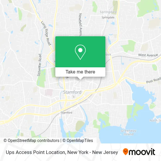
See Ups Access Point Location, Stamford, on the map
Public Transit to Ups Access Point Location in Stamford
Wondering how to get to Ups Access Point Location in Stamford? Moovit helps you find the best way to get to Ups Access Point Location with step-by-step directions from the nearest public transit station.
Moovit provides free maps and live directions to help you navigate through your city. View schedules, routes, timetables, and find out how long does it take to get to Ups Access Point Location in real time.
Looking for the nearest stop or station to Ups Access Point Location? Check out this list of stops closest to your destination: Grove St @ Prospect St; Prospect St @ North St; Bedford St @ Forest St; Stamford.
Bus: 331, 333, 334, 341, 971, 351.Train: 3, NORTHEAST REGIONAL, ACELA, COMMUTER RAIL, VERMONTER.
Want to see if there’s another route that gets you there at an earlier time? Moovit helps you find alternative routes or times. Get directions from and directions to Ups Access Point Location easily from the Moovit App or Website.
We make riding to Ups Access Point Location easy, which is why over 1.5 million users, including users in Stamford, trust Moovit as the best app for public transit. You don’t need to download an individual bus app or train app, Moovit is your all-in-one transit app that helps you find the best bus time or train time available.
For information on prices of bus and train, costs and ride fares to Ups Access Point Location, please check the Moovit app.
Use the app to navigate to popular places including to the airport, hospital, stadium, grocery store, mall, coffee shop, school, college, and university.
Ups Access Point Location Address: 135 Prospect St street in Stamford
- Bitcoinx Atm,
- Dunkin',
- Kx2 Music,
- Innovative Network Solutions Corp.,
- Cybersecop,
- Royal Communications Center,
- Chiropractic & Wellness Center Of Stamford,
- Scott Androvic at Crosscountry Mortgage,
- Jason Walker - Your Mortgage Guy,
- Jmx Realty Group,
- Helen C. Bruno, Attorney at Law,
- Jason Walker at First County Bank,
- The Maddox Law Firm, Llc,
- Safe and Sound Electric,
- Top Student,
- Acurio Services,
- The Medical Spa Of Aurora,
- Helen Bruno Atty,
- Ordered Steps Learning Center Llc,
- Jaebella Beauty Spa
Places Near Ups Access Point Location (Stamford)
- Times Square, Manhattan,
- Queens Center Mall, Queens,
- 1 Police Plaza, Manhattan,
- Bellevue Hospital, Manhattan,
- Rockefeller Center, Manhattan,
- Katz's Deli, Manhattan,
- San Gennaro Feast, Manhattan,
- 911 Memorial, Manhattan,
- Hudson Yards, Manhattan,
- 376 Hudson Street, Manhattan,
- qqqq, Manhattan,
- Chinatown, Manhattan,
- 3 Stone St, Manhattan,
- 111 Centre New York City Supreme Court, Manhattan,
- Wall Street, Manhattan,
- 26 Federal Plaza, Manhattan,
- Mountainside Hospital, Glen Ridge,
- SoHo, Manhattan,
- Pier 83, Manhattan,
- 66 John Street, Manhattan
How to get to popular places in New York - New Jersey with public transit
Get around Stamford by public transit!
Traveling around Stamford has never been so easy. See step by step directions as you travel to any attraction, street or major public transit station. View bus and train schedules, arrival times, service alerts and detailed routes on a map, so you know exactly how to get to anywhere in Stamford.
When traveling to any destination around Stamford use Moovit's Live Directions with Get Off Notifications to know exactly where and how far to walk, how long to wait for your line, and how many stops are left. Moovit will alert you when it's time to get off — no need to constantly re-check whether yours is the next stop.
Wondering how to use public transit in Stamford or how to pay for public transit in Stamford? Moovit public transit app can help you navigate your way with public transit easily, and at minimum cost. It includes public transit fees, ticket prices, and costs. Looking for a map of Stamford public transit lines? Moovit public transit app shows all public transit maps in Stamford with all Bus, Train, Subway, Light Rail, Ferry and Cable Car routes and stops on an interactive map.
New York - New Jersey has 6 transit type(s), including: Bus, Train, Subway, Light Rail, Ferry and Cable Car, operated by several transit agencies, including MTA Subway, Metro-North Railroad, LIRR, PATH, MTA New York City Transit - Express routes, MTA Bus, NJ Transit, NYC Ferry, NICE bus, Bee-Line Bus, NJ Transit Rail, Norwalk Transit District, Hartford Line, River Valley Transit and HART