How to get to Ups Access Point Location by bus?
Click on the bus route to see step by step directions with maps, line arrival times and updated time schedules.
How to get to Ups Access Point Location by train?
Click on the train route to see step by step directions with maps, line arrival times and updated time schedules.
How to get to Ups Access Point Location by subway?
Click on the subway route to see step by step directions with maps, line arrival times and updated time schedules.
Bus stops near Ups Access Point Location in New York - New Jersey
Subway stations near Ups Access Point Location in New York - New Jersey
Bus lines to Ups Access Point Location in New York - New Jersey
What are the closest stations to Ups Access Point Location?
The closest stations to Ups Access Point Location are:
- E 98 St/Hegeman Av is 31 yards away, 1 min walk.
- Church Av/Rockaway Pkwy is 221 yards away, 3 min walk.
- Saratoga Av is 1226 yards away, 15 min walk.
- East 105 St is 1388 yards away, 17 min walk.
Which bus lines stop near Ups Access Point Location?
These bus lines stop near Ups Access Point Location: B15, B35, B60, B8.
Which train line stops near Ups Access Point Location?
CITY TERMINAL ZONE (Atlantic Terminal)
Which subway lines stop near Ups Access Point Location?
These subway lines stop near Ups Access Point Location: 3, L.
What’s the nearest subway station to Ups Access Point Location in New York - New Jersey?
The nearest subway station to Ups Access Point Location in New York - New Jersey is Saratoga Av. It’s a 15 min walk away.
What’s the nearest bus station to Ups Access Point Location in New York - New Jersey?
The nearest bus station to Ups Access Point Location in New York - New Jersey is E 98 St/Hegeman Av. It’s a 1 min walk away.
What time is the first subway to Ups Access Point Location in New York - New Jersey?
The L is the first subway that goes to Ups Access Point Location in New York - New Jersey. It stops nearby at 3:02 AM.
What time is the last subway to Ups Access Point Location in New York - New Jersey?
The 4 is the last subway that goes to Ups Access Point Location in New York - New Jersey. It stops nearby at 4:32 AM.
What time is the first bus to Ups Access Point Location in New York - New Jersey?
The B35 is the first bus that goes to Ups Access Point Location in New York - New Jersey. It stops nearby at 3:02 AM.
What time is the last bus to Ups Access Point Location in New York - New Jersey?
The B15 is the last bus that goes to Ups Access Point Location in New York - New Jersey. It stops nearby at 3:13 AM.
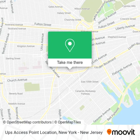
See Ups Access Point Location, New York - New Jersey, on the map
Public Transit to Ups Access Point Location in New York - New Jersey
Wondering how to get to Ups Access Point Location in New York - New Jersey? Moovit helps you find the best way to get to Ups Access Point Location with step-by-step directions from the nearest public transit station.
Moovit provides free maps and live directions to help you navigate through your city. View schedules, routes, timetables, and find out how long does it take to get to Ups Access Point Location in real time.
Looking for the nearest stop or station to Ups Access Point Location? Check out this list of stops closest to your destination: E 98 St/Hegeman Av; Church Av/Rockaway Pkwy; Saratoga Av; East 105 St.
Bus: B15, B35, B60, B8.Train: CITY TERMINAL ZONE.Subway: 3, L, 2, 4, 5.
Want to see if there’s another route that gets you there at an earlier time? Moovit helps you find alternative routes or times. Get directions from and directions to Ups Access Point Location easily from the Moovit App or Website.
We make riding to Ups Access Point Location easy, which is why over 1.5 million users, including users in New York - New Jersey, trust Moovit as the best app for public transit. You don’t need to download an individual bus app or train app, Moovit is your all-in-one transit app that helps you find the best bus time or train time available.
For information on prices of subway, bus, train and ferry, costs and ride fares to Ups Access Point Location, please check the Moovit app.
Use the app to navigate to popular places including to the airport, hospital, stadium, grocery store, mall, coffee shop, school, college, and university.
Ups Access Point Location Address: 2314 Strauss St street in New York - New Jersey
- Brookdale University Hospital,
- 7 Hegeman Avenue,
- Ap 4h,
- The Uplifted Mind,
- Jcarlosz,
- The Brookdale Hospital Center,
- Cardiovascular Associates,
- Abdul Wahid,
- One Brooklyn Health Faculty Associates,
- 1 Brookdale Plaza,
- Brookdale University Hospital Medical Center,
- Quest International Distributor,
- Cafe,
- Samuel Schulman Institute For Nursing & Rehabilitation,
- The Radutzky Emergency Care Pavilion,
- Dorothy & David Schachne Rehabilitation Institute Dtx Informatio,
- Jamrock Bistro,
- Brookdale Urgent Care Center,
- Brookdale Urgent Care,
- Amazon Locker - Debt
Places Near Ups Access Point Location (New York - New Jersey)
- Mountainside Hospital, Glen Ridge,
- Times Square, Manhattan,
- SoHo, Manhattan,
- Hudson Yards, Manhattan,
- 911 Memorial, Manhattan,
- Pier 83, Manhattan,
- 111 Centre New York City Supreme Court, Manhattan,
- 66 John Street, Manhattan,
- 3 Stone St, Manhattan,
- 1 Police Plaza, Manhattan,
- 26 Federal Plaza, Manhattan,
- qqqq, Manhattan,
- Wall Street, Manhattan,
- Bellevue Hospital, Manhattan,
- Katz's Deli, Manhattan,
- Rockefeller Center, Manhattan,
- San Gennaro Feast, Manhattan,
- Chinatown, Manhattan,
- Queens Center Mall, Queens,
- 376 Hudson Street, Manhattan
How to get to popular places in New York - New Jersey with public transit
Get around New York - New Jersey by public transit!
Traveling around New York - New Jersey has never been so easy. See step by step directions as you travel to any attraction, street or major public transit station. View bus and train schedules, arrival times, service alerts and detailed routes on a map, so you know exactly how to get to anywhere in New York - New Jersey.
When traveling to any destination around New York - New Jersey use Moovit's Live Directions with Get Off Notifications to know exactly where and how far to walk, how long to wait for your line, and how many stops are left. Moovit will alert you when it's time to get off — no need to constantly re-check whether yours is the next stop.
Wondering how to use public transit in New York - New Jersey or how to pay for public transit in New York - New Jersey? Moovit public transit app can help you navigate your way with public transit easily, and at minimum cost. It includes public transit fees, ticket prices, and costs. Looking for a map of New York - New Jersey public transit lines? Moovit public transit app shows all public transit maps in New York - New Jersey with all Bus, Train, Subway, Light Rail, Ferry and Cable Car routes and stops on an interactive map.
New York - New Jersey has 6 transit type(s), including: Bus, Train, Subway, Light Rail, Ferry and Cable Car, operated by several transit agencies, including MTA Subway, Metro-North Railroad, LIRR, PATH, MTA New York City Transit - Express routes, MTA Bus, NJ Transit, NYC Ferry, NICE bus, Bee-Line Bus, NJ Transit Rail, Norwalk Transit District, Hartford Line, River Valley Transit and HART