How to get to Ups Access Point Location by bus?
Click on the bus route to see step by step directions with maps, line arrival times and updated time schedules.
From Walmart, Linden
60 minFrom Plainfield, NJ, Plainfield
96 minFrom Linden, NJ, Linden
61 minFrom Perth Amboy, NJ, Perth Amboy
41 minFrom Union County College - Cranford Campus, Cranford
107 minFrom Staten Island Mall, Staten Island
160 minFrom South Ave, Staten Island
162 minFrom Edison NJ, Edison
74 minFrom Baps Shri Swaminarayan Mandir, Edison, NJ, USA, Edison
101 minFrom Staten Island, NY, Staten Island
205 min
How to get to Ups Access Point Location by train?
Click on the train route to see step by step directions with maps, line arrival times and updated time schedules.
Bus stops near Ups Access Point Location in Woodbridge
Train stations near Ups Access Point Location in Woodbridge
Bus lines to Ups Access Point Location in Woodbridge
What are the closest stations to Ups Access Point Location?
The closest stations to Ups Access Point Location are:
- Woodbridge Center Dr at Woodbridge Ter is 710 yards away, 9 min walk.
- Woodbridge is 852 yards away, 11 min walk.
- Green St at Dundee Ave is 1089 yards away, 13 min walk.
- Metropark Amtrak Station is 2952 yards away, 35 min walk.
Which bus lines stop near Ups Access Point Location?
These bus lines stop near Ups Access Point Location: 116, 48, 810, 815.
Which train lines stop near Ups Access Point Location?
These train lines stop near Ups Access Point Location: NC, NJCL.
What’s the nearest train station to Ups Access Point Location in Woodbridge?
The nearest train station to Ups Access Point Location in Woodbridge is Woodbridge. It’s a 11 min walk away.
What’s the nearest bus station to Ups Access Point Location in Woodbridge?
The nearest bus station to Ups Access Point Location in Woodbridge is Woodbridge Center Dr at Woodbridge Ter. It’s a 9 min walk away.
What time is the first train to Ups Access Point Location in Woodbridge?
The NC is the first train that goes to Ups Access Point Location in Woodbridge. It stops nearby at 4:26 AM.
What time is the last train to Ups Access Point Location in Woodbridge?
The NC is the last train that goes to Ups Access Point Location in Woodbridge. It stops nearby at 2:07 AM.
What time is the first bus to Ups Access Point Location in Woodbridge?
The 48 is the first bus that goes to Ups Access Point Location in Woodbridge. It stops nearby at 5:14 AM.
What time is the last bus to Ups Access Point Location in Woodbridge?
The 48 is the last bus that goes to Ups Access Point Location in Woodbridge. It stops nearby at 10:50 PM.
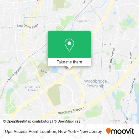
See Ups Access Point Location, Woodbridge, on the map
Public Transit to Ups Access Point Location in Woodbridge
Wondering how to get to Ups Access Point Location in Woodbridge? Moovit helps you find the best way to get to Ups Access Point Location with step-by-step directions from the nearest public transit station.
Moovit provides free maps and live directions to help you navigate through your city. View schedules, routes, timetables, and find out how long does it take to get to Ups Access Point Location in real time.
Looking for the nearest stop or station to Ups Access Point Location? Check out this list of stops closest to your destination: Woodbridge Center Dr at Woodbridge Ter; Woodbridge; Green St at Dundee Ave; Metropark Amtrak Station.
Bus: 116, 48, 810, 815, 803, 802.Train: NC, NJCL, ACELA, CAROLINIAN, CRESCENT, KEYSTONE SERVICE, NORTHEAST REGIONAL.
Want to see if there’s another route that gets you there at an earlier time? Moovit helps you find alternative routes or times. Get directions from and directions to Ups Access Point Location easily from the Moovit App or Website.
We make riding to Ups Access Point Location easy, which is why over 1.5 million users, including users in Woodbridge, trust Moovit as the best app for public transit. You don’t need to download an individual bus app or train app, Moovit is your all-in-one transit app that helps you find the best bus time or train time available.
For information on prices of bus and train, costs and ride fares to Ups Access Point Location, please check the Moovit app.
Use the app to navigate to popular places including to the airport, hospital, stadium, grocery store, mall, coffee shop, school, college, and university.
Ups Access Point Location Address: 801 US Highway 1 S street in Woodbridge
- Libertyx Bitcoin Atm,
- Aspen Dental,
- Swift Wheels Inc,
- Libertyx Bitcoin Atm,
- Ups Alliance Shipping Partner,
- Aspen Dental - Woodbridge, NJ,
- Coinhub,
- Coinhub Bitcoin Atm,
- Capital One (Capital One Bank),
- Garden State Cash Homes Llc,
- Woodbridge/Iselin,
- The Sleep Loft - Woodbridge, NJ Mattress Showroom,
- Ubreakifix - Phone and Computer Repair,
- Woodbridge Township Mattress & Bedding Store,
- Balaji Wine and Liquors,
- Buy-Sell-Repairs,
- Sinclair Gas Station,
- Ubreakifix,
- Ubreakifix,
- John Jackson: Allstate Insurance
Places Near Ups Access Point Location (Woodbridge)
- San Gennaro Feast, Manhattan,
- Times Square, Manhattan,
- Mountainside Hospital, Glen Ridge,
- qqqq, Manhattan,
- SoHo, Manhattan,
- Bellevue Hospital, Manhattan,
- 3 Stone St, Manhattan,
- Wall Street, Manhattan,
- Katz's Deli, Manhattan,
- Pier 83, Manhattan,
- Queens Center Mall, Queens,
- 66 John Street, Manhattan,
- 111 Centre New York City Supreme Court, Manhattan,
- 376 Hudson Street, Manhattan,
- Hudson Yards, Manhattan,
- 1 Police Plaza, Manhattan,
- Rockefeller Center, Manhattan,
- Chinatown, Manhattan,
- 911 Memorial, Manhattan,
- 26 Federal Plaza, Manhattan
How to get to popular places in New York - New Jersey with public transit
Get around Woodbridge by public transit!
Traveling around Woodbridge has never been so easy. See step by step directions as you travel to any attraction, street or major public transit station. View bus and train schedules, arrival times, service alerts and detailed routes on a map, so you know exactly how to get to anywhere in Woodbridge.
When traveling to any destination around Woodbridge use Moovit's Live Directions with Get Off Notifications to know exactly where and how far to walk, how long to wait for your line, and how many stops are left. Moovit will alert you when it's time to get off — no need to constantly re-check whether yours is the next stop.
Wondering how to use public transit in Woodbridge or how to pay for public transit in Woodbridge? Moovit public transit app can help you navigate your way with public transit easily, and at minimum cost. It includes public transit fees, ticket prices, and costs. Looking for a map of Woodbridge public transit lines? Moovit public transit app shows all public transit maps in Woodbridge with all Bus, Train, Subway, Light Rail, Ferry and Cable Car routes and stops on an interactive map.
New York - New Jersey has 6 transit type(s), including: Bus, Train, Subway, Light Rail, Ferry and Cable Car, operated by several transit agencies, including MTA Subway, Metro-North Railroad, LIRR, PATH, MTA New York City Transit - Express routes, MTA Bus, NJ Transit, NYC Ferry, NICE bus, Bee-Line Bus, NJ Transit Rail, Norwalk Transit District, Hartford Line, River Valley Transit and HART