Directions to Ups Access Point Location (Queens) with public transportation
The following transit lines have routes that pass near Ups Access Point Location
 Bus: Q111, Q113, Q77, Q114.
- Train: FAR ROCKAWAY BRANCH, LONG BEACH BRANCH, BABYLON BRANCH.
How to get to Ups Access Point Location by bus?
Click on the bus route to see step by step directions with maps, line arrival times and updated time schedules.
From Forest Hills, Queens
60 minFrom The Shops At Atlas Park, Queens
73 minFrom Resort World Casino New York City, Queens
46 minFrom Springhill Suites by Marriott, Queens
43 minFrom Ozone Park, Queens
47 minFrom Queens, NY, Queens
65 minFrom 163-03 Horace Harding Expressway, Queens
49 minFrom Long island Jewish Hospital, Queens
50 minFrom Nostrand Ave, Brooklyn, Queens
62 minFrom Queens County Farm Museum, Queens
57 min
How to get to Ups Access Point Location by train?
Click on the train route to see step by step directions with maps, line arrival times and updated time schedules.
Bus stops near Ups Access Point Location in Queens
Train station near Ups Access Point Location in Queens
- Laurelton, 16 min walk,VIEW
Bus lines to Ups Access Point Location in Queens
What are the closest stations to Ups Access Point Location?
The closest stations to Ups Access Point Location are:
- 147 Av /225 St is 62 yards away, 1 min walk.
- Guy R Brewer Blvd/147 Av is 417 yards away, 6 min walk.
- 147 Av/Guy R Brewer Blvd is 453 yards away, 6 min walk.
- Laurelton is 1316 yards away, 16 min walk.
Which bus lines stop near Ups Access Point Location?
These bus lines stop near Ups Access Point Location: Q111, Q113, Q77.
Which train lines stop near Ups Access Point Location?
These train lines stop near Ups Access Point Location: FAR ROCKAWAY BRANCH, LONG BEACH BRANCH.
What’s the nearest train station to Ups Access Point Location in Queens?
The nearest train station to Ups Access Point Location in Queens is Laurelton. It’s a 16 min walk away.
What’s the nearest bus station to Ups Access Point Location in Queens?
The nearest bus station to Ups Access Point Location in Queens is 147 Av /225 St. It’s a 1 min walk away.
What time is the first train to Ups Access Point Location in Queens?
The FAR ROCKAWAY BRANCH is the first train that goes to Ups Access Point Location in Queens. It stops nearby at 3:25 AM.
What time is the last train to Ups Access Point Location in Queens?
The FAR ROCKAWAY BRANCH is the last train that goes to Ups Access Point Location in Queens. It stops nearby at 2:55 AM.
What time is the first bus to Ups Access Point Location in Queens?
The Q111 is the first bus that goes to Ups Access Point Location in Queens. It stops nearby at 3:15 AM.
What time is the last bus to Ups Access Point Location in Queens?
The Q114 is the last bus that goes to Ups Access Point Location in Queens. It stops nearby at 2:56 AM.
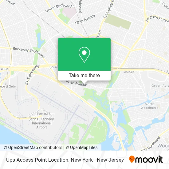
See Ups Access Point Location, Queens, on the map
Public Transit to Ups Access Point Location in Queens
Wondering how to get to Ups Access Point Location in Queens? Moovit helps you find the best way to get to Ups Access Point Location with step-by-step directions from the nearest public transit station.
Moovit provides free maps and live directions to help you navigate through your city. View schedules, routes, timetables, and find out how long does it take to get to Ups Access Point Location in real time.
Looking for the nearest stop or station to Ups Access Point Location? Check out this list of stops closest to your destination: 147 Av /225 St; Guy R Brewer Blvd/147 Av; 147 Av/Guy R Brewer Blvd; Laurelton.
Bus: Q111, Q113, Q77, Q114.Train: FAR ROCKAWAY BRANCH, LONG BEACH BRANCH, BABYLON BRANCH.
Want to see if there’s another route that gets you there at an earlier time? Moovit helps you find alternative routes or times. Get directions from and directions to Ups Access Point Location easily from the Moovit App or Website.
We make riding to Ups Access Point Location easy, which is why over 1.5 million users, including users in Queens, trust Moovit as the best app for public transit. You don’t need to download an individual bus app or train app, Moovit is your all-in-one transit app that helps you find the best bus time or train time available.
For information on prices of bus, train and subway, costs and ride fares to Ups Access Point Location, please check the Moovit app.
Use the app to navigate to popular places including to the airport, hospital, stadium, grocery store, mall, coffee shop, school, college, and university.
Ups Access Point Location Address: 14692 Guy R Brewer Blvd street in Queens
- Brinks Global (JFK Airport),
- Brinks Global,
- 7-Eleven,
- Agra Services Brokerage Co,
- The Martin Crew Photography, Llc,
- Idlewild Environmental Science Learning Center - Eastern Queens Alliance,
- Idlewild Cricket Ground,
- Ups Supply Chain Solutions,
- The Ups Store,
- 222 St 146th,
- Springfield Park,
- 146 Ave Springfield,
- 146th Ave and Springfield Blvd,
- Soca Invasion Weekend,
- Gebrüder Weiss,
- Aac Transport,
- Guywillship,
- Albatrans Inc,
- Savino Del Bene Usa Inc,
- Glass Christmas Ornaments
Places Near Ups Access Point Location (Queens)
- SoHo, Manhattan,
- 111 Centre New York City Supreme Court, Manhattan,
- Rockefeller Center, Manhattan,
- Pier 83, Manhattan,
- 911 Memorial, Manhattan,
- 1 Police Plaza, Manhattan,
- San Gennaro Feast, Manhattan,
- qqqq, Manhattan,
- 3 Stone St, Manhattan,
- Queens Center Mall, Queens,
- Times Square, Manhattan,
- Bellevue Hospital, Manhattan,
- Katz's Deli, Manhattan,
- Mountainside Hospital, Glen Ridge,
- Wall Street, Manhattan,
- 66 John Street, Manhattan,
- 26 Federal Plaza, Manhattan,
- Hudson Yards, Manhattan,
- Chinatown, Manhattan,
- 376 Hudson Street, Manhattan
How to get to popular places in New York - New Jersey with public transit
Get around Queens by public transit!
Traveling around Queens has never been so easy. See step by step directions as you travel to any attraction, street or major public transit station. View bus and train schedules, arrival times, service alerts and detailed routes on a map, so you know exactly how to get to anywhere in Queens.
When traveling to any destination around Queens use Moovit's Live Directions with Get Off Notifications to know exactly where and how far to walk, how long to wait for your line, and how many stops are left. Moovit will alert you when it's time to get off — no need to constantly re-check whether yours is the next stop.
Wondering how to use public transit in Queens or how to pay for public transit in Queens? Moovit public transit app can help you navigate your way with public transit easily, and at minimum cost. It includes public transit fees, ticket prices, and costs. Looking for a map of Queens public transit lines? Moovit public transit app shows all public transit maps in Queens with all Bus, Train, Subway, Light Rail, Ferry and Cable Car routes and stops on an interactive map.
New York - New Jersey has 6 transit type(s), including: Bus, Train, Subway, Light Rail, Ferry and Cable Car, operated by several transit agencies, including MTA Subway, Metro-North Railroad, LIRR, PATH, MTA New York City Transit - Express routes, MTA Bus, NJ Transit, NYC Ferry, NICE bus, Bee-Line Bus, NJ Transit Rail, Norwalk Transit District, Hartford Line, River Valley Transit and HART