Directions to Ups Access Point Location (Baltimore County) with public transportation
The following transit lines have routes that pass near Ups Access Point Location
 Bus: 115.
How to get to Ups Access Point Location by bus?
Click on the bus route to see step by step directions with maps, line arrival times and updated time schedules.
From I-695 Exit 29 (Loch Raven Blvd (MD 542)/Cromwell Bridge Rd), Baltimore County
108 minFrom Medstar Franklin Square Medical Center, Baltimore County
49 minFrom I-695 @ Exit 27 (Dulaney Valley Road/MD 146), Baltimore County
120 minFrom I-695 @ Exit 26 (York Rd/MD 45), Baltimore County
116 minFrom Towson, MD, Baltimore County
108 minFrom Franklin Square Dr (franklin hospital), Baltimore County
52 minFrom Towson Town Center, Baltimore County
71 minFrom Middle River, Maryland, Baltimore County
174 minFrom Good Samaritan Hospital, Baltimore
58 min
Bus stop near Ups Access Point Location in Baltimore County
- Chapel Rd & Chapeltown Cir Ns Wb, 7 min walk,VIEW
Bus lines to Ups Access Point Location in Baltimore County
- 115, Downtown,VIEW
What are the closest stations to Ups Access Point Location?
The closest stations to Ups Access Point Location are:
- Chapel Rd & Chapeltown Cir Ns Wb is 512 yards away, 7 min walk.
Which bus line stops near Ups Access Point Location?
115 (Perry Hall)
What’s the nearest bus station to Ups Access Point Location in Baltimore County?
The nearest bus station to Ups Access Point Location in Baltimore County is Chapel Rd & Chapeltown Cir Ns Wb. It’s a 7 min walk away.
What time is the first bus to Ups Access Point Location in Baltimore County?
The 115 is the first bus that goes to Ups Access Point Location in Baltimore County. It stops nearby at 5:53 AM.
What time is the last bus to Ups Access Point Location in Baltimore County?
The 115 is the last bus that goes to Ups Access Point Location in Baltimore County. It stops nearby at 6:33 PM.
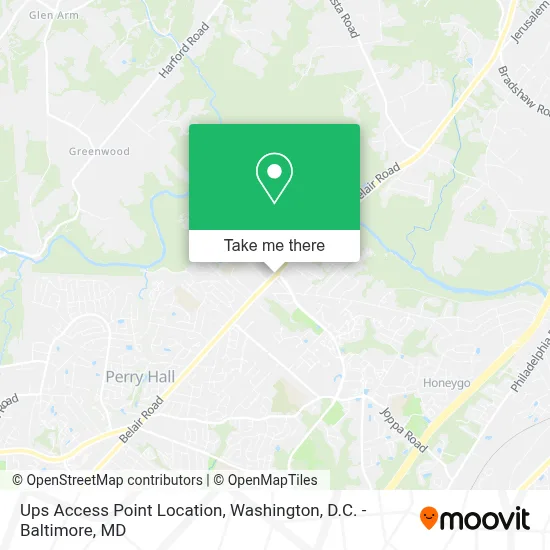
See Ups Access Point Location, Baltimore County, on the map
Public Transit to Ups Access Point Location in Baltimore County
Wondering how to get to Ups Access Point Location in Baltimore County? Moovit helps you find the best way to get to Ups Access Point Location with step-by-step directions from the nearest public transit station.
Moovit provides free maps and live directions to help you navigate through your city. View schedules, routes, timetables, and find out how long does it take to get to Ups Access Point Location in real time.
Looking for the nearest stop or station to Ups Access Point Location? Check out this list of stops closest to your destination: Chapel Rd & Chapeltown Cir Ns Wb.
Bus: 115.
Want to see if there’s another route that gets you there at an earlier time? Moovit helps you find alternative routes or times. Get directions from and directions to Ups Access Point Location easily from the Moovit App or Website.
We make riding to Ups Access Point Location easy, which is why over 1.7 million users, including users in Baltimore County, trust Moovit as the best app for public transit. You don’t need to download an individual bus app or train app, Moovit is your all-in-one transit app that helps you find the best bus time or train time available.
For information on prices of bus, costs and ride fares to Ups Access Point Location, please check the Moovit app.
Use the app to navigate to popular places including to the airport, hospital, stadium, grocery store, mall, coffee shop, school, college, and university.
Ups Access Point Location Address: 9820 Belair Rd street in Baltimore County
- Chapel Rd Belair Rd,
- E Joppa Rd and Belair,
- Joppa Rd & Belair Rd,
- Perry Hall, Maryland,
- Belair Road & Ebenezer Road Northbound Near-Side,
- Luxury No Credit Check Apartment Home Rentals Lease Guaranty & Approval Service Maryland,
- Lidl,
- Bottom Line Tax Solutions,
- Belair Rd | Perry Hall,
- Nail & Spa Ritual,
- Baltimore Biker,
- Salvatore R Rinaudo,
- Hearing Assessment Center,
- Edward Jones - Financial Advisor: Steve Reed, Aams®,
- M&T Bank Atm,
- Thebaltimorebikertradingcompanyllc,
- Medstar Health: Urgent Care at Perry Hall,
- Medstar Health Urgent Care at Perry Hall,
- The Baltimore Biker Trading Company,
- Hearing Assessment Center, Llc
Places Near Ups Access Point Location (Baltimore County)
- Sibley Memorial Hospital, Washington,
- PG Mall, Prince George's County,
- Warner Theatre, Washington,
- Washington National Cathedral, Washington,
- Westfield Montgomery Mall, Montgomery County,
- Museum Of The Bible, Washington,
- Amazon Hq2, Arlington County,
- National Zoo, Washington,
- National Museum of African American History and Culture, Washington,
- Capital One Arena, Washington,
- Camden Yards, Baltimore,
- Basilica of the National Shrine, Washington,
- Pennsylvania Ave NW (3rd st and pennsylvania), Washington,
- M&T Bank Stadium, Baltimore,
- Washington DC VA Medical Center, Washington,
- Marriott Marquis Washington, DC, Washington,
- National Theatre, Washington,
- Rock Creek Tennis Center, Washington,
- Georgetown, Washington,
- The Anthem, Washington
How to get to popular places in Washington, D.C. - Baltimore, MD with public transit
Get around Baltimore County by public transit!
Traveling around Baltimore County has never been so easy. See step by step directions as you travel to any attraction, street or major public transit station. View bus and train schedules, arrival times, service alerts and detailed routes on a map, so you know exactly how to get to anywhere in Baltimore County.
When traveling to any destination around Baltimore County use Moovit's Live Directions with Get Off Notifications to know exactly where and how far to walk, how long to wait for your line, and how many stops are left. Moovit will alert you when it's time to get off — no need to constantly re-check whether yours is the next stop.
Wondering how to use public transit in Baltimore County or how to pay for public transit in Baltimore County? Moovit public transit app can help you navigate your way with public transit easily, and at minimum cost. It includes public transit fees, ticket prices, and costs. Looking for a map of Baltimore County public transit lines? Moovit public transit app shows all public transit maps in Baltimore County with all Bus, Train, Metro, Light Rail and Ferry routes and stops on an interactive map.
Washington, D.C. - Baltimore, MD has 5 transit type(s), including: Bus, Train, Metro, Light Rail and Ferry, operated by several transit agencies, including WMATA, Montgomery County Ride On, Fairfax Connector, TheBus, PRTC, DASH - Alexandria, Arlington Transit (ART), RTA of Central Maryland, MDOT MTA, MDOT MTA Light RailLink, MDOT MTA Commuter Bus, MDOT MTA Local Bus, FXBGO!, Virginia Railway Express (VRE) and MARC