How to get to Ups Access Point Location by bus?
Click on the bus route to see step by step directions with maps, line arrival times and updated time schedules.
From The Capital Wheel at the National Harbor, Prince George's County
49 minFrom Ballou High School, Washington
62 minFrom U.S. Naval Research Laboratory - NRL, Washington
63 minFrom Tanger Outlets, Prince George's County
26 minFrom Oxon Hill, MD, Prince George's County
54 minFrom St Elizabeths Hospital, Washington
64 minFrom Navy Lodge, Washington
67 minFrom Oxon Hill Rivertowne, Prince George's County
16 minFrom Headquarters - U.S. Coast Guard, Washington
84 minFrom Naval Research Lab, Washington
63 min
How to get to Ups Access Point Location by metro?
Click on the metro route to see step by step directions with maps, line arrival times and updated time schedules.
Bus stops near Ups Access Point Location in Prince George's County
Metro station near Ups Access Point Location in Prince George's County
- Branch Avenue, 30 min walk,VIEW
Bus lines to Ups Access Point Location in Prince George's County
What are the closest stations to Ups Access Point Location?
The closest stations to Ups Access Point Location are:
- Allentown Rd & #5711 is 254 yards away, 4 min walk.
- Allentown Rd & Leaon St is 375 yards away, 5 min walk.
- Allentown Rd & Old Branch Ave is 628 yards away, 8 min walk.
- Branch Avenue is 2554 yards away, 30 min walk.
- Old Branch Avenue at Pgcc Skilled Trade Center is 4283 yards away, 50 min walk.
Which bus lines stop near Ups Access Point Location?
These bus lines stop near Ups Access Point Location: P87, P88.
Which metro line stops near Ups Access Point Location?
GREEN (Branch Av)
What’s the nearest metro station to Ups Access Point Location in Prince George's County?
The nearest metro station to Ups Access Point Location in Prince George's County is Branch Avenue. It’s a 30 min walk away.
What’s the nearest bus station to Ups Access Point Location in Prince George's County?
The nearest bus station to Ups Access Point Location in Prince George's County is Allentown Rd & #5711. It’s a 4 min walk away.
What time is the first metro to Ups Access Point Location in Prince George's County?
The GREEN is the first metro that goes to Ups Access Point Location in Prince George's County. It stops nearby at 5:00 AM.
What time is the last metro to Ups Access Point Location in Prince George's County?
The GREEN is the last metro that goes to Ups Access Point Location in Prince George's County. It stops nearby at 12:34 AM.
What time is the first bus to Ups Access Point Location in Prince George's County?
The P87 is the first bus that goes to Ups Access Point Location in Prince George's County. It stops nearby at 5:32 AM.
What time is the last bus to Ups Access Point Location in Prince George's County?
The P87 is the last bus that goes to Ups Access Point Location in Prince George's County. It stops nearby at 12:03 AM.
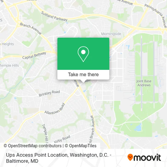
See Ups Access Point Location, Prince George's County, on the map
Public Transit to Ups Access Point Location in Prince George's County
Wondering how to get to Ups Access Point Location in Prince George's County? Moovit helps you find the best way to get to Ups Access Point Location with step-by-step directions from the nearest public transit station.
Moovit provides free maps and live directions to help you navigate through your city. View schedules, routes, timetables, and find out how long does it take to get to Ups Access Point Location in real time.
Looking for the nearest stop or station to Ups Access Point Location? Check out this list of stops closest to your destination: Allentown Rd & #5711; Allentown Rd & Leaon St; Allentown Rd & Old Branch Ave; Branch Avenue; Old Branch Avenue at Pgcc Skilled Trade Center.
Bus: P87, P88, P85, P86, P84.Metro: GREEN.
Want to see if there’s another route that gets you there at an earlier time? Moovit helps you find alternative routes or times. Get directions from and directions to Ups Access Point Location easily from the Moovit App or Website.
We make riding to Ups Access Point Location easy, which is why over 1.7 million users, including users in Prince George's County, trust Moovit as the best app for public transit. You don’t need to download an individual bus app or train app, Moovit is your all-in-one transit app that helps you find the best bus time or train time available.
For information on prices of bus and metro, costs and ride fares to Ups Access Point Location, please check the Moovit app.
Use the app to navigate to popular places including to the airport, hospital, stadium, grocery store, mall, coffee shop, school, college, and university.
Ups Access Point Location Address: 6000 ALLENTOWN RD, 101 street in Prince George's County
- Social Security Administration,
- Royal Farms,
- Kaiser Permanente,
- Topolino Italian Cuisine & Buffet,
- 2nd Ave Thrift Superstore,
- Emerald Spa - Asian Massage Spa,
- Camp Springs Allentown Rd,
- Andrews Federal Credit Union,
- Motel 6-Washington DC Camp Springs,
- Central Baptist Church Camp Springs ,
- Days Inn by Wyndham Camp Springs Andrews AFB,
- Exit 9 - MD 337 (Allentown Rd) / Andrews AFB, Morningside,
- Andrews Air Force Base Building 1558,
- Andrews Air Force Base, Maryland,
- Andrews Air Force Base,
- Andrews Air Force Base (Andrews AFB),
- Cheatham Heating - Air Conditioning,
- Thurgood Marshall Middle School (Marshall Thurgood MS),
- La Colonia International Supermarket,
- Joint Base Andrews
Places Near Ups Access Point Location (Prince George's County)
- The Anthem, Washington,
- Westfield Montgomery Mall, Montgomery County,
- Amazon Hq2, Arlington County,
- PG Mall, Prince George's County,
- Warner Theatre, Washington,
- Rock Creek Tennis Center, Washington,
- Georgetown, Washington,
- Capital One Arena, Washington,
- Camden Yards, Baltimore,
- National Zoo, Washington,
- Washington National Cathedral, Washington,
- National Museum of African American History and Culture, Washington,
- Museum Of The Bible, Washington,
- M&T Bank Stadium, Baltimore,
- Sibley Memorial Hospital, Washington,
- Basilica of the National Shrine, Washington,
- Washington DC VA Medical Center, Washington,
- Marriott Marquis Washington, DC, Washington,
- National Theatre, Washington,
- Pennsylvania Ave NW (3rd st and pennsylvania), Washington
How to get to popular places in Washington, D.C. - Baltimore, MD with public transit
Get around Prince George's County by public transit!
Traveling around Prince George's County has never been so easy. See step by step directions as you travel to any attraction, street or major public transit station. View bus and train schedules, arrival times, service alerts and detailed routes on a map, so you know exactly how to get to anywhere in Prince George's County.
When traveling to any destination around Prince George's County use Moovit's Live Directions with Get Off Notifications to know exactly where and how far to walk, how long to wait for your line, and how many stops are left. Moovit will alert you when it's time to get off — no need to constantly re-check whether yours is the next stop.
Wondering how to use public transit in Prince George's County or how to pay for public transit in Prince George's County? Moovit public transit app can help you navigate your way with public transit easily, and at minimum cost. It includes public transit fees, ticket prices, and costs. Looking for a map of Prince George's County public transit lines? Moovit public transit app shows all public transit maps in Prince George's County with all Bus, Train, Metro, Light Rail and Ferry routes and stops on an interactive map.
Washington, D.C. - Baltimore, MD has 5 transit type(s), including: Bus, Train, Metro, Light Rail and Ferry, operated by several transit agencies, including WMATA, Montgomery County Ride On, Fairfax Connector, TheBus, PRTC, DASH - Alexandria, Arlington Transit (ART), RTA of Central Maryland, MDOT MTA, MDOT MTA Light RailLink, MDOT MTA Commuter Bus, MDOT MTA Local Bus, FXBGO!, Virginia Railway Express (VRE) and MARC