Directions to Ups Customer Center (Talbot County) with public transportation
The following transit lines have routes that pass near Ups Customer Center
 Bus: C, HAPS BUILDING - WALMART.
How to get to Ups Customer Center by bus?
Click on the bus route to see step by step directions with maps, line arrival times and updated time schedules.
Bus stop near Ups Customer Center in Talbot County
- 612/Greyhound/Mva, 24 min walk,VIEW
Bus lines to Ups Customer Center in Talbot County
What are the closest stations to Ups Customer Center?
The closest stations to Ups Customer Center are:
- 612/Greyhound/Mva is 1978 yards away, 24 min walk.
Which bus line stops near Ups Customer Center?
C (Easton)
What time is the first bus to Ups Customer Center in Talbot County?
The HAPS BUILDING - WALMART is the first bus that goes to Ups Customer Center in Talbot County. It stops nearby at 6:30 AM.
What time is the last bus to Ups Customer Center in Talbot County?
The C is the last bus that goes to Ups Customer Center in Talbot County. It stops nearby at 5:22 PM.
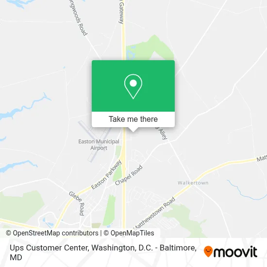
See Ups Customer Center, Talbot County, on the map
Public Transit to Ups Customer Center in Talbot County
Wondering how to get to Ups Customer Center in Talbot County? Moovit helps you find the best way to get to Ups Customer Center with step-by-step directions from the nearest public transit station.
Moovit provides free maps and live directions to help you navigate through your city. View schedules, routes, timetables, and find out how long does it take to get to Ups Customer Center in real time.
Looking for the nearest stop or station to Ups Customer Center? Check out this list of stops closest to your destination: 612/Greyhound/Mva.
Bus: C, HAPS BUILDING - WALMART.
Want to see if there’s another route that gets you there at an earlier time? Moovit helps you find alternative routes or times. Get directions from and directions to Ups Customer Center easily from the Moovit App or Website.
We make riding to Ups Customer Center easy, which is why over 1.7 million users, including users in Talbot County, trust Moovit as the best app for public transit. You don’t need to download an individual bus app or train app, Moovit is your all-in-one transit app that helps you find the best bus time or train time available.
For information on prices of bus, costs and ride fares to Ups Customer Center, please check the Moovit app.
Use the app to navigate to popular places including to the airport, hospital, stadium, grocery store, mall, coffee shop, school, college, and university.
Ups Customer Center Address: 9333A Nixon Dr street in Talbot County
- 9917 Longwoods Rd,
- 9982 Ocean Gtwy,
- Easton Tile and Marble Inc,
- Chesapeake Curling Club,
- Talbot County Parks & Rec,
- Fosters Mobile Home Park,
- Easton Volunteer Fire Department Station 66 Substation,
- First Mortgage Financial Group,
- Penco Corp,
- 10111 Hailem School Rd,
- Town & Country Roofing & Sdng,
- Dottie Brummel's Upholstery,
- Hog Neck Park Golf Course,
- Cecil Ganon & Sons Inc,
- Kenton's Plumbing & Heating,
- Robert L Gray,
- Canary Enterprises,
- Foster and Son,
- Amish Market (Amish Country Farmer's Market),
- Foster & Son Inc
Places Near Ups Customer Center (Talbot County)
- Marriott Marquis Washington, DC, Washington,
- Washington National Cathedral, Washington,
- Capital One Arena, Washington,
- Pennsylvania Ave NW (3rd st and pennsylvania), Washington,
- Westfield Montgomery Mall, Montgomery County,
- M&T Bank Stadium, Baltimore,
- The Anthem, Washington,
- Museum Of The Bible, Washington,
- National Museum of African American History and Culture, Washington,
- Georgetown, Washington,
- Amazon Hq2, Arlington County,
- Rock Creek Tennis Center, Washington,
- National Theatre, Washington,
- Basilica of the National Shrine, Washington,
- Camden Yards, Baltimore,
- Sibley Memorial Hospital, Washington,
- National Zoo, Washington,
- Washington DC VA Medical Center, Washington,
- Warner Theatre, Washington,
- PG Mall, Prince George's County
How to get to popular places in Washington, D.C. - Baltimore, MD with public transit
Get around Talbot County by public transit!
Traveling around Talbot County has never been so easy. See step by step directions as you travel to any attraction, street or major public transit station. View bus and train schedules, arrival times, service alerts and detailed routes on a map, so you know exactly how to get to anywhere in Talbot County.
When traveling to any destination around Talbot County use Moovit's Live Directions with Get Off Notifications to know exactly where and how far to walk, how long to wait for your line, and how many stops are left. Moovit will alert you when it's time to get off — no need to constantly re-check whether yours is the next stop.
Wondering how to use public transit in Talbot County or how to pay for public transit in Talbot County? Moovit public transit app can help you navigate your way with public transit easily, and at minimum cost. It includes public transit fees, ticket prices, and costs. Looking for a map of Talbot County public transit lines? Moovit public transit app shows all public transit maps in Talbot County with all Bus, Train, Metro, Light Rail and Ferry routes and stops on an interactive map.
Washington, D.C. - Baltimore, MD has 5 transit type(s), including: Bus, Train, Metro, Light Rail and Ferry, operated by several transit agencies, including WMATA, Montgomery County Ride On, Fairfax Connector, TheBus, PRTC, DASH - Alexandria, Arlington Transit (ART), RTA of Central Maryland, MDOT MTA, MDOT MTA Light RailLink, MDOT MTA Commuter Bus, MDOT MTA Local Bus, FXBGO!, Virginia Railway Express (VRE) and MARC