Directions to Urban Development Associates (Richmond) with public transportation
The following transit lines have routes that pass near Urban Development Associates
 Bus: 1A, 3B, FLIXBUS N2601, 1B, 1C.
- Train: NORTHEAST REGIONAL.
How to get to Urban Development Associates by bus?
Click on the bus route to see step by step directions with maps, line arrival times and updated time schedules.
From Potomac Mills Mall, Prince William County
204 minFrom Busch Gardens Williamsburg (Employee Parking Lot), James City County
145 minFrom Hampton University, Hampton
306 minFrom Lorton, VA, Fairfax County
214 minFrom Rose Gaming Resort, Prince William County
229 minFrom Lorton, VA - Amtrak Auto Train Station (LOR), Fairfax County
219 minFrom Woodbridge, VA, Prince William County
149 minFrom UVA Hospital Medical Center, Charlottesville
293 minFrom Amazon Fulfillment Center-Ric3, Richmond
50 min
How to get to Urban Development Associates by train?
Click on the train route to see step by step directions with maps, line arrival times and updated time schedules.
Bus stops near Urban Development Associates in Richmond
Train station near Urban Development Associates in Richmond
- Pathrichmond Main Street Amtrak Station, 36 min walk,VIEW
Bus lines to Urban Development Associates in Richmond
What are the closest stations to Urban Development Associates?
The closest stations to Urban Development Associates are:
- Hull + 11th is 8 yards away, 1 min walk.
- Bainbridge & 12th is 194 yards away, 3 min walk.
- Pathrichmond Main Street Amtrak Station is 2981 yards away, 36 min walk.
Which bus lines stop near Urban Development Associates?
These bus lines stop near Urban Development Associates: 1A, 3B, FLIXBUS N2601.
Which train line stops near Urban Development Associates?
NORTHEAST REGIONAL (Newport News)
What’s the nearest bus station to Urban Development Associates in Richmond?
The nearest bus station to Urban Development Associates in Richmond is Hull + 11th. It’s a 1 min walk away.
What time is the first train to Urban Development Associates in Richmond?
The NORTHEAST REGIONAL is the first train that goes to Urban Development Associates in Richmond. It stops nearby at 5:19 AM.
What time is the last train to Urban Development Associates in Richmond?
The NORTHEAST REGIONAL is the last train that goes to Urban Development Associates in Richmond. It stops nearby at 6:52 PM.
What time is the first bus to Urban Development Associates in Richmond?
The 1A is the first bus that goes to Urban Development Associates in Richmond. It stops nearby at 5:20 AM.
What time is the last bus to Urban Development Associates in Richmond?
The 1A is the last bus that goes to Urban Development Associates in Richmond. It stops nearby at 12:20 AM.
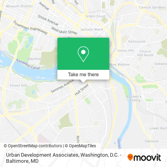
See Urban Development Associates, Richmond, on the map
Public Transit to Urban Development Associates in Richmond
Wondering how to get to Urban Development Associates in Richmond? Moovit helps you find the best way to get to Urban Development Associates with step-by-step directions from the nearest public transit station.
Moovit provides free maps and live directions to help you navigate through your city. View schedules, routes, timetables, and find out how long does it take to get to Urban Development Associates in real time.
Looking for the nearest stop or station to Urban Development Associates? Check out this list of stops closest to your destination: Hull + 11th; Bainbridge & 12th; Pathrichmond Main Street Amtrak Station.
Bus: 1A, 3B, FLIXBUS N2601, 1B, 1C, 87.Train: NORTHEAST REGIONAL.
Want to see if there’s another route that gets you there at an earlier time? Moovit helps you find alternative routes or times. Get directions from and directions to Urban Development Associates easily from the Moovit App or Website.
We make riding to Urban Development Associates easy, which is why over 1.5 million users, including users in Richmond, trust Moovit as the best app for public transit. You don’t need to download an individual bus app or train app, Moovit is your all-in-one transit app that helps you find the best bus time or train time available.
For information on prices of bus and train, costs and ride fares to Urban Development Associates, please check the Moovit app.
Use the app to navigate to popular places including to the airport, hospital, stadium, grocery store, mall, coffee shop, school, college, and university.
Urban Development Associates Address: 1001 Bainbridge St Richmond, VA 23224 street in Richmond
- Bainbridge Street Baptist Church,
- Community Baptist Church,
- The Sprout School,
- Commonwealth Christian Academy,
- Board of Young Professionals Advisory Council,
- City View Place,
- Sweet Fix,
- Maunyea Enterprises,
- Brewer's Cafe,
- Red Hibachi,
- 12th & Bainbridge,
- River City Comprehensive Counseling Services,
- Rva Street Foodies,
- Soul-Ice,
- Full Occupancy,
- Mr Bail's Bonding Services,
- Hanson Company,
- Mary Emma Silk Flowers 78 Grifts,
- Jericho Reach Aco,
- Shabazz Enterprises
Places Near Urban Development Associates (Richmond)
- Basilica of the National Shrine, Washington,
- Sibley Memorial Hospital, Washington,
- Capital One Arena, Washington,
- Rock Creek Tennis Center, Washington,
- Georgetown, Washington,
- National Museum of African American History and Culture, Washington,
- Marriott Marquis Washington, DC, Washington,
- Amazon Hq2, Arlington County,
- M&T Bank Stadium, Baltimore,
- PG Mall, Prince George's County,
- Camden Yards, Baltimore,
- National Zoo, Washington,
- Museum Of The Bible, Washington,
- Warner Theatre, Washington,
- Westfield Montgomery Mall, Montgomery County,
- Washington National Cathedral, Washington,
- National Mall, Washington,
- Pennsylvania Ave NW (3rd st and pennsylvania), Washington,
- Washington DC VA Medical Center, Washington,
- The Anthem, Washington
How to get to popular places in Washington, D.C. - Baltimore, MD with public transit
Get around Richmond by public transit!
Traveling around Richmond has never been so easy. See step by step directions as you travel to any attraction, street or major public transit station. View bus and train schedules, arrival times, service alerts and detailed routes on a map, so you know exactly how to get to anywhere in Richmond.
When traveling to any destination around Richmond use Moovit's Live Directions with Get Off Notifications to know exactly where and how far to walk, how long to wait for your line, and how many stops are left. Moovit will alert you when it's time to get off — no need to constantly re-check whether yours is the next stop.
Wondering how to use public transit in Richmond or how to pay for public transit in Richmond? Moovit public transit app can help you navigate your way with public transit easily, and at minimum cost. It includes public transit fees, ticket prices, and costs. Looking for a map of Richmond public transit lines? Moovit public transit app shows all public transit maps in Richmond with all Bus, Train, Metro, Light Rail and Ferry routes and stops on an interactive map.
Washington, D.C. - Baltimore, MD has 5 transit type(s), including: Bus, Train, Metro, Light Rail and Ferry, operated by several transit agencies, including WMATA, Montgomery County Ride On, Fairfax Connector, TheBus, PRTC, DASH - Alexandria, Arlington Transit (ART), RTA of Central Maryland, MDOT MTA, MDOT MTA Light RailLink, MDOT MTA Commuter Bus, MDOT MTA Local Bus, FXBGO!, Virginia Railway Express (VRE) and MARC