How to get to Urban Legends Fishing Charters by bus?
Click on the bus route to see step by step directions with maps, line arrival times and updated time schedules.
From Shops at Merrick Park, Miami
96 minFrom Sylvester Comprehensive Cancer Center, Miami
57 minFrom Sunset Dr, Miami
50 minFrom Trader Joe's, Miami
88 minFrom Nicklaus Children's Hospital, Miami
86 minFrom Life Time, Miami
91 minFrom SW 184 St & US 1, Kendall-Palmetto Bay
43 minFrom Coral Reef Senior High School, Kendall-Palmetto Bay
34 minFrom St Hugh Catholic Church, Miami
90 minFrom US1, Miami
56 min
Bus stop near Urban Legends Fishing Charters in Kendall-Palmetto Bay
- Sw 77 Av & Sw 136 St, 13 min walk,VIEW
Train station near Urban Legends Fishing Charters in Kendall-Palmetto Bay
- Dadeland South Stat.rail Northbound, 60 min walk,VIEW
Bus lines to Urban Legends Fishing Charters in Kendall-Palmetto Bay
- 73, 73 - SW 152 St/Transitway,VIEW
What are the closest stations to Urban Legends Fishing Charters?
The closest stations to Urban Legends Fishing Charters are:
- Sw 77 Av & Sw 136 St is 1084 yards away, 13 min walk.
- Dadeland South Stat.rail Northbound is 5074 yards away, 60 min walk.
Which bus line stops near Urban Legends Fishing Charters?
73 (73 - SW 152 St/Transitway)
What’s the nearest bus station to Urban Legends Fishing Charters in Kendall-Palmetto Bay?
The nearest bus station to Urban Legends Fishing Charters in Kendall-Palmetto Bay is Sw 77 Av & Sw 136 St. It’s a 13 min walk away.
What time is the first train to Urban Legends Fishing Charters in Kendall-Palmetto Bay?
The GREEN is the first train that goes to Urban Legends Fishing Charters in Kendall-Palmetto Bay. It stops nearby at 5:00 AM.
What time is the last train to Urban Legends Fishing Charters in Kendall-Palmetto Bay?
The GREEN is the last train that goes to Urban Legends Fishing Charters in Kendall-Palmetto Bay. It stops nearby at 1:04 AM.
What time is the first bus to Urban Legends Fishing Charters in Kendall-Palmetto Bay?
The 73 is the first bus that goes to Urban Legends Fishing Charters in Kendall-Palmetto Bay. It stops nearby at 4:38 AM.
What time is the last bus to Urban Legends Fishing Charters in Kendall-Palmetto Bay?
The 73 is the last bus that goes to Urban Legends Fishing Charters in Kendall-Palmetto Bay. It stops nearby at 10:30 PM.
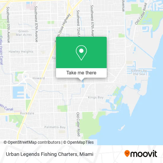
See Urban Legends Fishing Charters, Kendall-Palmetto Bay, on the map
Public Transit to Urban Legends Fishing Charters in Kendall-Palmetto Bay
Wondering how to get to Urban Legends Fishing Charters in Kendall-Palmetto Bay? Moovit helps you find the best way to get to Urban Legends Fishing Charters with step-by-step directions from the nearest public transit station.
Moovit provides free maps and live directions to help you navigate through your city. View schedules, routes, timetables, and find out how long does it take to get to Urban Legends Fishing Charters in real time.
Looking for the nearest stop or station to Urban Legends Fishing Charters? Check out this list of stops closest to your destination: Sw 77 Av & Sw 136 St; Dadeland South Stat.rail Northbound.
Bus: 73.Train: GREEN, ORANGE.
Want to see if there’s another route that gets you there at an earlier time? Moovit helps you find alternative routes or times. Get directions from and directions to Urban Legends Fishing Charters easily from the Moovit App or Website.
We make riding to Urban Legends Fishing Charters easy, which is why over 1.5 million users, including users in Kendall-Palmetto Bay, trust Moovit as the best app for public transit. You don’t need to download an individual bus app or train app, Moovit is your all-in-one transit app that helps you find the best bus time or train time available.
For information on prices of bus and train, costs and ride fares to Urban Legends Fishing Charters, please check the Moovit app.
Use the app to navigate to popular places including to the airport, hospital, stadium, grocery store, mall, coffee shop, school, college, and university.
Urban Legends Fishing Charters Address: SW 72nd Ave street in Kendall-Palmetto Bay
- Acosta Morales Y Asoc,
- B and M Insurance Group,
- The Florida Board of Bar Examiners,
- SC Medical,
- US Department of Agriculture Plant Protection & Quarantine,
- Good Shepherd Catholic Church,
- VXT Consulting,
- Efficient Business Tools Processes and Practices,
- The Snake,
- Saint Andrews Episcopal Church 1426 Old Cutler Rd,
- Farm To Table Miami,
- Collective Decor Interiors,
- Menina Step,
- Helms Country Estates Re,
- The National Junior Honor Society's,
- Burgos and Sosa Pa,
- Better Homes and Gardens Real Estate LLC,
- Nibbles with Nat,
- Capitán Nemo,
- The International Society of Arboriculture
Places Near Urban Legends Fishing Charters (Kendall-Palmetto Bay)
- Port of Miami Cruise Terminal, Miami,
- Hard Rock Stadium, Miami Gardens,
- Richard E. Gerstein Justice Building, Miami,
- Dolphin Mall Bus, Miami,
- Marlins Park, Miami,
- Sawgrass Mall, Miami,
- Zoo Miami, Miami,
- Aventura Mall, Miami,
- Bayside Marketplace, Miami,
- Wynwood, Miami,
- Brickell City Centre, Miami,
- Miami Design District, Miami,
- Little Havana, Miami,
- Keiser University Flagship Campus, West Palm Beach,
- Miami Freedom Park, Miami,
- Miami VA Hospital, Miami,
- Sawgrass mall ( FL ), Miami Beach,
- Aventura Mall, Miami Beach,
- Dolphin Mall, Miami,
- Miami-Dade County Courthouse, Miami
How to get to popular places in Miami with public transit
Get around Kendall-Palmetto Bay by public transit!
Traveling around Kendall-Palmetto Bay has never been so easy. See step by step directions as you travel to any attraction, street or major public transit station. View bus and train schedules, arrival times, service alerts and detailed routes on a map, so you know exactly how to get to anywhere in Kendall-Palmetto Bay.
When traveling to any destination around Kendall-Palmetto Bay use Moovit's Live Directions with Get Off Notifications to know exactly where and how far to walk, how long to wait for your line, and how many stops are left. Moovit will alert you when it's time to get off — no need to constantly re-check whether yours is the next stop.
Wondering how to use public transit in Kendall-Palmetto Bay or how to pay for public transit in Kendall-Palmetto Bay? Moovit public transit app can help you navigate your way with public transit easily, and at minimum cost. It includes public transit fees, ticket prices, and costs. Looking for a map of Kendall-Palmetto Bay public transit lines? Moovit public transit app shows all public transit maps in Kendall-Palmetto Bay with all Bus, Train, Light Rail and Ferry routes and stops on an interactive map.
Miami has 4 transit type(s), including: Bus, Train, Light Rail and Ferry, operated by several transit agencies, including Broward County Transit, Miami-Dade Transit, Metrorail, Palm Tran, Tri-Rail, Brightline, MARTY, City of Homestead Trolley, Key West Transit, Treasure Coast Connector, GoLine IRT, Amtrak, Greyhound-us, FlixBus-us and Aventura Express Shuttle Bus